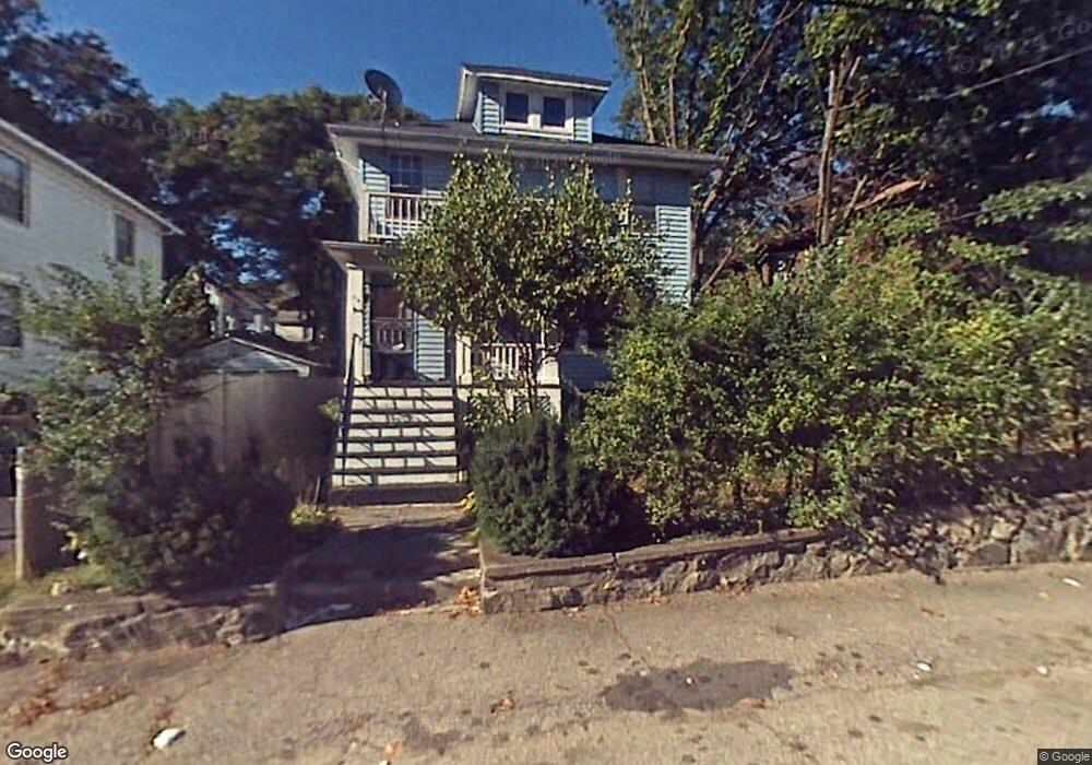
25 Lothrop Ave Unit 25A Milton, MA 02186
Brush Hill NeighborhoodEstimated Value: $882,000 - $947,000
5
Beds
2
Baths
2,160
Sq Ft
$420/Sq Ft
Est. Value
About This Home
This home is located at 25 Lothrop Ave Unit 25A, Milton, MA 02186 and is currently estimated at $906,207, approximately $419 per square foot. 25 Lothrop Ave Unit 25A is a home located in Norfolk County with nearby schools including Milton High School, KIPP Academy Boston Charter School, and St. Mary of the Hills School.
Ownership History
Date
Name
Owned For
Owner Type
Purchase Details
Closed on
Jun 30, 1999
Sold by
Quish Mary G
Bought by
Leite Jose R and Leite Maria D
Current Estimated Value
Home Financials for this Owner
Home Financials are based on the most recent Mortgage that was taken out on this home.
Original Mortgage
$211,500
Outstanding Balance
$57,513
Interest Rate
7.19%
Mortgage Type
Purchase Money Mortgage
Estimated Equity
$848,694
Create a Home Valuation Report for This Property
The Home Valuation Report is an in-depth analysis detailing your home's value as well as a comparison with similar homes in the area
Home Values in the Area
Average Home Value in this Area
Purchase History
| Date | Buyer | Sale Price | Title Company |
|---|---|---|---|
| Leite Jose R | $235,000 | -- |
Source: Public Records
Mortgage History
| Date | Status | Borrower | Loan Amount |
|---|---|---|---|
| Open | Leite Jose R | $30,000 | |
| Open | Leite Jose R | $211,500 | |
| Previous Owner | Leite Jose R | $76,000 |
Source: Public Records
Tax History Compared to Growth
Tax History
| Year | Tax Paid | Tax Assessment Tax Assessment Total Assessment is a certain percentage of the fair market value that is determined by local assessors to be the total taxable value of land and additions on the property. | Land | Improvement |
|---|---|---|---|---|
| 2025 | $8,350 | $752,900 | $332,400 | $420,500 |
| 2024 | $8,313 | $761,300 | $332,400 | $428,900 |
| 2023 | $8,046 | $705,800 | $309,100 | $396,700 |
| 2022 | $8,102 | $649,700 | $309,100 | $340,600 |
| 2021 | $8,198 | $624,400 | $300,100 | $324,300 |
| 2020 | $7,440 | $567,100 | $277,500 | $289,600 |
| 2019 | $6,902 | $523,700 | $269,400 | $254,300 |
| 2018 | $6,510 | $471,400 | $218,900 | $252,500 |
| 2017 | $5,939 | $438,000 | $208,500 | $229,500 |
| 2016 | $5,493 | $406,900 | $195,400 | $211,500 |
| 2015 | $5,304 | $380,500 | $179,800 | $200,700 |
Source: Public Records
Map
Nearby Homes
- 70 Warren Ave
- 1 Chilton Park
- 96 Houston Ave
- 10 Weston St
- 96 Brook Rd
- 112 Brush Hill Rd
- 16 Concord Ave Unit 1
- 137 Thacher St Unit 137
- 128 Blue Hills Pkwy
- 214 Brook Rd
- 16 Blue Hill Ave
- 15 Fairfax Rd
- 84 Blue Hills Pkwy
- 20 Massasoit St
- 42 Osceola St
- 27 Hawthorn Rd
- 40 Lafayette St
- 405 Blue Hill Ave
- 485 Blue Hills Pkwy Unit 11
- 485 Blue Hills Pkwy Unit 27
- 25 Lothrop Ave Unit 2
- 23 Lothrop Ave
- 23 Lothrop Ave Unit 1
- 27 Lothrop Ave
- 24 Lothrop Ave
- 14 Verndale Rd
- 12 Verndale Rd Unit 1
- 12 Verndale Rd
- 14 Verndale Rd Unit R
- 14 Verndale Rd Unit L
- 21 Lothrop Ave Unit 21A
- 21 Lothrop Ave Unit 2nd fl
- 29 Lothrop Ave
- 10 Verndale Rd
- 47 Decker St
- 30 Lothrop Ave Unit 32
- 32 Lothrop Ave Unit 2
- 32 Lothrop Ave Unit 32
- 30 Lothrop Ave Unit 2
- 30 Lothrop Ave Unit 1