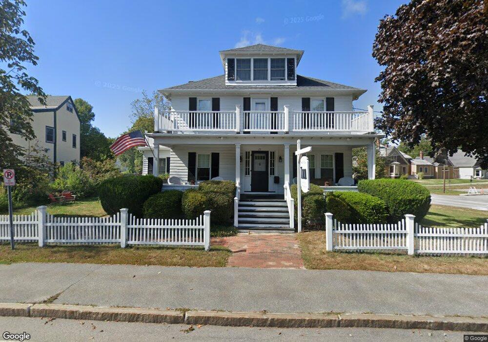
25 Main St Freeport, ME 04032
Estimated Value: $1,029,000 - $1,249,000
5
Beds
6
Baths
2,859
Sq Ft
$409/Sq Ft
Est. Value
About This Home
This home is located at 25 Main St, Freeport, ME 04032 and is currently estimated at $1,169,574, approximately $409 per square foot. 25 Main St is a home located in Cumberland County with nearby schools including Morse Street School, Mast Landing School, and Freeport Middle School.
Create a Home Valuation Report for This Property
The Home Valuation Report is an in-depth analysis detailing your home's value as well as a comparison with similar homes in the area
Home Values in the Area
Average Home Value in this Area
Tax History
| Year | Tax Paid | Tax Assessment Tax Assessment Total Assessment is a certain percentage of the fair market value that is determined by local assessors to be the total taxable value of land and additions on the property. | Land | Improvement |
|---|---|---|---|---|
| 2025 | $11,203 | $808,900 | $321,700 | $487,200 |
| 2024 | $10,593 | $793,500 | $306,300 | $487,200 |
| 2023 | $9,679 | $703,900 | $278,500 | $425,400 |
| 2022 | $9,201 | $674,100 | $248,700 | $425,400 |
| 2021 | $8,999 | $674,100 | $248,700 | $425,400 |
| 2020 | $8,761 | $625,800 | $230,300 | $395,500 |
| 2019 | $8,101 | $566,500 | $217,200 | $349,300 |
| 2018 | $7,490 | $514,900 | $191,900 | $323,000 |
| 2017 | $7,447 | $498,100 | $188,100 | $310,000 |
| 2016 | $7,195 | $455,400 | $168,500 | $286,900 |
Source: Public Records
Map
Nearby Homes
- 5 Holbrook St
- 15 Linwood Rd Unit 15
- 10 Durham Rd
- 212 Main St
- 39 Hunter Rd
- 42 Durham Rd
- 11 Orchard Hill Rd
- 26 Harvest Ridge Rd Unit 24
- 20 Harvest Ridge Rd Unit 23
- 52 Birch Point Rd
- 8 Statler Ln
- 1 Wardtown Rd
- 1260 Us Route 1
- 10 Prout Rd
- 15 Tinkers Way
- 62 Webster Rd
- 143 Bragdon Rd
- 4 Harper's Trail
- 0 Prout Rd
- 21 Renee Rd
Your Personal Tour Guide
Ask me questions while you tour the home.