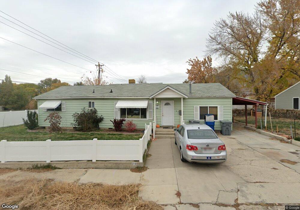
25 Maple Ln Pleasant Grove, UT 84062
Estimated Value: $418,000 - $480,000
3
Beds
2
Baths
1,539
Sq Ft
$294/Sq Ft
Est. Value
About This Home
This home is located at 25 Maple Ln, Pleasant Grove, UT 84062 and is currently estimated at $452,126, approximately $293 per square foot. 25 Maple Ln is a home located in Utah County with nearby schools including Mount Mahogany School, Pleasant Grove Junior High School, and Pleasant Grove High School.
Ownership History
Date
Name
Owned For
Owner Type
Purchase Details
Closed on
May 24, 2021
Sold by
Snyder Donna D and Snyder Russell K
Bought by
Nelson Emilee and Nelson Daniel
Current Estimated Value
Home Financials for this Owner
Home Financials are based on the most recent Mortgage that was taken out on this home.
Original Mortgage
$341,440
Outstanding Balance
$309,430
Interest Rate
3.1%
Mortgage Type
New Conventional
Estimated Equity
$142,696
Create a Home Valuation Report for This Property
The Home Valuation Report is an in-depth analysis detailing your home's value as well as a comparison with similar homes in the area
Home Values in the Area
Average Home Value in this Area
Purchase History
| Date | Buyer | Sale Price | Title Company |
|---|---|---|---|
| Nelson Emilee | -- | Stewart Title |
Source: Public Records
Mortgage History
| Date | Status | Borrower | Loan Amount |
|---|---|---|---|
| Open | Nelson Emilee | $341,440 |
Source: Public Records
Tax History Compared to Growth
Tax History
| Year | Tax Paid | Tax Assessment Tax Assessment Total Assessment is a certain percentage of the fair market value that is determined by local assessors to be the total taxable value of land and additions on the property. | Land | Improvement |
|---|---|---|---|---|
| 2025 | $1,557 | $201,410 | $186,500 | $179,700 |
| 2024 | $1,557 | $185,790 | $0 | $0 |
| 2023 | $1,493 | $182,435 | $0 | $0 |
| 2022 | $1,619 | $196,845 | $0 | $0 |
| 2021 | $1,396 | $258,300 | $133,700 | $124,600 |
| 2020 | $1,282 | $232,700 | $119,400 | $113,300 |
| 2019 | $1,110 | $208,300 | $109,800 | $98,500 |
| 2018 | $1,065 | $189,000 | $100,100 | $88,900 |
| 2017 | $939 | $88,660 | $0 | $0 |
| 2016 | $946 | $86,295 | $0 | $0 |
| 2015 | $918 | $82,170 | $0 | $0 |
| 2014 | -- | $81,125 | $0 | $0 |
Source: Public Records
Map
Nearby Homes