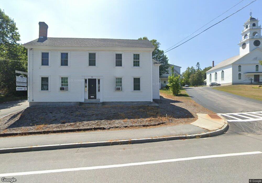
25 Maple St Unit 3 Henniker, NH 03242
Estimated Value: $334,291
2
Beds
--
Bath
3,736
Sq Ft
$89/Sq Ft
Est. Value
About This Home
This home is located at 25 Maple St Unit 3, Henniker, NH 03242 and is currently estimated at $334,291, approximately $89 per square foot. 25 Maple St Unit 3 is a home located in Merrimack County with nearby schools including Henniker Community School and John Stark Regional High School.
Ownership History
Date
Name
Owned For
Owner Type
Purchase Details
Closed on
Dec 19, 2016
Sold by
Kathryn S Forbush T S and Kathryn Forbush
Bought by
Defabrizio Angela M and Defabrizio Mario
Current Estimated Value
Home Financials for this Owner
Home Financials are based on the most recent Mortgage that was taken out on this home.
Original Mortgage
$150,195
Outstanding Balance
$121,515
Interest Rate
3.54%
Mortgage Type
Commercial
Estimated Equity
$211,932
Purchase Details
Closed on
Aug 7, 1997
Sold by
Ryan William N and Ryan Elene
Bought by
Gray David J and Elizabeth Gray M
Home Financials for this Owner
Home Financials are based on the most recent Mortgage that was taken out on this home.
Original Mortgage
$45,000
Interest Rate
7.5%
Mortgage Type
Commercial
Create a Home Valuation Report for This Property
The Home Valuation Report is an in-depth analysis detailing your home's value as well as a comparison with similar homes in the area
Home Values in the Area
Average Home Value in this Area
Purchase History
| Date | Buyer | Sale Price | Title Company |
|---|---|---|---|
| Defabrizio Angela M | $158,133 | -- | |
| Defabrizio Angela M | $158,133 | -- | |
| Gray David J | $87,500 | -- | |
| Gray David J | $87,500 | -- |
Source: Public Records
Mortgage History
| Date | Status | Borrower | Loan Amount |
|---|---|---|---|
| Open | Defabrizio Angela M | $150,195 | |
| Closed | Gray David J | $150,195 | |
| Previous Owner | Gray David J | $45,000 |
Source: Public Records
Tax History
| Year | Tax Paid | Tax Assessment Tax Assessment Total Assessment is a certain percentage of the fair market value that is determined by local assessors to be the total taxable value of land and additions on the property. | Land | Improvement |
|---|---|---|---|---|
| 2025 | $10,796 | $447,400 | $147,200 | $300,200 |
| 2024 | $10,418 | $435,900 | $147,200 | $288,700 |
| 2023 | $9,755 | $435,900 | $147,200 | $288,700 |
| 2022 | $9,346 | $435,900 | $147,200 | $288,700 |
| 2021 | $9,527 | $292,600 | $81,300 | $211,300 |
| 2020 | $9,141 | $292,600 | $81,300 | $211,300 |
| 2019 | $9,478 | $268,200 | $87,400 | $180,800 |
| 2018 | $9,036 | $268,200 | $87,400 | $180,800 |
| 2017 | $9,103 | $268,200 | $87,400 | $180,800 |
| 2016 | $8,939 | $268,200 | $87,400 | $180,800 |
| 2015 | $8,440 | $268,200 | $87,400 | $180,800 |
| 2014 | $7,872 | $256,600 | $87,400 | $169,200 |
Source: Public Records
Map
Nearby Homes
- 144 Fairview Ave
- 70 Hillside Dr
- Tax Map5B Lot97 Route 114
- 160 Atha's Way
- 738 Old Hillsboro Rd
- 1278 Weare Rd
- 586 C-4 Craney Hill Rd
- Map 11 Lot 729 Craney Hill Rd
- 322 French Rd
- 463 Craney Hill Rd
- 10 Hemlock St
- 6 Birch Tree Ln
- 0 Kings Row Unit 151 4855040
- 0 Spring St Unit 178 4855470
- 0 Spring St Unit 178 4855319
- 0 Bobolink Ln Unit 120 4858469
- 0 Dawn St Unit 79 4854584
- 0 Midnight Walk Unit 264 4914126
- 12 Old Lantern Rd
- 15 Sunrise Place
- 0 Western Ave Unit 4643969
- 0 Western Ave Unit 4476047
- 0 Western Ave Unit 2727433
- 0 Western Ave Unit 4331640
- 0 Western Ave Unit 4724256
- 32 Western Ave
- 39 Maple St
- 13 Maple St
- 4 Western Ave
- 24 Maple St
- 11 Gould St
- 36 Maple St
- 42 Western Ave
- 38 Maple St
- 25 Gould St
- Lot 1-742D Rte 114
- 8 Maple St Unit 4
- 8 Maple St Unit 2
- 8 Maple St Unit 5
- 8 Maple St
Your Personal Tour Guide
Ask me questions while you tour the home.