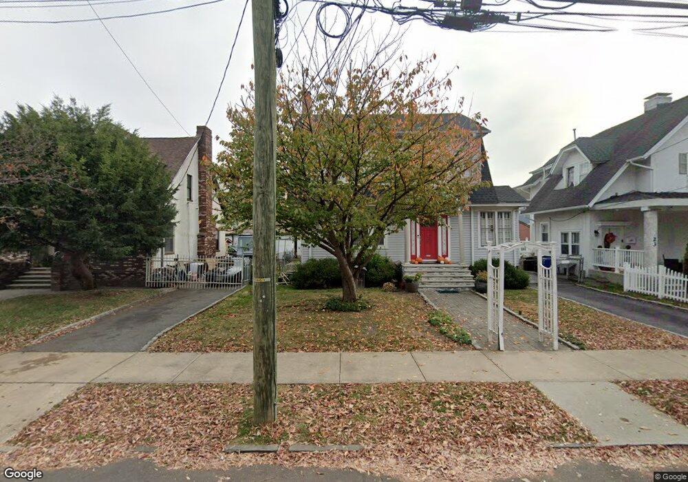
25 N 10th St Unit 27 Newark, NJ 07107
Upper Roseville NeighborhoodEstimated Value: $522,000 - $832,000
--
Bed
--
Bath
3,616
Sq Ft
$193/Sq Ft
Est. Value
About This Home
This home is located at 25 N 10th St Unit 27, Newark, NJ 07107 and is currently estimated at $696,730, approximately $192 per square foot. 25 N 10th St Unit 27 is a home located in Essex County with nearby schools including First Avenue Elementary School, Dr. William H. Horton School, and Rafael Hernandez School.
Ownership History
Date
Name
Owned For
Owner Type
Purchase Details
Closed on
Oct 11, 2004
Sold by
Antonio Maria
Bought by
Sosa John
Current Estimated Value
Home Financials for this Owner
Home Financials are based on the most recent Mortgage that was taken out on this home.
Original Mortgage
$224,000
Outstanding Balance
$111,159
Interest Rate
5.8%
Estimated Equity
$585,571
Purchase Details
Closed on
Oct 3, 1995
Sold by
Soares Augusto
Bought by
Antonio Maria and Antonio Joao
Home Financials for this Owner
Home Financials are based on the most recent Mortgage that was taken out on this home.
Original Mortgage
$109,000
Interest Rate
7.6%
Purchase Details
Closed on
Apr 26, 1991
Sold by
Soares Soares A and Soares Canhoto, M
Bought by
Soares Augusto and Soares Deceucanhoto,Marie
Create a Home Valuation Report for This Property
The Home Valuation Report is an in-depth analysis detailing your home's value as well as a comparison with similar homes in the area
Home Values in the Area
Average Home Value in this Area
Purchase History
| Date | Buyer | Sale Price | Title Company |
|---|---|---|---|
| Sosa John | $280,000 | -- | |
| Antonio Maria | $124,000 | -- | |
| Soares Augusto | -- | -- |
Source: Public Records
Mortgage History
| Date | Status | Borrower | Loan Amount |
|---|---|---|---|
| Open | Sosa John | $224,000 | |
| Previous Owner | Antonio Maria | $109,000 |
Source: Public Records
Tax History Compared to Growth
Tax History
| Year | Tax Paid | Tax Assessment Tax Assessment Total Assessment is a certain percentage of the fair market value that is determined by local assessors to be the total taxable value of land and additions on the property. | Land | Improvement |
|---|---|---|---|---|
| 2025 | $7,967 | $213,700 | $51,500 | $162,200 |
| 2024 | $7,967 | $213,700 | $51,500 | $162,200 |
| 2022 | $7,984 | $213,700 | $51,500 | $162,200 |
| 2021 | $7,980 | $213,700 | $51,500 | $162,200 |
| 2020 | $8,121 | $213,700 | $51,500 | $162,200 |
| 2019 | $8,037 | $213,700 | $51,500 | $162,200 |
| 2018 | $7,892 | $213,700 | $51,500 | $162,200 |
| 2017 | $7,608 | $213,700 | $51,500 | $162,200 |
| 2016 | $7,351 | $213,700 | $51,500 | $162,200 |
| 2015 | $7,071 | $213,700 | $51,500 | $162,200 |
| 2014 | $6,627 | $213,700 | $51,500 | $162,200 |
Source: Public Records
Map
Nearby Homes
- 457 N 7th St
- 504-506 N 7th St
- 504 N 7th St Unit 506
- 226 N 9th St
- 150 S 10th St
- 277 2nd Ave W Unit 2
- 277 2nd Ave W
- 382-384 N 7th St
- 372 N 7th St
- 352 N 7th St
- 105 N 15th St
- 101 Ellington St
- 191 1st Ave W
- 575 N 6th St
- 575 N 6th St Unit 4
- 362 N 6th St
- 580 3rd St
- 582 3rd St Unit 584
- 166 N 9th St Unit 3
- 582 3rd St
- 19 N 10th St Unit 23
- 29 N 10th St Unit 31
- 28 Peck Ave Unit 30
- 24 Peck Ave Unit 26
- 33 N 10th St Unit 35
- 32 Peck Ave
- 17 N 10th St
- 20 Peck Ave Unit 22
- 34 Peck Ave Unit 36
- 26 N 10th St Unit 28
- 37-39 N 10th St
- 37 N 10th St Unit 39
- 13 N 10th St Unit 15
- 18 Peck Ave
- 30 N 10th St Unit 32
- 22 N 10th St Unit 24
- 30-32 N 10th St
- 18 N 10th St Unit 20
- 34 N 10th St Unit 38
- 38 Peck Ave Unit 42