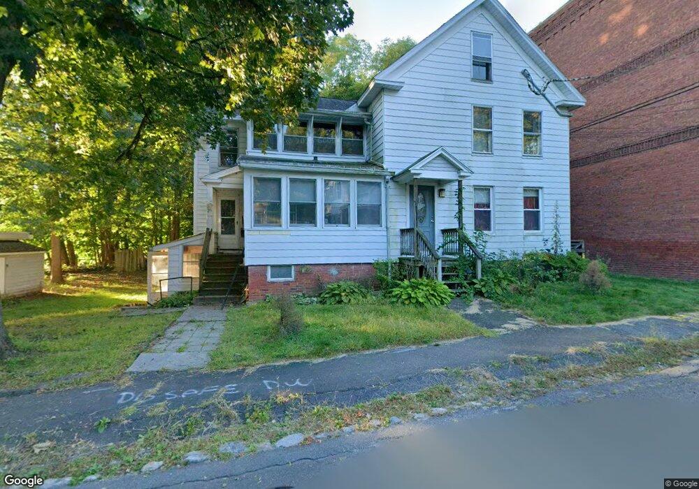
25 Perkins Ave Northampton, MA 01060
Estimated Value: $520,000 - $771,673
7
Beds
3
Baths
2,268
Sq Ft
$300/Sq Ft
Est. Value
About This Home
This home is located at 25 Perkins Ave, Northampton, MA 01060 and is currently estimated at $681,168, approximately $300 per square foot. 25 Perkins Ave is a home located in Hampshire County with nearby schools including Northampton High School, The Montessori School of Northampton, and Lander Grinspoon Academy.
Ownership History
Date
Name
Owned For
Owner Type
Purchase Details
Closed on
Jul 26, 2005
Sold by
Shelton David G and Cole Susan
Bought by
Harrington Kimberly L and Harrington Ryan J
Current Estimated Value
Home Financials for this Owner
Home Financials are based on the most recent Mortgage that was taken out on this home.
Original Mortgage
$344,000
Outstanding Balance
$179,894
Interest Rate
5.59%
Mortgage Type
Purchase Money Mortgage
Estimated Equity
$501,274
Purchase Details
Closed on
Jul 9, 1999
Sold by
Torres-Avalla Chiara D and Torres-Avalla Hector E
Bought by
Shelton David G
Home Financials for this Owner
Home Financials are based on the most recent Mortgage that was taken out on this home.
Original Mortgage
$136,000
Interest Rate
7.19%
Mortgage Type
Purchase Money Mortgage
Create a Home Valuation Report for This Property
The Home Valuation Report is an in-depth analysis detailing your home's value as well as a comparison with similar homes in the area
Home Values in the Area
Average Home Value in this Area
Purchase History
| Date | Buyer | Sale Price | Title Company |
|---|---|---|---|
| Harrington Kimberly L | $430,000 | -- | |
| Shelton David G | $170,000 | -- |
Source: Public Records
Mortgage History
| Date | Status | Borrower | Loan Amount |
|---|---|---|---|
| Open | Harrington Kimberly L | $344,000 | |
| Previous Owner | Shelton David G | $20,000 | |
| Previous Owner | Shelton David G | $136,000 |
Source: Public Records
Tax History Compared to Growth
Tax History
| Year | Tax Paid | Tax Assessment Tax Assessment Total Assessment is a certain percentage of the fair market value that is determined by local assessors to be the total taxable value of land and additions on the property. | Land | Improvement |
|---|---|---|---|---|
| 2025 | $8,429 | $605,100 | $244,200 | $360,900 |
| 2024 | $7,867 | $517,900 | $222,000 | $295,900 |
| 2023 | $7,825 | $494,000 | $201,900 | $292,100 |
| 2022 | $7,358 | $411,300 | $188,700 | $222,600 |
| 2021 | $7,179 | $413,300 | $179,600 | $233,700 |
| 2020 | $6,943 | $413,300 | $179,600 | $233,700 |
| 2019 | $6,950 | $400,100 | $179,600 | $220,500 |
| 2018 | $6,668 | $391,300 | $179,600 | $211,700 |
| 2017 | $6,531 | $391,300 | $179,600 | $211,700 |
| 2016 | $6,323 | $391,300 | $179,600 | $211,700 |
| 2015 | $5,971 | $377,900 | $159,700 | $218,200 |
| 2014 | $5,816 | $377,900 | $159,700 | $218,200 |
Source: Public Records
Map
Nearby Homes
- 5 Prospect Ct
- 37 Finn St
- 13 1/2 Finn St
- 215 State St
- 76 Crescent St Unit 2
- 8 View Ave Unit A
- 8 View Ave Unit B
- 9 Walnut St Unit B
- 103 Massasoit St
- 50 Walnut St
- 30 Cherry St
- 30 Cherry St Unit A
- 30 Cherry St Unit B
- 74 Barrett St Unit 105
- 14 Arlington St
- 30 Graves Ave Unit B
- 61 Woodlawn Ave
- 218 Elm St
- 16 Taylor St
- 43 Center St Unit K
- 25 Perkins Ave Unit 2
- 25 Perkins Ave Unit 1
- 31 Perkins Ave
- 28 Perkins Ave
- 24 Perkins Ave
- 32 Perkins Ave
- 264 State St
- 22 Perkins Ave
- 34 Perkins Ave
- 29 Stoddard St
- 250 State St
- 37 Stoddard St
- 18 Perkins Ave
- 23 Stoddard St
- 17 Perkins Ave
- 276 State St
- 51 Stoddard St
- 17 Stoddard St
- 265 State St
- 13 Perkins Ave