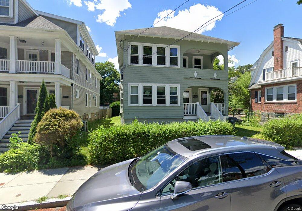
25 Pheasant St Unit 27 West Roxbury, MA 02132
Upper Washington-Spring Street NeighborhoodEstimated Value: $964,318 - $1,170,000
6
Beds
2
Baths
2,548
Sq Ft
$417/Sq Ft
Est. Value
About This Home
This home is located at 25 Pheasant St Unit 27, West Roxbury, MA 02132 and is currently estimated at $1,062,080, approximately $416 per square foot. 25 Pheasant St Unit 27 is a home located in Suffolk County with nearby schools including St Theresa School, Holy Name Parish School, and The Roxbury Latin School.
Ownership History
Date
Name
Owned For
Owner Type
Purchase Details
Closed on
Jul 26, 2024
Sold by
Meyer Street Nt and Gangemi
Bought by
25 Pheasant Street Llc
Current Estimated Value
Purchase Details
Closed on
Jan 9, 2012
Sold by
Gangemi Nicola
Bought by
Meyer Street Nt and Gangemi
Create a Home Valuation Report for This Property
The Home Valuation Report is an in-depth analysis detailing your home's value as well as a comparison with similar homes in the area
Home Values in the Area
Average Home Value in this Area
Purchase History
| Date | Buyer | Sale Price | Title Company |
|---|---|---|---|
| 25 Pheasant Street Llc | -- | None Available | |
| 25 Pheasant Street Llc | -- | None Available | |
| Meyer Street Nt | -- | -- | |
| Meyer Street Nt | -- | -- |
Source: Public Records
Tax History Compared to Growth
Tax History
| Year | Tax Paid | Tax Assessment Tax Assessment Total Assessment is a certain percentage of the fair market value that is determined by local assessors to be the total taxable value of land and additions on the property. | Land | Improvement |
|---|---|---|---|---|
| 2025 | $9,080 | $784,100 | $275,500 | $508,600 |
| 2024 | $8,281 | $759,700 | $245,900 | $513,800 |
| 2023 | $7,622 | $709,700 | $229,700 | $480,000 |
| 2022 | $7,284 | $669,500 | $216,700 | $452,800 |
| 2021 | $6,495 | $608,700 | $197,000 | $411,700 |
| 2020 | $6,027 | $570,700 | $180,800 | $389,900 |
| 2019 | $5,681 | $539,000 | $144,900 | $394,100 |
| 2018 | $5,279 | $503,700 | $144,900 | $358,800 |
| 2017 | $5,080 | $479,700 | $144,900 | $334,800 |
| 2016 | $4,979 | $452,600 | $144,900 | $307,700 |
| 2015 | $5,291 | $436,900 | $168,100 | $268,800 |
| 2014 | $4,997 | $397,200 | $168,100 | $229,100 |
Source: Public Records
Map
Nearby Homes
- 2 Lagrange St Unit 4
- 2 Lagrange St Unit 7
- 4873 Washington St Unit 2
- 12 Loyola Cir
- 87 Searle Rd
- 35 Heron St
- 12 Eagle St
- 15 Starling St
- 4959 Washington St
- 10 Starling St
- 4975 Washington St Unit 311
- 4975 Washington St Unit 305
- 231 Lagrange St
- 15 White Oak Rd
- 45 Weymouth Ave
- 141 Bellevue St
- 150 Aldrich St
- 296 Kittredge St Unit 298
- 51 Wren St
- 276 Cornell St
- 25 Pheasant St Unit 1
- 25-27 Pheasant St
- 21 Pheasant St Unit 23
- 21 Pheasant St Unit 23
- 21 Pheasant St Unit 2
- 21-23 Pheasant St
- 23 Pheasant St Unit 2
- 23 Pheasant St
- 29 Pheasant St
- 17 Pheasant St Unit 19
- 17 Pheasant St Unit 1
- 17-19 Pheasant St
- 19 Pheasant St Unit 2
- 19 Pheasant St
- 9 Cowing St
- 19 Cowing St
- 26 Pheasant St
- 37 Pheasant St
- 4785 Washington St
- 20 Pheasant St