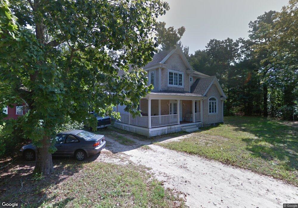
25 Quail Hill Rd Pocasset, MA 02559
Pocasset NeighborhoodEstimated Value: $606,000 - $956,000
3
Beds
2
Baths
1,215
Sq Ft
$644/Sq Ft
Est. Value
About This Home
This home is located at 25 Quail Hill Rd, Pocasset, MA 02559 and is currently estimated at $782,519, approximately $644 per square foot. 25 Quail Hill Rd is a home located in Barnstable County with nearby schools including Bourne High School and Cadence Academy Preschool - Bourne.
Ownership History
Date
Name
Owned For
Owner Type
Purchase Details
Closed on
Jun 28, 2016
Sold by
Speers Kathleen A
Bought by
Speers Kathleen A and Hinds Daniel P
Current Estimated Value
Home Financials for this Owner
Home Financials are based on the most recent Mortgage that was taken out on this home.
Original Mortgage
$328,000
Outstanding Balance
$260,342
Interest Rate
3.57%
Mortgage Type
New Conventional
Estimated Equity
$522,177
Create a Home Valuation Report for This Property
The Home Valuation Report is an in-depth analysis detailing your home's value as well as a comparison with similar homes in the area
Home Values in the Area
Average Home Value in this Area
Purchase History
| Date | Buyer | Sale Price | Title Company |
|---|---|---|---|
| Speers Kathleen A | -- | -- | |
| Speers Kathleen A | -- | -- |
Source: Public Records
Mortgage History
| Date | Status | Borrower | Loan Amount |
|---|---|---|---|
| Open | Speers Kathleen A | $328,000 | |
| Closed | Speers Kathleen A | $328,000 |
Source: Public Records
Tax History Compared to Growth
Tax History
| Year | Tax Paid | Tax Assessment Tax Assessment Total Assessment is a certain percentage of the fair market value that is determined by local assessors to be the total taxable value of land and additions on the property. | Land | Improvement |
|---|---|---|---|---|
| 2025 | $5,741 | $735,100 | $319,700 | $415,400 |
| 2024 | $4,669 | $582,200 | $304,500 | $277,700 |
| 2023 | $4,368 | $495,800 | $247,000 | $248,800 |
| 2022 | $4,230 | $419,200 | $218,600 | $200,600 |
| 2021 | $4,136 | $384,000 | $198,900 | $185,100 |
| 2020 | $4,030 | $375,200 | $197,100 | $178,100 |
| 2019 | $3,790 | $360,600 | $197,100 | $163,500 |
| 2018 | $3,641 | $345,400 | $187,700 | $157,700 |
| 2017 | $3,523 | $342,000 | $185,900 | $156,100 |
| 2016 | $3,205 | $315,500 | $163,400 | $152,100 |
| 2015 | $3,177 | $315,500 | $163,400 | $152,100 |
Source: Public Records
Map
Nearby Homes
- 171 Bellavista Dr
- 22 Nairn Rd
- 254 Barlows Landing Rd
- 48 Red Brook Harbor Rd
- 940 County Rd
- 3 Red Brook Pond Dr
- 940 County Rd
- 1094 County Rd
- 34 Kenwood Rd
- 709 County Rd
- 45 Kenwood Rd
- 174 Barlows Landing Rd
- 7 4th Ave
- 70 Wings Neck Rd
- 15 1st St
- 14 Navajo Rd
- 24 Richmond Rd
- 39 Bennets Neck Dr
- 89 Harbor Dr
- 7 Portside Dr
- 31 Quail Hill Rd
- 21 Quail Hill Rd
- 4 Circuit Ave
- 30 Quail Hill Rd Unit 32
- 30-32 Quail Hill Rd
- 17 Lantern Ln
- 6 Circuit Ave
- 7 Circuit Ave
- 4 Quail Hill Rd
- 5 Lantern Ln
- 975 Shore Rd
- 7 Lantern Ln
- 985 Shore Rd
- 969 Shore Rd
- 971 Shore Rd
- 17 Robin Ln Wenaumet Bluffs
- 23 Circuit Ave
- 2 Lantern Ln
- 967 Shore Rd
- 995 Shore Rd