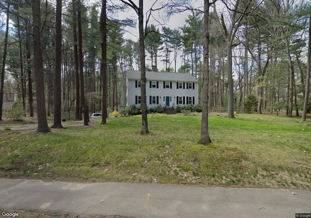
25 Rambling Rd Sudbury, MA 01776
Estimated Value: $932,000 - $1,290,000
4
Beds
4
Baths
2,288
Sq Ft
$498/Sq Ft
Est. Value
About This Home
This home is located at 25 Rambling Rd, Sudbury, MA 01776 and is currently estimated at $1,139,000, approximately $497 per square foot. 25 Rambling Rd is a home located in Middlesex County with nearby schools including Israel Loring Elementary School, Ephraim Curtis Middle School, and Lincoln-Sudbury Regional High School.
Ownership History
Date
Name
Owned For
Owner Type
Purchase Details
Closed on
Jul 18, 1997
Sold by
Dines Amy L and Dines David F
Bought by
Herel Charles R and Herel Susan A
Current Estimated Value
Purchase Details
Closed on
Dec 2, 1987
Sold by
Faber Alan L
Bought by
Dines David F
Create a Home Valuation Report for This Property
The Home Valuation Report is an in-depth analysis detailing your home's value as well as a comparison with similar homes in the area
Home Values in the Area
Average Home Value in this Area
Purchase History
| Date | Buyer | Sale Price | Title Company |
|---|---|---|---|
| Herel Charles R | $375,000 | -- | |
| Herel Charles R | $375,000 | -- | |
| Dines David F | $330,500 | -- |
Source: Public Records
Mortgage History
| Date | Status | Borrower | Loan Amount |
|---|---|---|---|
| Open | Dines David F | $130,000 | |
| Open | Dines David F | $370,000 |
Source: Public Records
Tax History Compared to Growth
Tax History
| Year | Tax Paid | Tax Assessment Tax Assessment Total Assessment is a certain percentage of the fair market value that is determined by local assessors to be the total taxable value of land and additions on the property. | Land | Improvement |
|---|---|---|---|---|
| 2025 | $15,387 | $1,051,000 | $501,600 | $549,400 |
| 2024 | $14,569 | $997,200 | $487,200 | $510,000 |
| 2023 | $13,483 | $855,000 | $435,200 | $419,800 |
| 2022 | $13,417 | $743,300 | $399,200 | $344,100 |
| 2021 | $12,955 | $688,000 | $399,200 | $288,800 |
| 2020 | $12,694 | $688,000 | $399,200 | $288,800 |
| 2019 | $12,322 | $688,000 | $399,200 | $288,800 |
| 2018 | $12,345 | $688,500 | $424,800 | $263,700 |
| 2017 | $12,106 | $682,400 | $421,200 | $261,200 |
| 2016 | $11,727 | $658,800 | $405,200 | $253,600 |
| 2015 | $11,303 | $642,200 | $393,600 | $248,600 |
| 2014 | $11,280 | $625,600 | $382,000 | $243,600 |
Source: Public Records
Map
Nearby Homes
- 84 Hopestill Brown Rd
- 14 Eisenhower Rd
- 0 Wagonwheel Rd
- 91 Eaton Rd W
- 63 Landham Rd
- 19 Nob Hill Dr
- 27 Sloane Dr
- 32 Eaton Rd W
- 30 Edith Rd
- 128 Nobscot Rd
- 30 Nobscot Rd Unit 14
- 216 Landham Rd
- 53 Davidson Rd
- 40 Gregory Rd
- 14 Francine Rd
- 41 James St
- 8 Clara Rd
- 1011 Boston Post Rd
- 78 Apple d or Rd
- 106 Baldwin Ave
- 22 Rambling Rd
- 30 Rambling Rd
- 11 Rambling Rd
- 11 Lombard Ln
- 12 Rambling Rd
- 37 Rambling Rd
- 14 Cider Mill Rd
- 38 Rambling Rd
- 12 Lombard Ln
- 17 Lombard Ln
- 7 Cider Mill Rd
- 186 Woodside Rd
- 20 Cider Mill Rd
- 7 Rambling Rd
- 178 Woodside Rd
- 46 Rambling Rd
- 45 Rambling Rd
- 18 Lombard Ln
- 28 Cider Mill Rd
- 168 Woodside Rd