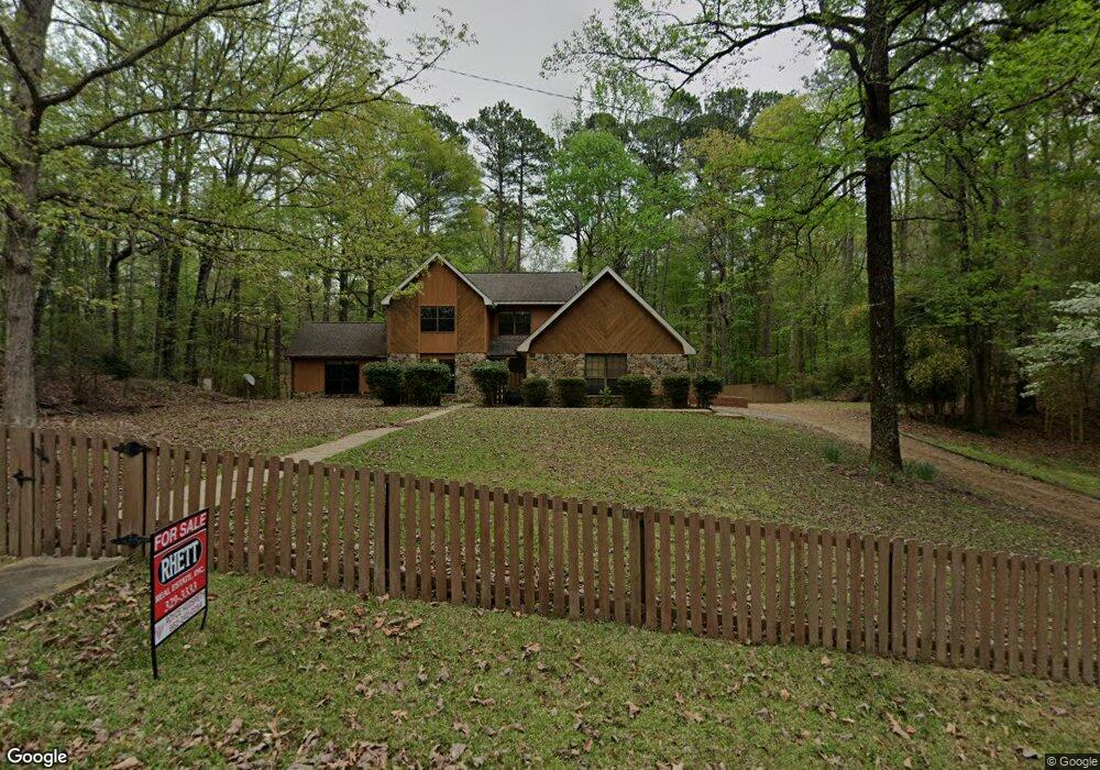
25 Rolling Fork Dr Columbus, MS 39705
Estimated Value: $258,418 - $307,000
3
Beds
3
Baths
2,572
Sq Ft
$113/Sq Ft
Est. Value
About This Home
This home is located at 25 Rolling Fork Dr, Columbus, MS 39705 and is currently estimated at $291,605, approximately $113 per square foot. 25 Rolling Fork Dr is a home located in Lowndes County with nearby schools including Columbus Middle School, Columbus High School, and Heritage Academy.
Ownership History
Date
Name
Owned For
Owner Type
Purchase Details
Closed on
Apr 10, 2024
Sold by
Gordon And Gail Kimpel Family Trust and Kimpel Gordon P
Bought by
Grant Crystal and Grant Edward
Current Estimated Value
Home Financials for this Owner
Home Financials are based on the most recent Mortgage that was taken out on this home.
Original Mortgage
$274,725
Outstanding Balance
$270,043
Interest Rate
6.5%
Mortgage Type
FHA
Estimated Equity
$21,562
Purchase Details
Closed on
Nov 2, 2018
Sold by
Kimpel Gordon P and Kimpel Gail
Bought by
Kimpel Gordon P and Kimpel Gail
Create a Home Valuation Report for This Property
The Home Valuation Report is an in-depth analysis detailing your home's value as well as a comparison with similar homes in the area
Purchase History
| Date | Buyer | Sale Price | Title Company |
|---|---|---|---|
| Grant Crystal | -- | None Listed On Document | |
| Kimpel Gordon P | -- | -- |
Source: Public Records
Mortgage History
| Date | Status | Borrower | Loan Amount |
|---|---|---|---|
| Open | Grant Crystal | $274,725 |
Source: Public Records
Tax History
| Year | Tax Paid | Tax Assessment Tax Assessment Total Assessment is a certain percentage of the fair market value that is determined by local assessors to be the total taxable value of land and additions on the property. | Land | Improvement |
|---|---|---|---|---|
| 2025 | $2,488 | $17,065 | $0 | $0 |
| 2024 | $2,753 | $17,065 | $0 | $0 |
| 2023 | $2,494 | $15,251 | $0 | $0 |
| 2022 | $2,506 | $15,251 | $0 | $0 |
| 2021 | $2,412 | $15,251 | $0 | $0 |
| 2020 | $2,354 | $15,251 | $0 | $0 |
| 2019 | $2,297 | $15,136 | $0 | $0 |
| 2018 | $2,297 | $15,168 | $0 | $0 |
| 2017 | $1,944 | $13,603 | $0 | $0 |
| 2016 | $1,944 | $13,603 | $0 | $0 |
| 2015 | $2,018 | $14,118 | $0 | $0 |
| 2014 | $2,046 | $14,118 | $0 | $0 |
Source: Public Records
Map
Nearby Homes
- 0 Belle Vallee Dr
- 1501 Briarwood Cir
- 1816 Seminole Rd
- 1507 Hickory Ln
- 7 Edinborough Dr
- 437 Forrest Glen Rd
- 2314 Bluecutt Rd
- 169 Crestwood Dr
- 1611 Chickasaw Dr
- 323 Forest Glen Rd
- 0 Fuqua Dr
- 177 Hunters Hollow
- 2405 Military Rd
- 2404 7th St N
- 500 Television Rd
- 520 Television Rd
- 130 Griffin Rd
- 0 Willowbrook Rd
- 254 Carr Rd
- 0 Ridge Rd
- 122 Davis Woods Dr
- 138 Davis Woods Dr
- 43 Day Cir
- 60 Rolling Fork Dr
- 375 Christopher Rd
- 0 Davis Wood Dr
- 115 Day Cir
- 160 Davis Woods Dr
- 38 Day Cir
- 62 Davis Woods Dr
- 59 Davis Woods Dr
- 216 Briarbend Dr
- 114 Day Cir
- 140 Rolling Fork Dr
- 226 Davis Woods Dr
- 219 Rolling Fork Dr
- 328 Christopher Rd
- 553 Christopher Rd
- 251 Christopher Rd
- 129 Day Cir
Your Personal Tour Guide
Ask me questions while you tour the home.