Estimated Value: $1,651,000 - $1,816,000
3
Beds
3
Baths
3,117
Sq Ft
$548/Sq Ft
Est. Value
About This Home
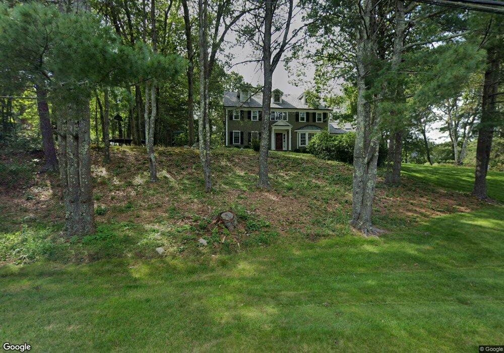
This home is located at 25 Rolling Ln, Dover, MA 02030 and is currently estimated at $1,707,162, approximately $547 per square foot. 25 Rolling Ln is a home located in Norfolk County with nearby schools including Chickering Elementary School, Dover-Sherborn Regional Middle School, and Dover-Sherborn Regional High School.
Ownership History
Date
Name
Owned For
Owner Type
Purchase Details
Closed on
Jun 16, 2008
Sold by
Tracy Blair W and Tracy Clifford B
Bought by
Wyers Beth S and Wyers Mark C
Current Estimated Value
Home Financials for this Owner
Home Financials are based on the most recent Mortgage that was taken out on this home.
Original Mortgage
$724,000
Interest Rate
6.13%
Mortgage Type
Purchase Money Mortgage
Purchase Details
Closed on
Mar 30, 1990
Sold by
Clancey Richard F H
Bought by
Tracy Clifford B
Create a Home Valuation Report for This Property
The Home Valuation Report is an in-depth analysis detailing your home's value as well as a comparison with similar homes in the area
Home Values in the Area
Average Home Value in this Area
Purchase History
| Date | Buyer | Sale Price | Title Company |
|---|---|---|---|
| Wyers Beth S | $905,000 | -- | |
| Tracy Clifford B | $435,000 | -- |
Source: Public Records
Mortgage History
| Date | Status | Borrower | Loan Amount |
|---|---|---|---|
| Open | Tracy Clifford B | $683,000 | |
| Closed | Wyers Beth S | $724,000 | |
| Previous Owner | Tracy Clifford B | $330,000 | |
| Previous Owner | Tracy Clifford B | $40,000 |
Source: Public Records
Tax History
| Year | Tax Paid | Tax Assessment Tax Assessment Total Assessment is a certain percentage of the fair market value that is determined by local assessors to be the total taxable value of land and additions on the property. | Land | Improvement |
|---|---|---|---|---|
| 2025 | $15,461 | $1,371,900 | $578,300 | $793,600 |
| 2024 | $14,272 | $1,302,200 | $558,700 | $743,500 |
| 2023 | $13,837 | $1,135,100 | $490,100 | $645,000 |
| 2022 | $12,911 | $1,039,500 | $470,400 | $569,100 |
| 2021 | $13,137 | $1,019,200 | $470,400 | $548,800 |
| 2020 | $13,087 | $1,019,200 | $470,400 | $548,800 |
| 2019 | $12,816 | $991,200 | $470,400 | $520,800 |
| 2018 | $14,124 | $1,100,000 | $470,400 | $629,600 |
| 2017 | $14,108 | $1,081,100 | $431,200 | $649,900 |
| 2016 | $13,925 | $1,081,100 | $431,200 | $649,900 |
| 2015 | $13,457 | $1,059,600 | $409,700 | $649,900 |
Source: Public Records
Map
Nearby Homes
Your Personal Tour Guide
Ask me questions while you tour the home.