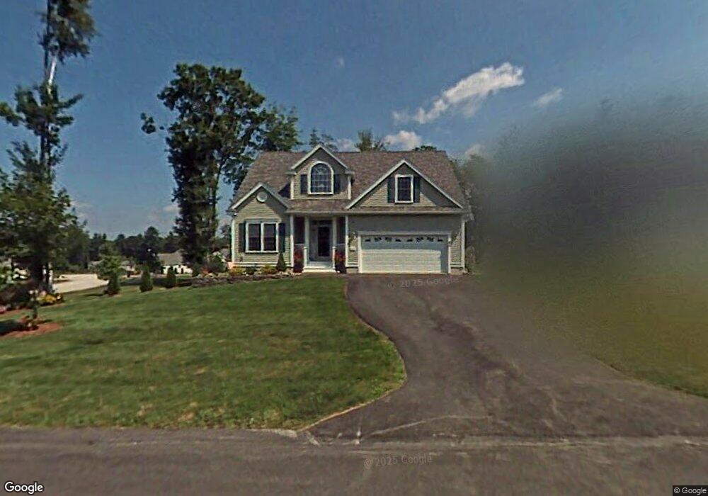
25 Saint Andrews Way Unit 25 Londonderry, NH 03053
Estimated Value: $597,000 - $647,251
2
Beds
3
Baths
2,974
Sq Ft
$209/Sq Ft
Est. Value
About This Home
This home is located at 25 Saint Andrews Way Unit 25, Londonderry, NH 03053 and is currently estimated at $621,063, approximately $208 per square foot. 25 Saint Andrews Way Unit 25 is a home located in Rockingham County with nearby schools including North Londonderry Elementary School, Londonderry Middle School, and Londonderry Senior High School.
Ownership History
Date
Name
Owned For
Owner Type
Purchase Details
Closed on
Dec 7, 2015
Sold by
Nolan Ft and Nolan Jeanne M
Bought by
Edward W&J M Nolan Ret and Nolan Edward W
Current Estimated Value
Purchase Details
Closed on
May 10, 2012
Sold by
Nolan Edward W and Nolan Jeanne M
Bought by
Nolan Edward and Nolan Jeanne M
Purchase Details
Closed on
Sep 13, 2004
Sold by
Londonderry Oaks Inc
Bought by
Nolan Ft
Home Financials for this Owner
Home Financials are based on the most recent Mortgage that was taken out on this home.
Original Mortgage
$270,000
Interest Rate
6.08%
Mortgage Type
Purchase Money Mortgage
Create a Home Valuation Report for This Property
The Home Valuation Report is an in-depth analysis detailing your home's value as well as a comparison with similar homes in the area
Home Values in the Area
Average Home Value in this Area
Purchase History
| Date | Buyer | Sale Price | Title Company |
|---|---|---|---|
| Edward W&J M Nolan Ret | -- | -- | |
| Nolan Edward | -- | -- | |
| Nolan Ft | $361,300 | -- |
Source: Public Records
Mortgage History
| Date | Status | Borrower | Loan Amount |
|---|---|---|---|
| Previous Owner | Nolan Ft | $288,000 | |
| Previous Owner | Nolan Ft | $304,000 | |
| Previous Owner | Nolan Ft | $37,000 | |
| Previous Owner | Nolan Ft | $270,000 |
Source: Public Records
Tax History Compared to Growth
Tax History
| Year | Tax Paid | Tax Assessment Tax Assessment Total Assessment is a certain percentage of the fair market value that is determined by local assessors to be the total taxable value of land and additions on the property. | Land | Improvement |
|---|---|---|---|---|
| 2024 | $8,699 | $539,000 | $0 | $539,000 |
| 2023 | $8,435 | $539,000 | $0 | $539,000 |
| 2022 | $9,648 | $522,100 | $0 | $522,100 |
| 2021 | $10,100 | $549,500 | $0 | $549,500 |
| 2020 | $7,789 | $387,300 | $0 | $387,300 |
| 2019 | $7,510 | $387,300 | $0 | $387,300 |
| 2018 | $7,512 | $344,600 | $0 | $344,600 |
| 2017 | $7,447 | $344,600 | $0 | $344,600 |
| 2016 | $6,886 | $320,300 | $0 | $320,300 |
| 2015 | $6,733 | $320,300 | $0 | $320,300 |
| 2014 | $6,755 | $320,300 | $0 | $320,300 |
| 2011 | -- | $326,300 | $0 | $326,300 |
Source: Public Records
Map
Nearby Homes
- 35 Red Deer Rd
- 224 High Range Rd
- 15 Harvey Rd
- 8 Iroquois Cir
- 5 Hickory Hill Dr
- 193 Fieldstone Dr
- 193 Fieldstone Dr Unit 193
- 169 Fieldstone Dr
- 118 Fieldstone Dr Unit 118
- 15 Tamarack Ct
- 11 Elise Ave Unit Lot 91
- 17 Welch Rd
- 29 Watts Landing Unit 24
- 28 Barksdale Ave
- 67 Pullman St
- 53 Pine Ave
- 8 Barksdale Ave
- 3 Chandler Dr
- 38 Bartley Hill Rd
- 3-C Mustang Dr Unit MODEL
- 24 Saint Andrews Way Unit 24
- 24 Saint Andrews Way Unit 24
- 51 Sawgrass Cir Unit 51
- 26 Saint Andrews Way Unit 26
- 26 St Andrews Way
- 26 Saint Andrews Way
- 40 Sawgrass Cir
- 41 Sawgrass Cir Unit 41
- 40 Sawgrass Cir
- 52 Sawgrass Cir Unit 52
- 39 Sawgrass Cir
- 28 St Andrews Way Unit 28
- 28 Saint Andrews Way Unit 28
- 42 Sawgrass Cir
- 53 Sawgrass Cir Unit 53
- 53 Sawgrass Cir
- 56 Sawgrass Cir Unit 56
- 21 Saint Andrews Way
- 49 Sawgrass Cir
- 49 Sawgrass Cir Unit 49