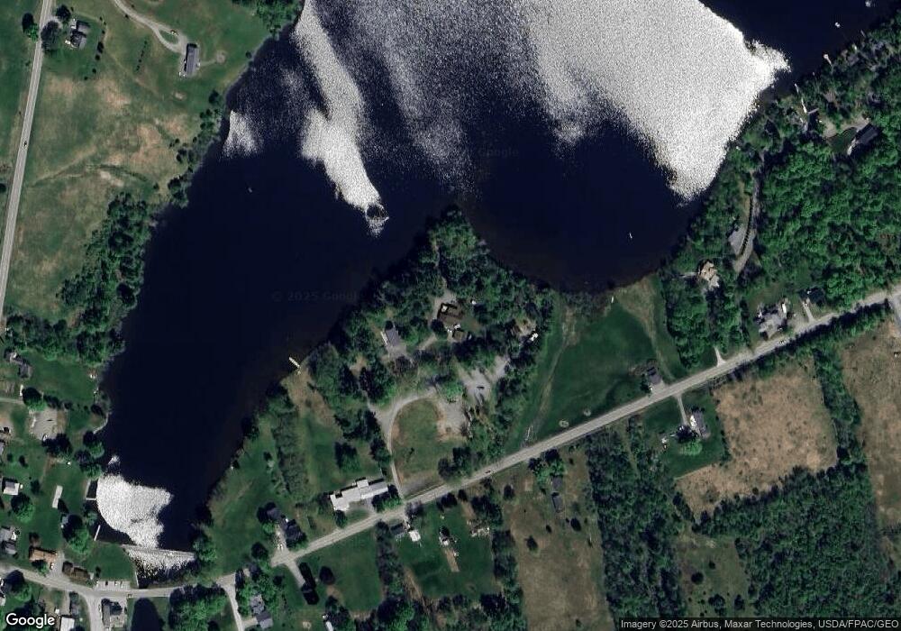
25 Sandy Point Dr Saint Albans, ME 04971
Estimated Value: $385,000 - $567,000
3
Beds
2
Baths
1,232
Sq Ft
$384/Sq Ft
Est. Value
About This Home
This home is located at 25 Sandy Point Dr, Saint Albans, ME 04971 and is currently estimated at $473,042, approximately $383 per square foot. 25 Sandy Point Dr is a home located in Somerset County with nearby schools including St Albans Consolidated, Somerset Elementary School, and Nokomis Regional Middle School/High School.
Ownership History
Date
Name
Owned For
Owner Type
Purchase Details
Closed on
Nov 14, 2012
Sold by
Mower Edwin H and Mower Irene S
Bought by
Harris Debra L and Harris Terrence W
Current Estimated Value
Home Financials for this Owner
Home Financials are based on the most recent Mortgage that was taken out on this home.
Original Mortgage
$248,454
Outstanding Balance
$171,686
Interest Rate
3.39%
Mortgage Type
Commercial
Estimated Equity
$301,356
Purchase Details
Closed on
Nov 5, 2012
Sold by
Mower Edwin H and Mower Irene S
Bought by
Mower Tyler J
Home Financials for this Owner
Home Financials are based on the most recent Mortgage that was taken out on this home.
Original Mortgage
$248,454
Outstanding Balance
$171,686
Interest Rate
3.39%
Mortgage Type
Commercial
Estimated Equity
$301,356
Create a Home Valuation Report for This Property
The Home Valuation Report is an in-depth analysis detailing your home's value as well as a comparison with similar homes in the area
Home Values in the Area
Average Home Value in this Area
Purchase History
| Date | Buyer | Sale Price | Title Company |
|---|---|---|---|
| Harris Debra L | -- | -- | |
| Mower Tyler J | -- | -- |
Source: Public Records
Mortgage History
| Date | Status | Borrower | Loan Amount |
|---|---|---|---|
| Open | Harris Debra L | $248,454 |
Source: Public Records
Tax History Compared to Growth
Tax History
| Year | Tax Paid | Tax Assessment Tax Assessment Total Assessment is a certain percentage of the fair market value that is determined by local assessors to be the total taxable value of land and additions on the property. | Land | Improvement |
|---|---|---|---|---|
| 2022 | $4,737 | $282,800 | $152,400 | $130,400 |
| 2021 | $4,737 | $282,800 | $152,400 | $130,400 |
| 2020 | $3,388 | $276,100 | $152,400 | $123,700 |
| 2019 | $4,625 | $276,100 | $152,400 | $123,700 |
| 2018 | $1,299 | $276,100 | $152,400 | $123,700 |
| 2017 | $1,299 | $276,100 | $152,400 | $123,700 |
| 2016 | $4,249 | $191,400 | $98,500 | $92,900 |
| 2015 | $3,804 | $187,400 | $98,500 | $88,900 |
| 2012 | $3,636 | $199,800 | $125,100 | $74,700 |
Source: Public Records
Map
Nearby Homes
- 30 Main St
- 19 Mason Corner Rd
- 4 Main St
- PO72,P090 Cotta Lane & Rt 43
- 230 Todds Corner Rd
- 43 Stage Rd
- M6 L22C Stage Rd
- Lot #86-3 Martin Rd
- M9 L7 Finson Rd
- 40 Orchard Dr
- M11 Loon Ln
- 553 Corinna Rd
- 247 Commercial St
- 20 Burton St
- 83 Commercial St
- 37 North St
- TBD Ballard Rd
- 355 Melody Ln
- 33 Brown Rd
- 47 Higgins Rd
- 20 Sandy Point Dr
- 20 Sandy Point Dr
- 22 Sandy Point Dr
- Map 22 Sandy Point Dr
- 12 Sandy Point Dr
- 77 Corinna Rd
- 96 Corinna Rd
- 57 Corinna Rd
- 54 Corinna Rd
- 104 Corinna Rd
- 95 Corinna Rd
- 44 Corinna Rd
- 32 Osprey Dr
- 39 Osprey Dr
- 43 Corinna Rd
- 43 Corinna Rd
- 43 Corinna Rd
- Lot 4 Route 43 Corinna Rd
- Lot 2 Route 43 Corrina Rd
- 22 Osprey Dr
