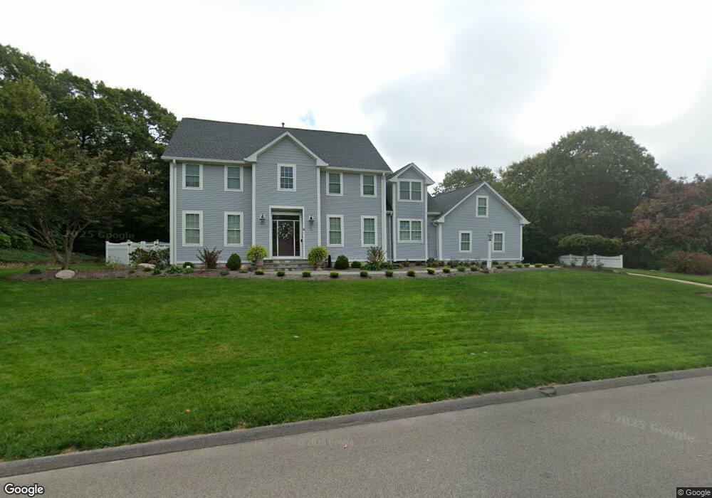
25 Seabury Dr Westerly, RI 02891
Estimated Value: $1,195,487 - $1,547,000
4
Beds
3
Baths
3,232
Sq Ft
$424/Sq Ft
Est. Value
About This Home
This home is located at 25 Seabury Dr, Westerly, RI 02891 and is currently estimated at $1,371,872, approximately $424 per square foot. 25 Seabury Dr is a home located in Washington County with nearby schools including Westerly High School and St. Michael School.
Ownership History
Date
Name
Owned For
Owner Type
Purchase Details
Closed on
Feb 15, 2019
Sold by
Murphy James O and Murphy Ann M
Bought by
Ann Marie Murphy Lt
Current Estimated Value
Purchase Details
Closed on
Sep 12, 1995
Sold by
Gaudy Richard E and Notaro Peter F
Bought by
Murphy James O and Murphy Marie
Home Financials for this Owner
Home Financials are based on the most recent Mortgage that was taken out on this home.
Original Mortgage
$45,000
Interest Rate
7.8%
Create a Home Valuation Report for This Property
The Home Valuation Report is an in-depth analysis detailing your home's value as well as a comparison with similar homes in the area
Home Values in the Area
Average Home Value in this Area
Purchase History
| Date | Buyer | Sale Price | Title Company |
|---|---|---|---|
| Ann Marie Murphy Lt | -- | -- | |
| Murphy James O | $47,500 | -- |
Source: Public Records
Mortgage History
| Date | Status | Borrower | Loan Amount |
|---|---|---|---|
| Previous Owner | Murphy James O | $100,000 | |
| Previous Owner | Murphy James O | $125,800 | |
| Previous Owner | Murphy James O | $135,000 | |
| Previous Owner | Murphy James O | $45,000 |
Source: Public Records
Tax History Compared to Growth
Tax History
| Year | Tax Paid | Tax Assessment Tax Assessment Total Assessment is a certain percentage of the fair market value that is determined by local assessors to be the total taxable value of land and additions on the property. | Land | Improvement |
|---|---|---|---|---|
| 2025 | $9,038 | $1,161,700 | $490,400 | $671,300 |
| 2024 | $9,129 | $873,600 | $327,400 | $546,200 |
| 2023 | $8,876 | $873,600 | $327,400 | $546,200 |
| 2022 | $8,585 | $850,000 | $327,400 | $522,600 |
| 2021 | $8,026 | $665,500 | $238,100 | $427,400 |
| 2020 | $7,886 | $665,500 | $238,100 | $427,400 |
| 2019 | $7,813 | $665,500 | $238,100 | $427,400 |
| 2018 | $8,396 | $679,800 | $238,100 | $441,700 |
| 2017 | $8,158 | $679,800 | $238,100 | $441,700 |
| 2016 | $8,158 | $679,800 | $238,100 | $441,700 |
| 2015 | $8,074 | $719,000 | $254,800 | $464,200 |
| 2014 | $7,945 | $719,000 | $254,800 | $464,200 |
Source: Public Records
Map
Nearby Homes
- 6 Newbury Dr
- 9 Compass Way Unit 201
- 9 Compass Way Unit 202
- 9 Compass Way Unit 101
- 9 Compass Way Unit 102
- 9 Compass Way Unit 103
- 9 Compass Way Unit 203
- 3 Settlers Landing
- 13 No Bottom Ridge Rd
- 11 Hamilton Rd
- 7 Spring Pond Rd
- 18 No Bottom Ridge Ridge
- 9 Cedar Crest Dr
- 10 Tristam St
- 2 Brass Ring Rd
- 11 Rabbit Run
- 18 Timothy Dr
- 26 Windward Dr
- 44 Benson Ave
- 9 Montauk Ave