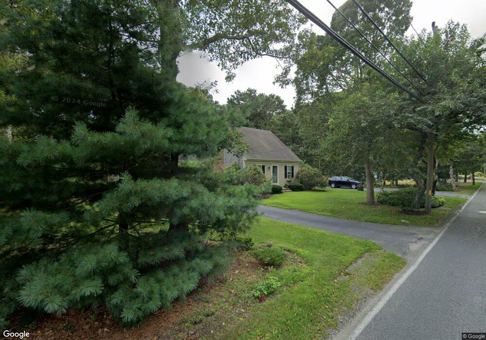
25 Sheridan Rd South Yarmouth, MA 02664
Estimated Value: $566,000 - $635,317
3
Beds
2
Baths
1,272
Sq Ft
$478/Sq Ft
Est. Value
About This Home
This home is located at 25 Sheridan Rd, South Yarmouth, MA 02664 and is currently estimated at $608,079, approximately $478 per square foot. 25 Sheridan Rd is a home located in Barnstable County with nearby schools including Dennis-Yarmouth Regional High School and St. Pius X. School.
Ownership History
Date
Name
Owned For
Owner Type
Purchase Details
Closed on
May 27, 2021
Sold by
Murphy David H and Murphy Cynthia M
Bought by
Murphy David H and Murphy Cynthia M
Current Estimated Value
Home Financials for this Owner
Home Financials are based on the most recent Mortgage that was taken out on this home.
Original Mortgage
$682,500
Outstanding Balance
$672,406
Interest Rate
2.9%
Mortgage Type
Reverse Mortgage Home Equity Conversion Mortgage
Estimated Equity
-$64,327
Purchase Details
Closed on
Oct 28, 1996
Sold by
Popovich Cecilia A
Bought by
Murphy David H and Murphy Cynthia M
Purchase Details
Closed on
May 1, 1992
Sold by
Sidoti Mark S
Bought by
Popovich Cecilia A
Purchase Details
Closed on
Sep 29, 1989
Sold by
Stoddard C R
Bought by
Sidotti Mark
Create a Home Valuation Report for This Property
The Home Valuation Report is an in-depth analysis detailing your home's value as well as a comparison with similar homes in the area
Home Values in the Area
Average Home Value in this Area
Purchase History
| Date | Buyer | Sale Price | Title Company |
|---|---|---|---|
| Murphy David H | -- | None Available | |
| Murphy David H | -- | None Available | |
| Murphy David H | $122,500 | -- | |
| Popovich Cecilia A | $40,000 | -- | |
| Murphy David H | $122,500 | -- | |
| Popovich Cecilia A | $40,000 | -- | |
| Sidotti Mark | $50,000 | -- |
Source: Public Records
Mortgage History
| Date | Status | Borrower | Loan Amount |
|---|---|---|---|
| Open | Murphy David H | $682,500 | |
| Previous Owner | Sidotti Mark | $132,000 | |
| Previous Owner | Sidotti Mark | $63,000 |
Source: Public Records
Tax History Compared to Growth
Tax History
| Year | Tax Paid | Tax Assessment Tax Assessment Total Assessment is a certain percentage of the fair market value that is determined by local assessors to be the total taxable value of land and additions on the property. | Land | Improvement |
|---|---|---|---|---|
| 2025 | $3,863 | $545,600 | $168,500 | $377,100 |
| 2024 | $3,579 | $485,000 | $146,600 | $338,400 |
| 2023 | $3,560 | $439,000 | $133,200 | $305,800 |
| 2022 | $3,287 | $358,100 | $127,100 | $231,000 |
| 2021 | $3,237 | $338,600 | $127,100 | $211,500 |
| 2020 | $3,205 | $320,500 | $134,400 | $186,100 |
| 2019 | $3,010 | $298,000 | $134,400 | $163,600 |
| 2018 | $2,836 | $275,600 | $112,000 | $163,600 |
| 2017 | $2,762 | $275,600 | $112,000 | $163,600 |
| 2016 | $2,662 | $266,700 | $103,100 | $163,600 |
| 2015 | $2,591 | $258,100 | $98,600 | $159,500 |
Source: Public Records
Map
Nearby Homes
- 116 N Main St
- 1 Country Club Dr
- 18 Turner Ln
- 30 Pebble Beach Way
- 29 Bass River Rd
- 4 Raymond Ave
- 7 Sunset Pines Rd
- 21 Green Way
- 61 Station Ave
- 45 Seth Ln
- 23 Fairwood Rd
- 15 Sharon Rd
- 91 Chipping Green Cir
- 140 Diane Ave
- 308 Old Main St
- 22 Powhatan Rd
- 141 Main St Unit 4
- 141 Main St Unit 23
- 209 Main St Unit 3
- 209 Main St Unit 4
- 0 Sheridan Rd Unit 26 2040781
- 0 Sheridan Rd
- 109 High Bank Rd
- 109 Highbank Rd
- 26 Sheridan Rd
- 28 Sheridan Rd
- 113 High Bank Rd
- 15 Sheridan Rd
- 113 Highbank Rd
- 22 Sheridan Rd
- 119 High Bank Rd
- 32 Sheridan Rd
- 119 Highbank Rd
- 12 Sheridan Rd
- 97 High Bank Rd
- 36 Sheridan Rd
- 102 High Bank Rd
- 196 N Main St
- 102 Highbank Rd
- 5 Sheridan Rd