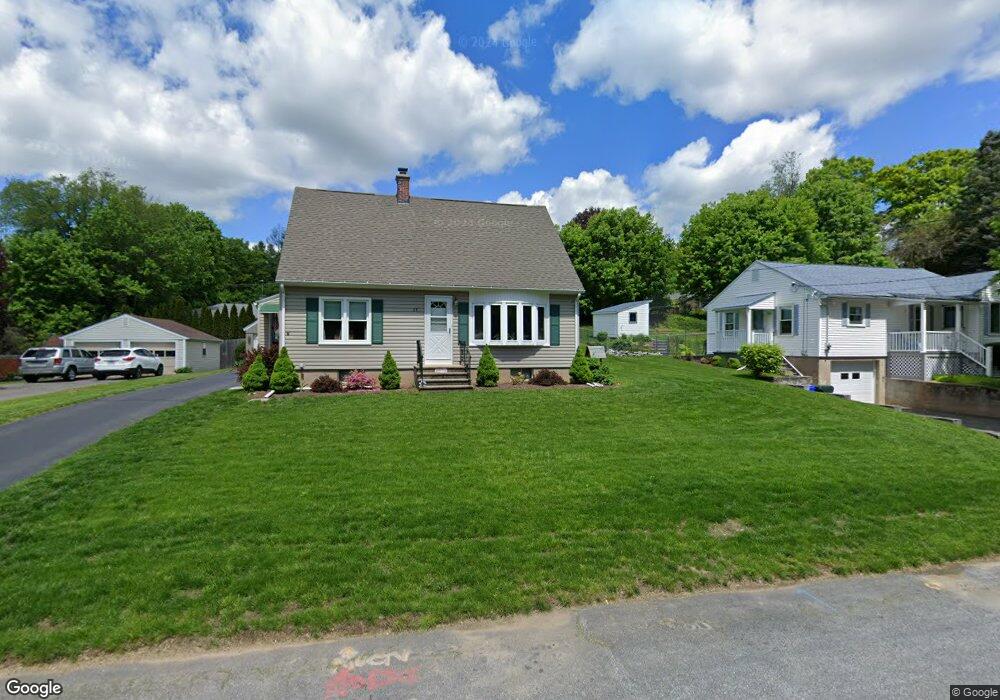
25 Stumpf Ave Thomaston, CT 06787
Estimated Value: $205,000 - $303,000
3
Beds
1
Bath
1,075
Sq Ft
$248/Sq Ft
Est. Value
About This Home
This home is located at 25 Stumpf Ave, Thomaston, CT 06787 and is currently estimated at $267,020, approximately $248 per square foot. 25 Stumpf Ave is a home located in Litchfield County with nearby schools including Black Rock School, Thomaston Center School, and Thomaston High School.
Ownership History
Date
Name
Owned For
Owner Type
Purchase Details
Closed on
Dec 9, 2014
Sold by
Mdore Susan M
Bought by
Madore Michael J
Current Estimated Value
Purchase Details
Closed on
Feb 15, 2000
Sold by
Sheldon Cliff and Atwood Newell H
Bought by
Madore Michael and Madore Susan
Home Financials for this Owner
Home Financials are based on the most recent Mortgage that was taken out on this home.
Original Mortgage
$119,000
Interest Rate
7.98%
Create a Home Valuation Report for This Property
The Home Valuation Report is an in-depth analysis detailing your home's value as well as a comparison with similar homes in the area
Home Values in the Area
Average Home Value in this Area
Purchase History
| Date | Buyer | Sale Price | Title Company |
|---|---|---|---|
| Madore Michael J | -- | -- | |
| Madore Michael | $120,000 | -- |
Source: Public Records
Mortgage History
| Date | Status | Borrower | Loan Amount |
|---|---|---|---|
| Previous Owner | Madore Michael | $116,912 | |
| Previous Owner | Madore Michael | $119,000 |
Source: Public Records
Tax History
| Year | Tax Paid | Tax Assessment Tax Assessment Total Assessment is a certain percentage of the fair market value that is determined by local assessors to be the total taxable value of land and additions on the property. | Land | Improvement |
|---|---|---|---|---|
| 2025 | $4,377 | $122,220 | $43,750 | $78,470 |
| 2024 | $4,199 | $122,220 | $43,750 | $78,470 |
| 2023 | $4,110 | $122,220 | $43,750 | $78,470 |
| 2022 | $3,924 | $122,220 | $43,750 | $78,470 |
| 2021 | $3,801 | $105,210 | $43,750 | $61,460 |
| 2020 | $3,801 | $105,210 | $43,750 | $61,460 |
| 2019 | $3,843 | $105,210 | $43,750 | $61,460 |
| 2018 | $3,765 | $105,210 | $43,750 | $61,460 |
| 2017 | $3,688 | $105,210 | $43,750 | $61,460 |
| 2016 | $3,475 | $101,990 | $41,650 | $60,340 |
| 2015 | $3,430 | $101,990 | $41,650 | $60,340 |
| 2014 | $3,430 | $101,990 | $41,650 | $60,340 |
Source: Public Records
Map
Nearby Homes
- 143 Pine Hill Rd Unit 17A
- 143 Pine Hill Rd Unit 15F
- 2 Branch Rd Unit 5A
- 37 Steven's Blvd
- 58 Litchfield St
- 102 Elm St
- 16 Grand St
- 22 Park St
- 104 Judson St
- 16 Tracy St
- 56 Hillside Ave
- 785 Main St
- 211 Pine Hill Blvd Unit 211
- 713 Pine Hill Blvd
- 24 W Lakeview Rd
- 41 South St
- 7 South St
- 311 Lake Plymouth Blvd
- 23 Keegan Rd
- 531 Hickory Hill Rd
- 21 Stumpf Ave
- 31 Stumpf Ave
- 15 Stumpf Ave
- 35 Stumpf Ave
- 127 Watertown Rd
- 139 Watertown Rd
- 32 Stumpf Ave
- 119 Watertown Rd
- 126 Pine Hill Rd
- 118 Pine Hill Rd
- 36 Stumpf Ave
- 110 Pine Hill Rd
- 41 Stumpf Ave
- 102 Pine Hill Rd
- 141 Watertown Rd
- 42 Stumpf Ave
- 105 Watertown Rd
- 89 Pine Hill Rd
- 98 Pine Hill Rd
- 49 Stumpf Ave
Your Personal Tour Guide
Ask me questions while you tour the home.