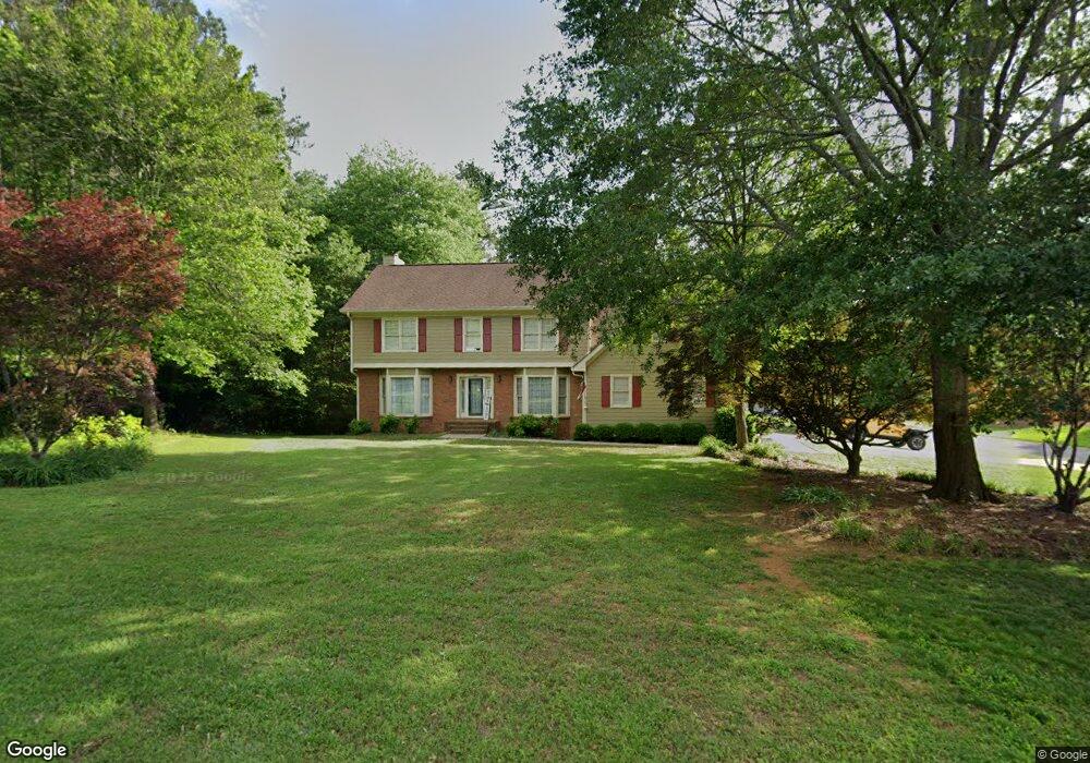
250 Camp Dr Carrollton, GA 30117
Estimated Value: $388,534 - $459,000
4
Beds
3
Baths
2,766
Sq Ft
$152/Sq Ft
Est. Value
About This Home
This home is located at 250 Camp Dr, Carrollton, GA 30117 and is currently estimated at $421,134, approximately $152 per square foot. 250 Camp Dr is a home located in Carroll County with nearby schools including Central Elementary School, Central Middle School, and Central High School.
Ownership History
Date
Name
Owned For
Owner Type
Purchase Details
Closed on
Feb 9, 2006
Sold by
Thomason Beck W
Bought by
Baxley James G
Current Estimated Value
Purchase Details
Closed on
Aug 28, 2002
Sold by
Deese Norman L and Deese Reb
Bought by
Thomason Beck W and Thomason Donna M
Purchase Details
Closed on
Jun 27, 2000
Sold by
Reynolds David A
Bought by
Deese Norman L and Deese Reb
Purchase Details
Closed on
Jun 26, 2000
Sold by
Deese Norman L and Deese Reb
Bought by
Watson Jim and Watson Robyn L
Purchase Details
Closed on
Feb 24, 1995
Sold by
Reynolds David
Bought by
Deese Norman L and Deese Reb
Purchase Details
Closed on
Aug 5, 1993
Bought by
Reynolds David
Create a Home Valuation Report for This Property
The Home Valuation Report is an in-depth analysis detailing your home's value as well as a comparison with similar homes in the area
Home Values in the Area
Average Home Value in this Area
Purchase History
| Date | Buyer | Sale Price | Title Company |
|---|---|---|---|
| Baxley James G | $205,000 | -- | |
| Thomason Beck W | $174,000 | -- | |
| Deese Norman L | -- | -- | |
| Watson Jim | $167,500 | -- | |
| Deese Norman L | $132,000 | -- | |
| Reynolds David | -- | -- |
Source: Public Records
Tax History Compared to Growth
Tax History
| Year | Tax Paid | Tax Assessment Tax Assessment Total Assessment is a certain percentage of the fair market value that is determined by local assessors to be the total taxable value of land and additions on the property. | Land | Improvement |
|---|---|---|---|---|
| 2024 | $401 | $141,325 | $16,000 | $125,325 |
| 2023 | $478 | $130,202 | $16,000 | $114,202 |
| 2022 | $478 | $107,540 | $16,000 | $91,540 |
| 2021 | $482 | $94,761 | $16,000 | $78,761 |
| 2020 | $2,293 | $86,429 | $16,000 | $70,429 |
| 2019 | $497 | $81,400 | $16,000 | $65,400 |
| 2018 | $521 | $73,084 | $16,000 | $57,084 |
| 2017 | $526 | $73,084 | $16,000 | $57,084 |
| 2016 | $527 | $73,084 | $16,000 | $57,084 |
| 2015 | $513 | $68,966 | $8,000 | $60,966 |
| 2014 | $517 | $68,966 | $8,000 | $60,966 |
Source: Public Records
Map
Nearby Homes
- 95 Camp Ln
- 20 Camp Ct
- 21 Crabapple Place
- 399 Old Camp Church Rd
- The Coleman Plan at Summerfield Place
- The Pearson Plan at Summerfield Place
- The Piedmont Plan at Summerfield Place
- The Harrington Plan at Summerfield Place
- The McGinnis Plan at Summerfield Place
- The Telfair Plan at Summerfield Place
- 40 Red Holly Gap
- 0 Bonner Rd Unit 10635754
- 345 Piney Grove Rd
- 105 Woodbine Dr
- 3680 W Highway 166
- 295 Timber Ridge Trail
- 115 Greenwood Ln
- 202 Hickory Chase
- 107 Hickory Chase Unit 102
- 107 Hickory Chase
- 0 Woods Way Unit 7113488
- 34 Woods Way
- 34 Woods Way
- 235 Camp Dr
- 274 Camp Dr
- 274 Camp Dr
- 220 Camp Dr
- 42 Woods Way Unit 28
- 42 Woods Way
- 12 Pine Ct
- 21 Pine Ct
- 205 Camp Dr Unit 12C
- 0 Pine Ct Unit 7330237
- 0 Pine Ct Unit 8265310
- 0 Pine Ct Unit 7539832
- 0 Pine Ct
- 24 Pine Ct
- 45 Woods Way
- 296 Camp Dr
- 190 Camp Dr