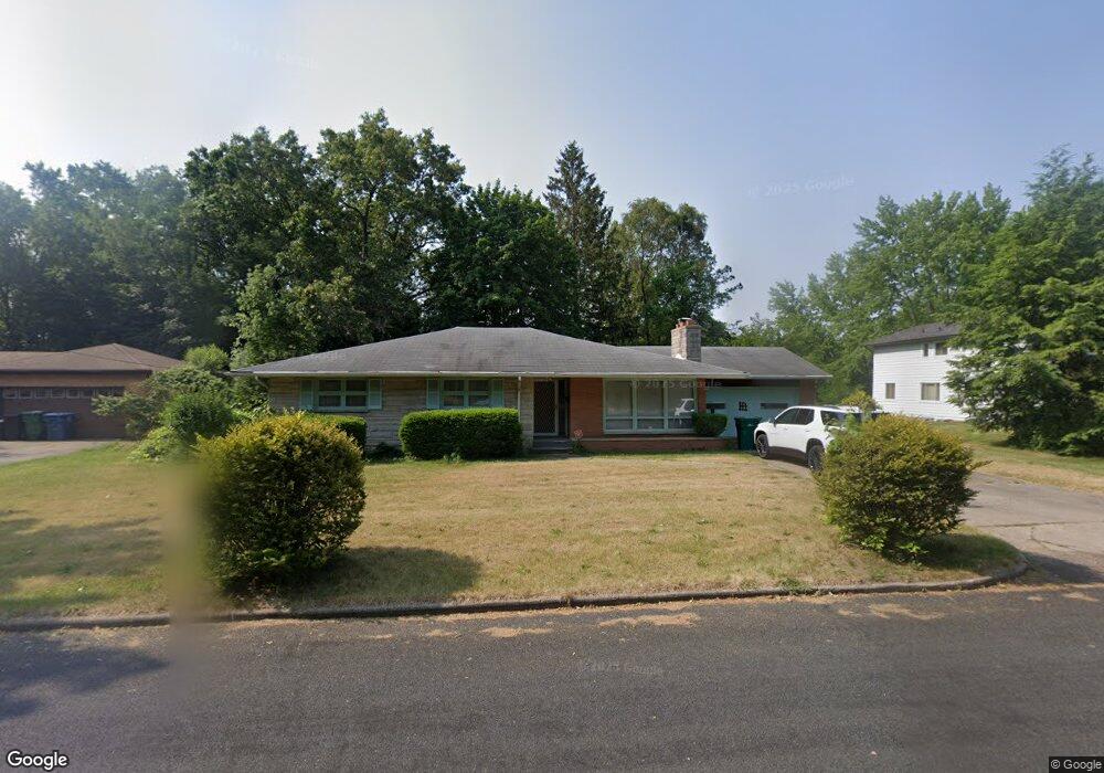
250 Cornell Dr Battle Creek, MI 49017
Northeast Battle Creek NeighborhoodEstimated Value: $242,000 - $261,000
3
Beds
3
Baths
1,780
Sq Ft
$139/Sq Ft
Est. Value
About This Home
This home is located at 250 Cornell Dr, Battle Creek, MI 49017 and is currently estimated at $247,919, approximately $139 per square foot. 250 Cornell Dr is a home located in Calhoun County with nearby schools including Northwestern Middle School, Battle Creek Central High School, and Battle Creek Christian School.
Ownership History
Date
Name
Owned For
Owner Type
Purchase Details
Closed on
Dec 13, 2010
Sold by
Comerica Bank
Bought by
Jackson Kevin
Current Estimated Value
Home Financials for this Owner
Home Financials are based on the most recent Mortgage that was taken out on this home.
Original Mortgage
$86,850
Outstanding Balance
$57,468
Interest Rate
4.25%
Mortgage Type
FHA
Estimated Equity
$190,451
Purchase Details
Closed on
Nov 10, 2010
Sold by
Rodgers John M and Rodgers Cynthia E
Bought by
Mapes Ruth Ellen and Living Trust Of Ruth Ellen Map
Home Financials for this Owner
Home Financials are based on the most recent Mortgage that was taken out on this home.
Original Mortgage
$86,850
Outstanding Balance
$57,468
Interest Rate
4.25%
Mortgage Type
FHA
Estimated Equity
$190,451
Purchase Details
Closed on
Aug 30, 2010
Sold by
Rodgers John M and Rodgers Cynthia E
Bought by
Light Of Messiah Fellowship
Home Financials for this Owner
Home Financials are based on the most recent Mortgage that was taken out on this home.
Original Mortgage
$90,000
Interest Rate
4.6%
Mortgage Type
Seller Take Back
Purchase Details
Closed on
Mar 27, 2003
Sold by
Mapes Ellen
Bought by
Mapes Trust Ruth Ellen
Create a Home Valuation Report for This Property
The Home Valuation Report is an in-depth analysis detailing your home's value as well as a comparison with similar homes in the area
Home Values in the Area
Average Home Value in this Area
Purchase History
| Date | Buyer | Sale Price | Title Company |
|---|---|---|---|
| Jackson Kevin | $90,000 | Fatic | |
| Mapes Ruth Ellen | -- | First American Title Ins Co | |
| Light Of Messiah Fellowship | $90,000 | None Available | |
| Mapes Trust Ruth Ellen | -- | -- |
Source: Public Records
Mortgage History
| Date | Status | Borrower | Loan Amount |
|---|---|---|---|
| Open | Jackson Kevin | $86,850 | |
| Previous Owner | Light Of Messiah Fellowship | $90,000 |
Source: Public Records
Tax History Compared to Growth
Tax History
| Year | Tax Paid | Tax Assessment Tax Assessment Total Assessment is a certain percentage of the fair market value that is determined by local assessors to be the total taxable value of land and additions on the property. | Land | Improvement |
|---|---|---|---|---|
| 2025 | -- | $101,700 | $0 | $0 |
| 2024 | $2,611 | $98,380 | $0 | $0 |
| 2023 | $3,550 | $83,010 | $0 | $0 |
| 2022 | $2,358 | $80,122 | $0 | $0 |
| 2021 | $2,815 | $76,734 | $0 | $0 |
| 2020 | $2,648 | $73,203 | $0 | $0 |
| 2019 | $2,638 | $66,308 | $0 | $0 |
| 2018 | $2,638 | $65,259 | $2,750 | $62,509 |
| 2017 | $2,557 | $63,036 | $0 | $0 |
| 2016 | $2,552 | $61,826 | $0 | $0 |
| 2015 | $2,500 | $55,694 | $4,913 | $50,781 |
| 2014 | $2,500 | $54,257 | $4,913 | $49,344 |
Source: Public Records
Map
Nearby Homes
- 274 Central St
- 276 Mckinley Ave N
- 261 Emmett St E
- 195 Union St N
- 176 Union St N
- 21 Bryant St
- 292 Hunter St
- 561 Garrison Rd
- 162 Orchard Ave
- 78 Central St
- 174 East Ave N
- 192 Fremont St
- 45 Central St
- 495 Emmett St E
- 14 Elizabeth St
- 91 Sherman Rd
- 31 Oxford St
- 170 Sherman Rd
- 90 N Broad St
- 323 Garfield Ave
- 410 Orchard Ave
- 400 Orchard Ave
- 183 Pleasantview Dr
- 189 Pleasantview Dr
- 251 Cornell Dr
- 420 Orchard Ave
- 375 Garrison Rd
- 195 Pleasantview Dr
- 267 Cornell Dr
- 415 Orchard Ave
- 405 Orchard Ave
- 437 Orchard Ave
- 409 Orchard Ave
- 440 Orchard Ave
- 165 Pleasantview Dr
- 220 Curtis Ave
- 374 Garrison Rd
- 230 Curtis Ave
- 188 Pleasantview Dr
- 172 Pleasantview Dr