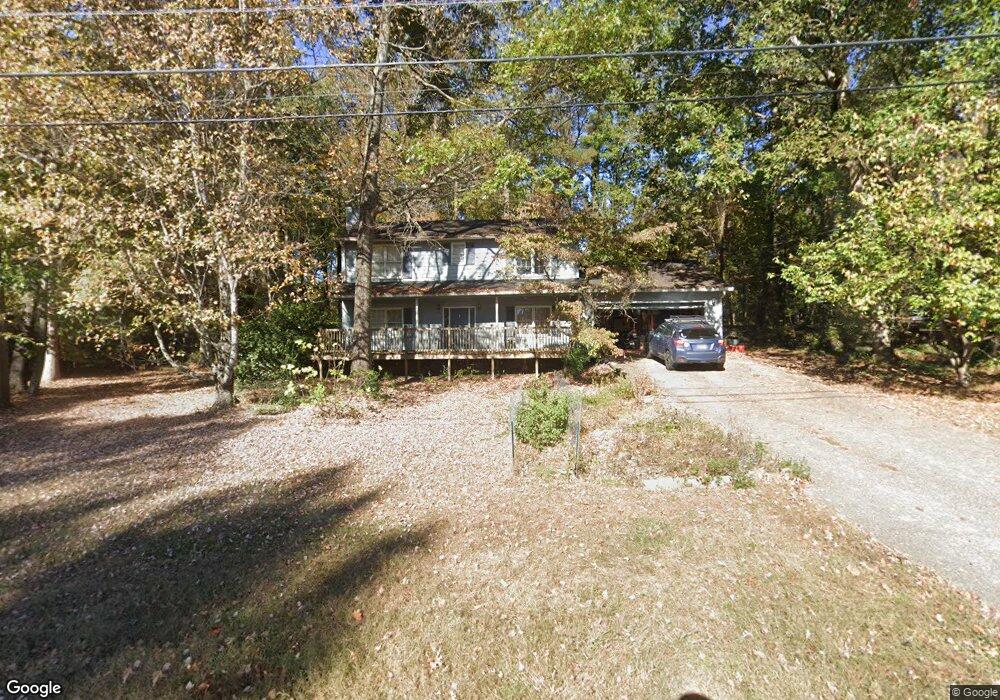
250 Cottonpatch Rd Unit 3 Lawrenceville, GA 30046
Estimated Value: $334,000 - $383,000
3
Beds
3
Baths
1,992
Sq Ft
$178/Sq Ft
Est. Value
About This Home
This home is located at 250 Cottonpatch Rd Unit 3, Lawrenceville, GA 30046 and is currently estimated at $355,532, approximately $178 per square foot. 250 Cottonpatch Rd Unit 3 is a home located in Gwinnett County with nearby schools including Simonton Elementary School, Jordan Middle School, and Central Gwinnett High School.
Ownership History
Date
Name
Owned For
Owner Type
Purchase Details
Closed on
Jan 30, 2006
Sold by
Reece Michael J and Reece Judith A
Bought by
Dobson Adam D and Dobson Amanda D
Current Estimated Value
Home Financials for this Owner
Home Financials are based on the most recent Mortgage that was taken out on this home.
Original Mortgage
$130,500
Outstanding Balance
$73,205
Interest Rate
6.14%
Mortgage Type
New Conventional
Estimated Equity
$282,327
Purchase Details
Closed on
Mar 7, 2002
Sold by
Reece Michael J and Reece Judith A
Bought by
Powell Donald E and Powell Karen
Home Financials for this Owner
Home Financials are based on the most recent Mortgage that was taken out on this home.
Original Mortgage
$115,000
Interest Rate
6.49%
Mortgage Type
New Conventional
Create a Home Valuation Report for This Property
The Home Valuation Report is an in-depth analysis detailing your home's value as well as a comparison with similar homes in the area
Home Values in the Area
Average Home Value in this Area
Purchase History
| Date | Buyer | Sale Price | Title Company |
|---|---|---|---|
| Dobson Adam D | $145,000 | -- | |
| Powell Donald E | -- | -- |
Source: Public Records
Mortgage History
| Date | Status | Borrower | Loan Amount |
|---|---|---|---|
| Open | Dobson Adam D | $130,500 | |
| Previous Owner | Powell Donald E | $115,000 |
Source: Public Records
Tax History Compared to Growth
Tax History
| Year | Tax Paid | Tax Assessment Tax Assessment Total Assessment is a certain percentage of the fair market value that is determined by local assessors to be the total taxable value of land and additions on the property. | Land | Improvement |
|---|---|---|---|---|
| 2024 | $3,214 | $133,720 | $23,600 | $110,120 |
| 2023 | $3,214 | $133,720 | $23,600 | $110,120 |
| 2022 | $2,855 | $115,720 | $19,200 | $96,520 |
| 2021 | $2,334 | $87,640 | $14,800 | $72,840 |
| 2020 | $2,369 | $80,360 | $14,800 | $65,560 |
| 2019 | $2,280 | $76,760 | $13,600 | $63,160 |
| 2018 | $2,101 | $71,200 | $12,000 | $59,200 |
| 2016 | $1,775 | $57,040 | $9,600 | $47,440 |
| 2015 | $1,367 | $44,960 | $9,600 | $35,360 |
| 2014 | $1,377 | $44,960 | $9,600 | $35,360 |
Source: Public Records
Map
Nearby Homes
- 234 Park Place Dr Unit 1
- 1160 Creekwood Cove
- 982 Waverly Dr
- 990 Grayson Hwy
- 927 Winding Trail
- 41 Ludwick Ln
- 1080 Chandler Ridge Dr
- 347 Karen Ct
- 78 Dorothy Ln
- 1020 Chandler Ridge Dr SE
- 999 Chestnut Oak Ct
- 208 Dorothy Ln
- 70 Chandler Ridge Ln
- 191 Gates Mill Dr
- 91 Gates Mill Dr
- 1230 Polaris Ct
- 142 Bernice Dr
- 980 Hilltop Ct
- 1097 Cherry Wood Dr
- 260 Cottonpatch Rd
- 240 Cottonpatch Rd
- 240 Cottonpatch Rd Unit 21
- 1092 Magnolia Way
- 251 Cottonpatch Rd
- 1087 Cherry Wood Dr Unit 3
- 0 Magnolia Way
- 1074 Magnolia Way
- 231 Cottonpatch Rd
- 261 Cottonpatch Rd
- 1077 Cherry Wood Dr
- 270 Cottonpatch Rd
- 1093 Magnolia Way
- 491 Cottonpatch Rd
- 1083 Magnolia Way Unit 3
- 1073 Magnolia Way
- 271 Cottonpatch Rd
- 166 Stone Wood Ln
- 166 Stone Wood Ln Unit 26