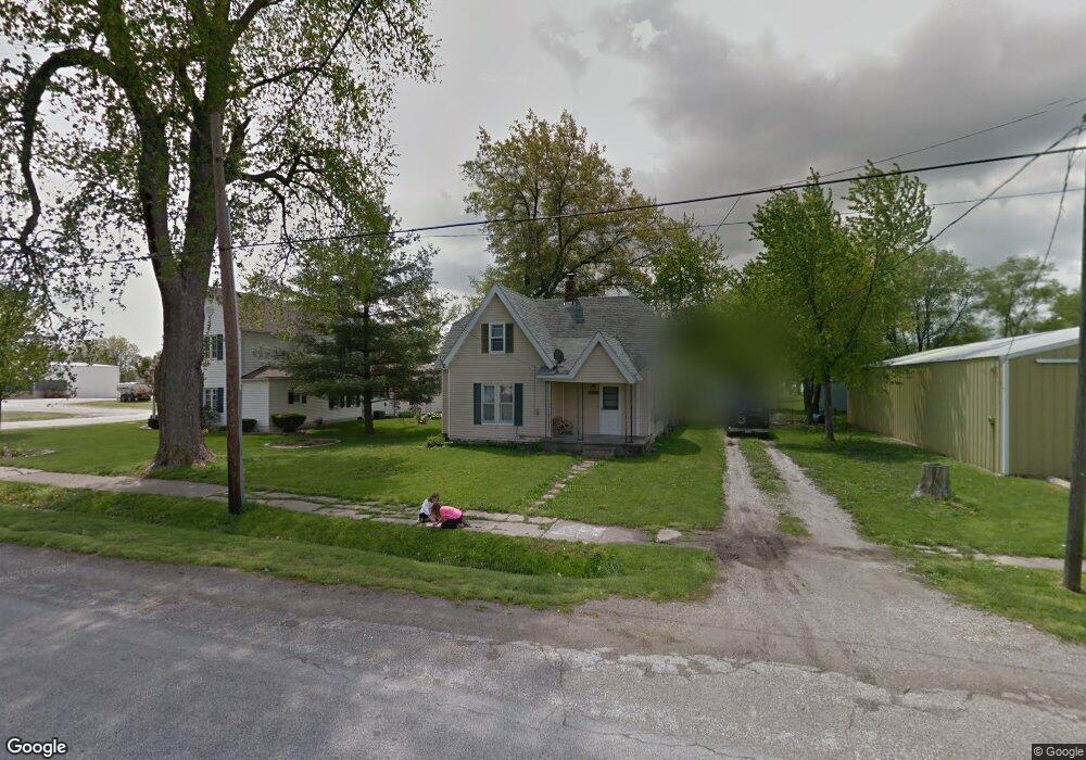
250 E State St Palmyra, IL 62674
Estimated Value: $47,000 - $168,000
4
Beds
1
Bath
1,344
Sq Ft
$82/Sq Ft
Est. Value
About This Home
This home is located at 250 E State St, Palmyra, IL 62674 and is currently estimated at $110,815, approximately $82 per square foot. 250 E State St is a home located in Macoupin County with nearby schools including Northwestern Elementary School, Northwestern Junior High School, and Northwestern High School.
Ownership History
Date
Name
Owned For
Owner Type
Purchase Details
Closed on
Sep 25, 2024
Sold by
Jones James Glenn
Bought by
Baker Dameon Lee and Fagg Angelica Shawn
Current Estimated Value
Purchase Details
Closed on
Sep 28, 2018
Sold by
Jones Shannon Elizabeth
Bought by
Jones James Glenn
Purchase Details
Closed on
Feb 23, 2015
Sold by
March William and March Jaime
Bought by
Jones Shannon
Purchase Details
Closed on
Feb 1, 2011
Bought by
March William R and March Jamie N
Create a Home Valuation Report for This Property
The Home Valuation Report is an in-depth analysis detailing your home's value as well as a comparison with similar homes in the area
Purchase History
| Date | Buyer | Sale Price | Title Company |
|---|---|---|---|
| Baker Dameon Lee | -- | Lange Title | |
| Jones James Glenn | $15,000 | None Available | |
| Jones Shannon | -- | -- | |
| March William R | $20,000 | -- |
Source: Public Records
Tax History
| Year | Tax Paid | Tax Assessment Tax Assessment Total Assessment is a certain percentage of the fair market value that is determined by local assessors to be the total taxable value of land and additions on the property. | Land | Improvement |
|---|---|---|---|---|
| 2024 | $408 | $13,007 | $2,645 | $10,362 |
| 2023 | $369 | $12,043 | $2,449 | $9,594 |
| 2022 | $369 | $11,255 | $2,289 | $8,966 |
| 2021 | $304 | $16,518 | $2,139 | $14,379 |
| 2020 | $283 | $15,830 | $1,999 | $13,831 |
| 2019 | $246 | $9,362 | $1,904 | $7,458 |
| 2018 | $237 | $9,151 | $0 | $0 |
| 2017 | $204 | $8,859 | $1,802 | $7,057 |
| 2016 | $195 | $8,618 | $1,753 | $6,865 |
| 2015 | $199 | $8,618 | $1,753 | $6,865 |
| 2014 | $200 | $8,618 | $1,753 | $6,865 |
| 2013 | $196 | $8,618 | $1,753 | $6,865 |
Source: Public Records
Map
Nearby Homes
- Lots 2-4 Barton St
- 12140 County Loop Rd
- 367 E Oak St
- 205 E Main St
- 15296 Magnolia Dr
- 279 Athensville Rd
- 0 Enos Rd
- 2750 Nortonville Rd
- 0 Hagaman Rd
- L 6 7 8 Ryder St
- Tbd Hagaman Rd
- 3422 Hagaman Rd
- 475 S Pearl St
- 207 Brenda Ln
- 150 E Tanner St
- 355 W Elm St
- 420 S 7th St
- 619 S 6th St
- 217 E Tremont St
- L7 4th St
- 280 E State St
- 283 E State St
- 289 E Malone St
- 273 E Malone St
- 189 E Malone St
- 254 E Malone St
- 181 N Union St
- 216 S Pearl St
- 162 N Pearl St
- 256 E Lewis St
- 405 E State St
- 425 E State St
- 227 S Pearl St
- 184 E Malone St
- 173 N Pearl St
- 334 E Malone St
- 263 S Union St
- 285 E Oak St
- 283 E Lewis St
- 209 E Lewis St
Your Personal Tour Guide
Ask me questions while you tour the home.