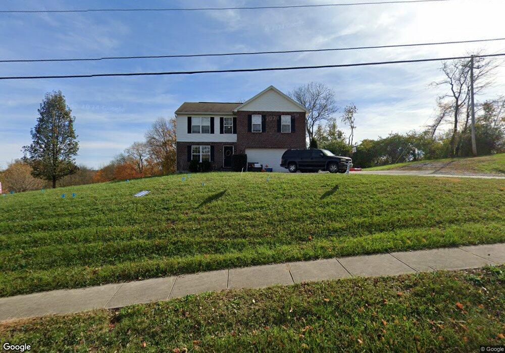
250 Independence Station Rd Independence, KY 41051
Estimated Value: $259,000 - $356,647
4
Beds
3
Baths
1,600
Sq Ft
$193/Sq Ft
Est. Value
About This Home
This home is located at 250 Independence Station Rd, Independence, KY 41051 and is currently estimated at $308,912, approximately $193 per square foot. 250 Independence Station Rd is a home with nearby schools including Simon Kenton High School and St. Cecilia Catholic School.
Ownership History
Date
Name
Owned For
Owner Type
Purchase Details
Closed on
Jun 13, 2022
Sold by
Finley Timothy L and Finley Lindsay
Bought by
Gilbert Nathan Daniel and Gilbert Kimberly
Current Estimated Value
Home Financials for this Owner
Home Financials are based on the most recent Mortgage that was taken out on this home.
Original Mortgage
$197,395
Outstanding Balance
$187,286
Interest Rate
5.27%
Mortgage Type
New Conventional
Estimated Equity
$121,626
Purchase Details
Closed on
Mar 18, 2014
Sold by
Celestial Building Corp
Bought by
Finley Timothy L and Finley Lindsay
Home Financials for this Owner
Home Financials are based on the most recent Mortgage that was taken out on this home.
Original Mortgage
$143,600
Interest Rate
4.24%
Mortgage Type
New Conventional
Purchase Details
Closed on
Nov 21, 2013
Sold by
Independence Station Road Llc
Bought by
Celestial Building Corp
Create a Home Valuation Report for This Property
The Home Valuation Report is an in-depth analysis detailing your home's value as well as a comparison with similar homes in the area
Home Values in the Area
Average Home Value in this Area
Purchase History
| Date | Buyer | Sale Price | Title Company |
|---|---|---|---|
| Gilbert Nathan Daniel | $203,500 | None Listed On Document | |
| Finley Timothy L | $179,500 | 360 American Title Svcs Llc | |
| Celestial Building Corp | $26,000 | Kentucky Land Title Agency I |
Source: Public Records
Mortgage History
| Date | Status | Borrower | Loan Amount |
|---|---|---|---|
| Open | Gilbert Nathan Daniel | $197,395 | |
| Previous Owner | Finley Timothy L | $143,600 |
Source: Public Records
Tax History Compared to Growth
Tax History
| Year | Tax Paid | Tax Assessment Tax Assessment Total Assessment is a certain percentage of the fair market value that is determined by local assessors to be the total taxable value of land and additions on the property. | Land | Improvement |
|---|---|---|---|---|
| 2024 | $2,712 | $221,400 | $35,000 | $186,400 |
| 2023 | $2,794 | $221,400 | $35,000 | $186,400 |
| 2022 | $2,852 | $221,400 | $35,000 | $186,400 |
| 2021 | $2,895 | $221,400 | $35,000 | $186,400 |
| 2020 | $2,410 | $179,500 | $26,000 | $153,500 |
| 2019 | $2,417 | $179,500 | $26,000 | $153,500 |
| 2018 | $2,430 | $179,500 | $26,000 | $153,500 |
| 2017 | $2,363 | $179,500 | $26,000 | $153,500 |
| 2015 | $2,295 | $179,500 | $26,000 | $153,500 |
| 2014 | $379 | $26,000 | $26,000 | $0 |
Source: Public Records
Map
Nearby Homes
- 9947 Meadow Glen Dr
- 10363 Canberra Dr
- 9972 Meadow Glen Dr
- 1365 Cairns Ct
- 114 Sylvan Dr
- 1355 Meadowcrest Cir
- 10438 Canberra Dr
- 10444 Canberra Dr
- 10448 Canberra Dr
- 5186 Christopher Dr
- 64 Sylvan Dr
- Cumberland Plan at Meadow Glen - Maple Street Collection
- Wesley Plan at Meadow Glen - Maple Street Collection
- 1375 Grandarbor Cir
- 10150 Meadow Glen Dr
- 1381 Poplartree Place
- 10383 Lynchburg Dr
- 1373 Meadowrun Ln
- 10323 Manassas Ct
- 10434 Sharpsburg Dr
- 0 S Phillips Rd Unit LOT 6 3090228
- 0 S Phillips Rd Unit LOT 3 3090224
- 0 S Phillips Rd Unit LOT 4 3090226
- 0 S Phillips Rd Unit LOT 5 3090227
- 0 S Phillips Rd Unit LOT 7 3090230
- 0 S Phillips Rd Unit LOT 8 3090218
- 0 S Phillips Rd Unit LOT 2 3090221
- 0 S Phillips Rd Unit 7142937
- 0 S Phillips Rd Unit 7092765
- 0 Phillips and 32nd St Unit 3251672
- 0 S Phillips Rd Unit 8985963
- 0 S Phillips Rd Unit 7153407
- 10330 Canberra Dr
- 10334 Canberra Dr
- 216 Canberra Dr
- 35 Canberra Dr
- 48 Canberra Dr
- 48 Canberra Dr
- 49 Canberra Dr
- 72 Canberra Dr