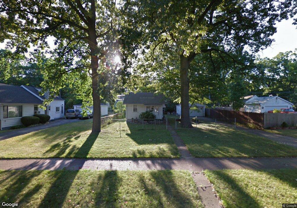
250 Kensington Ave Ferndale, MI 48220
Estimated Value: $132,000 - $196,000
2
Beds
1
Bath
619
Sq Ft
$270/Sq Ft
Est. Value
About This Home
This home is located at 250 Kensington Ave, Ferndale, MI 48220 and is currently estimated at $166,958, approximately $269 per square foot. 250 Kensington Ave is a home located in Oakland County with nearby schools including Ferndale Lower Elementary Campus, Ferndale Upper Elementary Campus, and Ferndale Middle School.
Ownership History
Date
Name
Owned For
Owner Type
Purchase Details
Closed on
Dec 14, 1999
Sold by
Welch Thomas A
Bought by
Carter William S
Current Estimated Value
Home Financials for this Owner
Home Financials are based on the most recent Mortgage that was taken out on this home.
Original Mortgage
$59,969
Outstanding Balance
$18,816
Interest Rate
7.89%
Estimated Equity
$148,142
Create a Home Valuation Report for This Property
The Home Valuation Report is an in-depth analysis detailing your home's value as well as a comparison with similar homes in the area
Home Values in the Area
Average Home Value in this Area
Purchase History
| Date | Buyer | Sale Price | Title Company |
|---|---|---|---|
| Carter William S | $60,000 | -- |
Source: Public Records
Mortgage History
| Date | Status | Borrower | Loan Amount |
|---|---|---|---|
| Open | Carter William S | $59,969 |
Source: Public Records
Tax History Compared to Growth
Tax History
| Year | Tax Paid | Tax Assessment Tax Assessment Total Assessment is a certain percentage of the fair market value that is determined by local assessors to be the total taxable value of land and additions on the property. | Land | Improvement |
|---|---|---|---|---|
| 2024 | $1,427 | $82,670 | $0 | $0 |
| 2023 | $1,380 | $78,650 | $0 | $0 |
| 2022 | $1,380 | $71,750 | $0 | $0 |
| 2021 | $1,388 | $58,110 | $0 | $0 |
| 2020 | $1,320 | $47,130 | $0 | $0 |
| 2019 | $1,339 | $40,180 | $0 | $0 |
| 2018 | $1,344 | $31,890 | $0 | $0 |
| 2017 | $1,327 | $30,180 | $0 | $0 |
| 2016 | $1,305 | $25,610 | $0 | $0 |
| 2015 | -- | $22,540 | $0 | $0 |
| 2014 | -- | $20,200 | $0 | $0 |
| 2011 | -- | $29,230 | $0 | $0 |
Source: Public Records
Map
Nearby Homes
- 20401 Santa Rosa Dr
- 591 Parkside Way Unit 16
- 695 Livernois St
- 20235 Prairie St
- 768 Pinecrest Dr
- 20235 San Juan Dr
- 20441 Gardendale St
- 20174 San Juan Dr
- 832 Pinecrest Dr
- 21078 Mitchelldale Ave
- 20200 Woodingham Dr
- 20179 Canterbury Rd
- 20038 Santa Rosa Dr
- 20145 Santa Barbara Dr
- 20115 Santa Barbara Dr
- 860 Gardendale St
- 20805 Bethlawn Blvd
- 19994 Santa Rosa Dr
- 19980 Stoepel St
- 20073 Shrewsbury Rd
- 256 Kensington Ave
- 245 Stratford Rd
- 303 Stratford Rd
- 259 Stratford Rd
- 259 Kensington Ave
- 314 Kensington Ave Unit Bldg-Unit
- 314 Kensington Ave
- 229 Stratford Rd
- 307 Stratford Rd
- 303 Kensington Ave
- 235 Kensington Ave
- 253 Kensington Ave
- 241 Kensington Ave
- 315 Stratford Rd
- 324 Kensington Ave
- 323 Stratford Rd
- 305 Kensington Ave
- 217 Stratford Rd
- 212 Kensington Ave
- 330 Kensington Ave