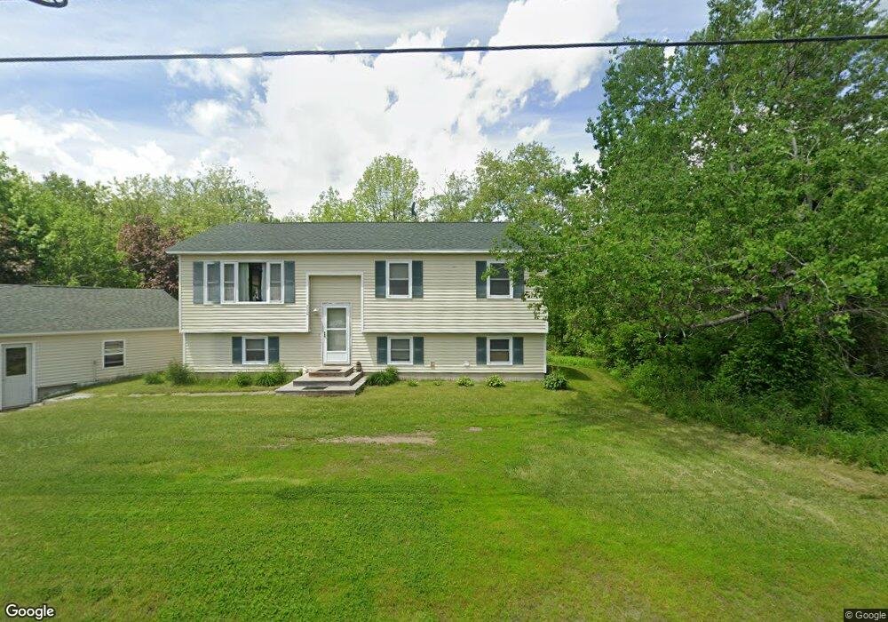
250 Leighton Rd Augusta, ME 04330
Estimated Value: $232,000 - $339,000
3
Beds
2
Baths
1,440
Sq Ft
$200/Sq Ft
Est. Value
About This Home
This home is located at 250 Leighton Rd, Augusta, ME 04330 and is currently estimated at $288,606, approximately $200 per square foot. 250 Leighton Rd is a home located in Kennebec County with nearby schools including Cony Middle School, Cony School, and St. Augustine School.
Ownership History
Date
Name
Owned For
Owner Type
Purchase Details
Closed on
Dec 1, 2010
Sold by
Turner Ken P
Bought by
Dutton Douglas L
Current Estimated Value
Home Financials for this Owner
Home Financials are based on the most recent Mortgage that was taken out on this home.
Original Mortgage
$131,089
Outstanding Balance
$86,402
Interest Rate
4.25%
Mortgage Type
FHA
Estimated Equity
$202,204
Create a Home Valuation Report for This Property
The Home Valuation Report is an in-depth analysis detailing your home's value as well as a comparison with similar homes in the area
Home Values in the Area
Average Home Value in this Area
Purchase History
| Date | Buyer | Sale Price | Title Company |
|---|---|---|---|
| Dutton Douglas L | $134,500 | -- | |
| Dutton Douglas L | $134,500 | -- | |
| Dutton Douglas L | $134,500 | -- |
Source: Public Records
Mortgage History
| Date | Status | Borrower | Loan Amount |
|---|---|---|---|
| Open | Dutton Douglas L | $131,089 | |
| Closed | Dutton Douglas L | $131,089 |
Source: Public Records
Tax History Compared to Growth
Tax History
| Year | Tax Paid | Tax Assessment Tax Assessment Total Assessment is a certain percentage of the fair market value that is determined by local assessors to be the total taxable value of land and additions on the property. | Land | Improvement |
|---|---|---|---|---|
| 2024 | $2,661 | $111,800 | $27,900 | $83,900 |
| 2023 | $2,567 | $111,800 | $27,900 | $83,900 |
| 2022 | $2,451 | $111,800 | $27,900 | $83,900 |
| 2021 | $2,341 | $111,800 | $27,900 | $83,900 |
| 2020 | $2,341 | $111,800 | $27,900 | $83,900 |
| 2019 | $2,344 | $111,800 | $27,900 | $83,900 |
| 2018 | $2,344 | $111,800 | $27,900 | $83,900 |
| 2017 | $2,278 | $111,800 | $27,900 | $83,900 |
| 2016 | $2,213 | $111,800 | $27,900 | $83,900 |
| 2015 | $1,975 | $111,800 | $27,900 | $83,900 |
| 2014 | $2,087 | $111,800 | $27,900 | $83,900 |
Source: Public Records
Map
Nearby Homes
- 127 Bond Brook Rd
- 120 Bond Brook Rd
- 3 Tallwood Rd
- 0 Anthony Ave Map 5 Lot 110a
- 189 Old Winthrop Rd
- 83 Mount Vernon Rd
- 309 Civic Center Dr
- 214 Mount Vernon Ave
- 165 Wade Rd
- 202 Mount Vernon Ave
- 8 High Ridge Dr
- 82 Townsend Rd
- 13 Tibbetts St
- 369 Civic Center Dr
- Lot 14D Western Ave
- Lot 14 Western Ave
- 39 Albert Ave Unit 8
- 8 Townsend Rd
- Map21Lot39 Orchard St
- Lot# 38A Orchard St
- 249 Leighton Rd
- 266 Leighton Rd
- 265 Leighton Rd
- 572 Leighton Rd
- 70 Leighton Rd
- 224 Leighton Rd
- 271 Leighton Rd
- 1311 Bond Brook Rd
- 221 Leighton Rd
- 223 Leighton Rd
- 290 Leighton Rd
- 285 Leighton Rd
- 211 Leighton Rd
- 201 Leighton Rd
- 232 Bond Brook Rd
- 197 Leighton Rd
- 196 Leighton Rd
- 189 Leighton Rd
- 239 Bond Brook Rd
- 81 Bond Brook Rd