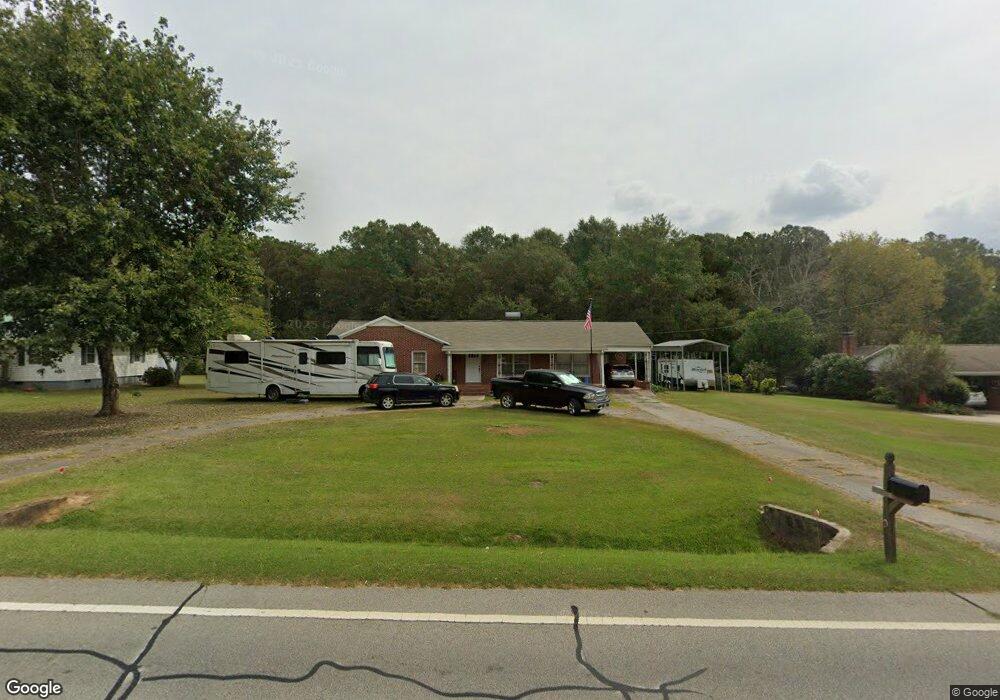
250 N Carroll St Bowdon, GA 30108
Estimated Value: $211,000 - $259,000
3
Beds
1
Bath
1,643
Sq Ft
$142/Sq Ft
Est. Value
About This Home
This home is located at 250 N Carroll St, Bowdon, GA 30108 and is currently estimated at $233,424, approximately $142 per square foot. 250 N Carroll St is a home located in Carroll County with nearby schools including Bowdon Elementary School, Bowdon Middle School, and Bowdon High School.
Ownership History
Date
Name
Owned For
Owner Type
Purchase Details
Closed on
Apr 8, 2019
Sold by
Anderson John Andrew
Bought by
Champion Lori Anderson
Current Estimated Value
Purchase Details
Closed on
Aug 31, 1998
Sold by
Anderson John Andrew
Bought by
Anderson John Andrew
Purchase Details
Closed on
May 15, 1998
Sold by
Johnson Reda Nelle
Bought by
Anderson John Andrew
Purchase Details
Closed on
Jul 17, 1995
Sold by
Johnson Lizzie Mae
Bought by
Johnson Reda Nelle
Purchase Details
Closed on
Mar 20, 1987
Bought by
Johnson Lizzie Mae
Create a Home Valuation Report for This Property
The Home Valuation Report is an in-depth analysis detailing your home's value as well as a comparison with similar homes in the area
Home Values in the Area
Average Home Value in this Area
Purchase History
| Date | Buyer | Sale Price | Title Company |
|---|---|---|---|
| Champion Lori Anderson | -- | -- | |
| Anderson John Andrew | -- | -- | |
| Anderson John Andrew | $50,000 | -- | |
| Johnson Reda Nelle | -- | -- | |
| Johnson Lizzie Mae | -- | -- |
Source: Public Records
Tax History Compared to Growth
Tax History
| Year | Tax Paid | Tax Assessment Tax Assessment Total Assessment is a certain percentage of the fair market value that is determined by local assessors to be the total taxable value of land and additions on the property. | Land | Improvement |
|---|---|---|---|---|
| 2024 | $1,829 | $73,055 | $1,710 | $71,345 |
| 2023 | $1,829 | $66,457 | $1,710 | $64,747 |
| 2022 | $1,513 | $52,724 | $1,154 | $51,570 |
| 2021 | $1,364 | $45,059 | $855 | $44,204 |
| 2020 | $1,255 | $40,383 | $855 | $39,528 |
| 2019 | $1,263 | $37,073 | $855 | $36,218 |
| 2018 | $1,131 | $32,470 | $855 | $31,615 |
| 2017 | $1,134 | $32,470 | $855 | $31,615 |
| 2016 | $1,134 | $32,470 | $855 | $31,615 |
| 2015 | $761 | $20,812 | $4,160 | $16,652 |
| 2014 | $765 | $20,812 | $4,160 | $16,652 |
Source: Public Records
Map
Nearby Homes
- 215 Rome St
- 6.41 ac N Carroll St & Ave W
- 473 West Ave
- 485 West Ave
- 479 West Ave
- 427 E College St
- 407 E College St
- 0 College View St Unit 7641168
- 0 College View St Unit 10594648
- 0 Hwy 100 Unit LotWP001 24911780
- 0 Hwy 100 Unit 10541558
- 313 Ellenwood Dr
- 310 Pine Cir
- 310 W College St
- 460 Sally Ann Cir
- 400/460 Sally Ann Cir
- 267 Eason St
- 254 Eason St
- 254 N Carroll St
- 244 N Carroll St
- 242 N Carroll St
- 258 N Carroll St
- 245 N Carroll St
- 257 Rome St
- 241 N Carroll St
- 234 N Carroll St
- 237 N Carroll St
- 235 N Carroll St
- 301 N Carroll St
- 250 Rome St
- 231 N Carroll St
- 226 N Carroll St
- 288 Old Word Rd
- 288 Rome St
- 227 N Carroll St
- 244 Rome St
- 306 Old Word Rd
- 101 Navajo Trail