Estimated Value: $117,000 - $200,000
About This Home
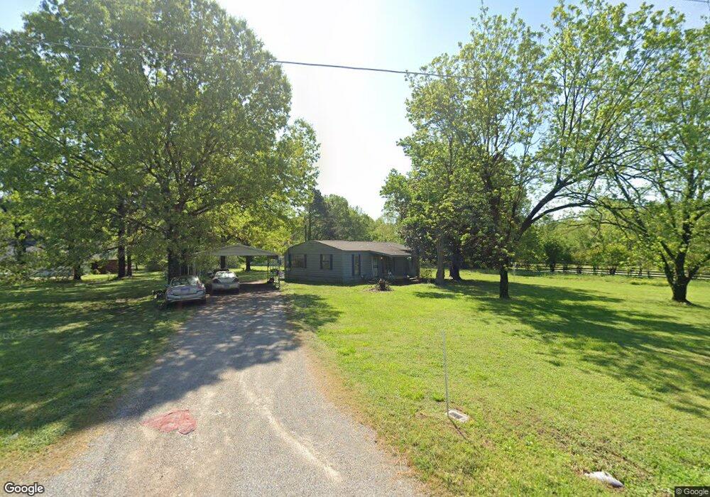
This home is located at 250 Randy Rd, Eads, TN 38028 and is currently estimated at $155,133, approximately $146 per square foot. 250 Randy Rd is a home located in Fayette County with nearby schools including Oakland Elementary School, West Junior High School, and Fayette Ware Comprehensive High School.
Ownership History
We collect this data history from publicly available records. To have your information removed, we recommend requesting removal directly through your county’s website.
Purchase Details
Purchase Details
Purchase Details
Purchase Details
Purchase Details
Purchase Details
Home Financials for this Owner
Home Financials are based on the most recent Mortgage that was taken out on this home.Purchase Details
Home Financials for this Owner
Home Financials are based on the most recent Mortgage that was taken out on this home.Purchase Details
Purchase Details
Purchase Details
Purchase Details
Purchase History
We collect this data history from publicly available records. To have your information removed, we recommend requesting removal directly through your county’s website.
| Date | Buyer | Sale Price | Title Company |
|---|---|---|---|
| -- | None Available | ||
| $59,500 | -- | ||
| $59,500 | -- | ||
| -- | -- | ||
| -- | -- | ||
| $94,963 | -- | ||
| -- | -- | ||
| $75,500 | -- | ||
| $19,000 | -- | ||
| $49,900 | -- | ||
| -- | -- | ||
| $25,000 | -- | ||
| -- | -- |
Mortgage History
We collect this data history from publicly available records. To have your information removed, we recommend requesting removal directly through your county’s website.
| Date | Status | Borrower | Loan Amount |
|---|---|---|---|
| Previous Owner | $73,235 | ||
| Previous Owner | $46,470 |
Tax History
We collect this data history from publicly available records. To have your information removed, we recommend requesting removal directly through your county’s website.
| Year | Tax Paid | Tax Assessment Tax Assessment Total Assessment is a certain percentage of the fair market value that is determined by local assessors to be the total taxable value of land and additions on the property. | Land | Improvement |
|---|---|---|---|---|
| 2025 | $249 | $23,850 | $11,325 | $12,525 |
| 2024 | $249 | $19,250 | $9,975 | $9,275 |
| 2023 | $249 | $19,250 | $0 | $0 |
| 2022 | $249 | $19,250 | $9,975 | $9,275 |
| 2021 | $249 | $19,250 | $9,975 | $9,275 |
| 2020 | $275 | $19,250 | $9,975 | $9,275 |
| 2019 | $275 | $18,225 | $9,975 | $8,250 |
| 2018 | $275 | $18,225 | $9,975 | $8,250 |
| 2017 | $275 | $18,225 | $9,975 | $8,250 |
| 2016 | $289 | $17,975 | $9,975 | $8,000 |
| 2015 | $289 | $17,975 | $9,975 | $8,000 |
| 2014 | $289 | $17,975 | $9,975 | $8,000 |
Map
- 245 Ecology Loop
- 0 Bell Grove Rd Unit 10211043
- 0 Bell Grove Rd Unit 10211044
- 0 Donelson Dr Unit 10222423
- 1120 Donelson Dr
- 225 Bibury Ln
- 260 Bibury Ln
- 260 Bibury Ln
- 120 Tewkesbury Ln
- 400 Cypress Village Ln
- 410 Cypress Village Ln
- 435 Cypress Village Ln
- 65 Watson Rd
- 335 Bibury Ln
- 170 Forest Edge Dr
- 2015 Bell Grove Rd
- 230 Oak Haven Cir
- 30 Arrowwood Trail
- 270 Oak Haven Cir
- 330 Oak Haven Cir
- 265 Randy Rd
- 595 Ecology Loop
- 305 Randy Rd
- 525 Ecology Loop
- 635 Ecology Loop
- 195 Randy Rd
- 495 Ecology Loop
- 345 Randy Rd
- 475 Ecology Loop
- 835 Ecology Loop
- 542 Ecology Loop
- 145 Randy Rd
- 430 Rolling Acres Dr
- 120 Randy Rd
- 695 Ecology Loop
- 855 Ecology Loop
- 455 Ecology Loop
- 500 Ecology Loop
- 780 Ecology Loop
- 540 Ecology Loop
Ask me questions while you tour the home.