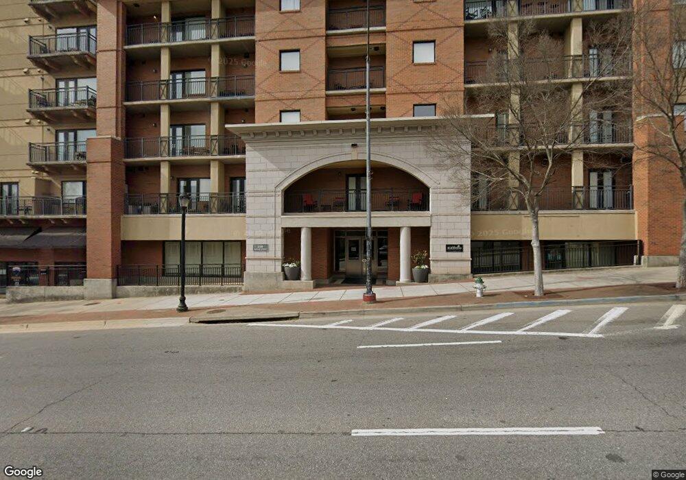
250 W Broad St Unit 303 Athens, GA 30601
Estimated Value: $655,895 - $725,000
2
Beds
2
Baths
770
Sq Ft
$884/Sq Ft
Est. Value
About This Home
This home is located at 250 W Broad St Unit 303, Athens, GA 30601 and is currently estimated at $680,974, approximately $884 per square foot. 250 W Broad St Unit 303 is a home located in Clarke County with nearby schools including Barrow Elementary School, Clarke Middle School, and Clarke Central High School.
Ownership History
Date
Name
Owned For
Owner Type
Purchase Details
Closed on
Dec 7, 2009
Sold by
Young Earl H
Bought by
Young Earl H
Current Estimated Value
Purchase Details
Closed on
Sep 11, 2009
Sold by
Us Bank National Associati
Bought by
Young Earl H
Purchase Details
Closed on
Jul 7, 2009
Sold by
Kane Myles
Bought by
Us Bank National Association T
Purchase Details
Closed on
Oct 8, 2004
Sold by
Gameday Athens Llc
Bought by
Kane Myles
Create a Home Valuation Report for This Property
The Home Valuation Report is an in-depth analysis detailing your home's value as well as a comparison with similar homes in the area
Home Values in the Area
Average Home Value in this Area
Purchase History
| Date | Buyer | Sale Price | Title Company |
|---|---|---|---|
| Young Earl H | -- | -- | |
| Young Earl H | $155,000 | -- | |
| Us Bank National Association T | $164,557 | -- | |
| Kane Myles | $195,500 | -- |
Source: Public Records
Tax History Compared to Growth
Tax History
| Year | Tax Paid | Tax Assessment Tax Assessment Total Assessment is a certain percentage of the fair market value that is determined by local assessors to be the total taxable value of land and additions on the property. | Land | Improvement |
|---|---|---|---|---|
| 2025 | $8,065 | $251,644 | $16,940 | $234,704 |
| 2024 | $8,065 | $214,036 | $16,940 | $197,096 |
| 2023 | $6,903 | $189,544 | $16,940 | $172,604 |
| 2022 | $5,004 | $152,104 | $16,940 | $135,164 |
| 2021 | $4,984 | $143,644 | $16,940 | $126,704 |
| 2020 | $4,603 | $132,665 | $16,940 | $115,725 |
| 2019 | $4,433 | $126,844 | $16,940 | $109,904 |
| 2018 | $4,008 | $114,669 | $16,940 | $97,729 |
| 2017 | $0 | $102,540 | $16,940 | $85,600 |
| 2016 | $3,133 | $89,644 | $16,940 | $72,704 |
| 2015 | $2,767 | $79,044 | $16,940 | $62,104 |
| 2014 | $2,524 | $72,004 | $16,940 | $55,064 |
Source: Public Records
Map
Nearby Homes
- 250 W Broad St Unit 811
- 250 W Broad St Unit 521
- 250 W Broad St Unit 408
- 250 W Broad St Unit 615
- 269 N Hull St Unit 212
- 131 E Broad St Unit 707
- 100 Prince Ave Unit A404
- 100 Prince Ave Unit A407
- 559 Pulaski St
- 365 S Church St Unit 1A, 1B, 1C
- 257 Hill St
- 494 Baxter St Unit 32
- 600 Pulaski St
- 570 Prince Ave
- 668 Pulaski St
- 468 N Milledge Ave Unit 203
- 500 Dearing St Unit 6
- 145 Hendrix Ave
- 597 Dearing St
- 255 Bloomfield St
- 250 W Broad St Unit Suite 601
- 250 W Broad St Unit 718
- 250 W Broad St Unit 714
- 250 W Broad St Unit 626
- 250 W Broad St Unit 618
- 250 W Broad St Unit 301
- 250 W Broad St Unit 207
- 250 W Broad St Unit 617
- 250 W Broad St Unit 608
- 250 W Broad St Unit 806
- 250 W Broad St Unit 620
- 250 W Broad St Unit 801
- 250 W Broad St Unit 409
- 250 W Broad St Unit 614
- 250 W Broad St Unit 206
- 250 W Broad St Unit 520
- 250 W Broad St Unit 724
- 250 W Broad St Unit 809
- 250 W Broad St Unit 726
- 250 W Broad St Unit 808