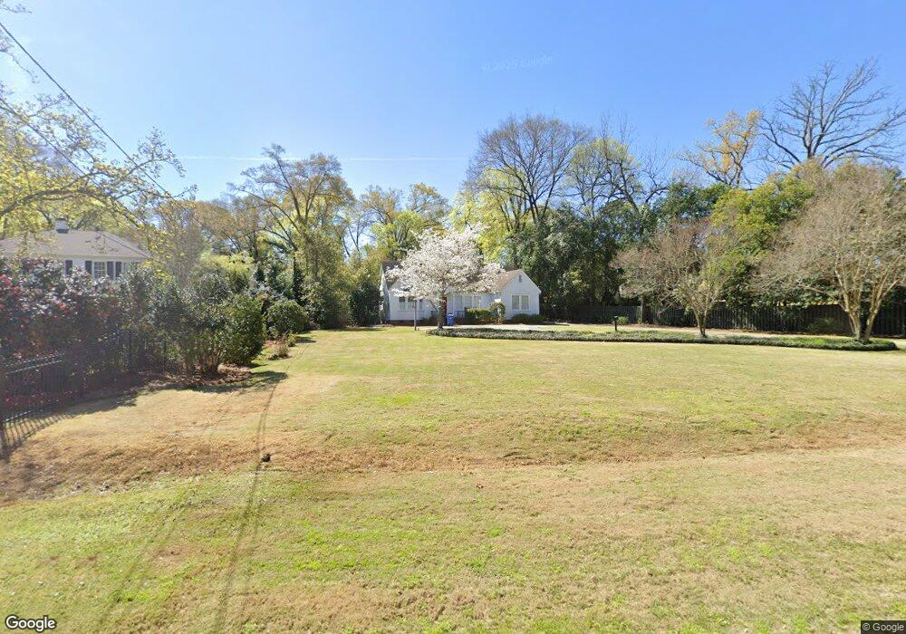
2500 17th St Columbus, GA 31906
Wyntonn Grove NeighborhoodEstimated Value: $322,000 - $397,000
2
Beds
3
Baths
1,926
Sq Ft
$183/Sq Ft
Est. Value
About This Home
This home is located at 2500 17th St, Columbus, GA 31906 and is currently estimated at $353,091, approximately $183 per square foot. 2500 17th St is a home located in Muscogee County with nearby schools including Richards Middle School, Hardaway High School, and Wynnton Elementary School.
Ownership History
Date
Name
Owned For
Owner Type
Purchase Details
Closed on
Mar 18, 2016
Sold by
Pitts Wynn P
Bought by
Johnson Steven Lee
Current Estimated Value
Home Financials for this Owner
Home Financials are based on the most recent Mortgage that was taken out on this home.
Original Mortgage
$234,945
Outstanding Balance
$185,958
Interest Rate
3.65%
Estimated Equity
$167,133
Purchase Details
Closed on
Sep 21, 2012
Sold by
Waldrep Betty Sue
Bought by
Pitts Wynn P and Pitts Robert E
Home Financials for this Owner
Home Financials are based on the most recent Mortgage that was taken out on this home.
Original Mortgage
$180,000
Interest Rate
3.71%
Create a Home Valuation Report for This Property
The Home Valuation Report is an in-depth analysis detailing your home's value as well as a comparison with similar homes in the area
Home Values in the Area
Average Home Value in this Area
Purchase History
| Date | Buyer | Sale Price | Title Company |
|---|---|---|---|
| Johnson Steven Lee | $230,000 | -- | |
| Pitts Wynn P | $225,000 | -- |
Source: Public Records
Mortgage History
| Date | Status | Borrower | Loan Amount |
|---|---|---|---|
| Open | Johnson Steven Lee | $234,945 | |
| Previous Owner | Pitts Wynn P | $180,000 |
Source: Public Records
Tax History Compared to Growth
Tax History
| Year | Tax Paid | Tax Assessment Tax Assessment Total Assessment is a certain percentage of the fair market value that is determined by local assessors to be the total taxable value of land and additions on the property. | Land | Improvement |
|---|---|---|---|---|
| 2025 | $4,395 | $112,276 | $24,084 | $88,192 |
| 2024 | $4,395 | $112,276 | $24,084 | $88,192 |
| 2023 | $4,423 | $112,276 | $24,084 | $88,192 |
| 2022 | $3,958 | $96,932 | $24,084 | $72,848 |
| 2021 | $3,435 | $84,124 | $24,084 | $60,040 |
| 2020 | $3,436 | $84,124 | $24,084 | $60,040 |
| 2019 | $3,447 | $84,124 | $24,084 | $60,040 |
| 2018 | $3,447 | $84,124 | $24,084 | $60,040 |
| 2017 | $3,458 | $84,124 | $24,084 | $60,040 |
| 2016 | $3,713 | $90,000 | $11,536 | $78,464 |
| 2015 | $3,717 | $90,000 | $11,536 | $78,464 |
| 2014 | $1,489 | $90,000 | $11,536 | $78,464 |
| 2013 | -- | $90,000 | $11,536 | $78,464 |
Source: Public Records
Map
Nearby Homes
- 1700 Stark Ave
- 1706 Stark Ave
- 1717 Stark Ave
- 1806 Stark Ave
- 1809 Carter Ave
- 2227 15th St
- 2533 15th St
- 1319 Hilton Ave
- 2010 Wells Dr
- 1513 Wells Dr
- 2125 13th St Unit 12
- 2133 13th St
- 2016 Poplar Dr
- 1500 Preston Dr
- 1400 Eberhart Ave
- 1714 Iris Dr
- 1227 Forest Ave Unit 4
- 1310 S Dixon Dr
- 2911 Gardenia St
- 2104 Cherokee Ave
- 2510 17th St
- 1644 Carter Ave
- 1652 Carter Ave
- 1634 Carter Ave
- 1664 Carter Ave
- 1626 Carter Ave
- 2505 17th St
- 1701 Stark Ave
- 1705 Hilton Ave
- 2405 16th St
- 1620 Carter Ave
- 1635 Hilton Ave
- 1643 Carter Ave
- 1653 Carter Ave
- 1631 Carter Ave
- 1659 Carter Ave
- 1717 Hilton Ave
- 1623 Carter Ave
- 1631 Hilton Ave
- 1711 Stark Ave