Estimated Value: $256,716 - $318,000
4
Beds
2
Baths
2,070
Sq Ft
$142/Sq Ft
Est. Value
About This Home
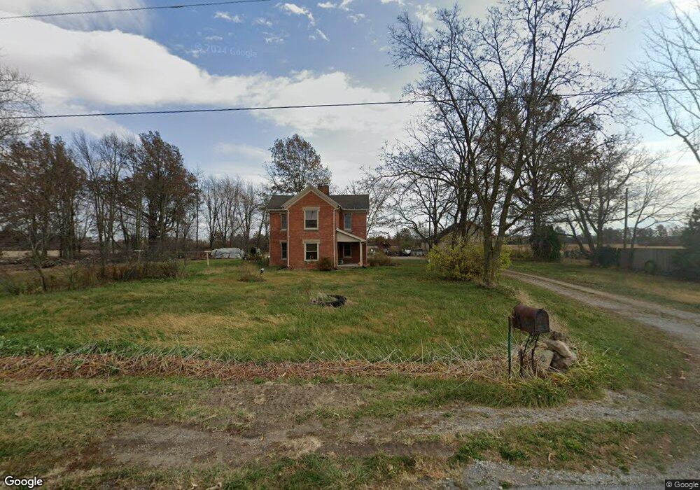
This home is located at 2501 Coon Rd, Lima, OH 45806 and is currently estimated at $294,679, approximately $142 per square foot. 2501 Coon Rd is a home located in Allen County with nearby schools including Maplewood Elementary School, Elmwood Elementary School, and Shawnee Middle School.
Ownership History
Date
Name
Owned For
Owner Type
Purchase Details
Closed on
Dec 7, 2016
Bought by
John N Mccain
Current Estimated Value
Purchase Details
Closed on
Jul 1, 1976
Bought by
Heath Phillip A
Create a Home Valuation Report for This Property
The Home Valuation Report is an in-depth analysis detailing your home's value as well as a comparison with similar homes in the area
Purchase History
| Date | Buyer | Sale Price | Title Company |
|---|---|---|---|
| John N Mccain | -- | -- | |
| Heath Phillip A | $30,000 | -- |
Source: Public Records
Tax History
| Year | Tax Paid | Tax Assessment Tax Assessment Total Assessment is a certain percentage of the fair market value that is determined by local assessors to be the total taxable value of land and additions on the property. | Land | Improvement |
|---|---|---|---|---|
| 2024 | $2,352 | $59,080 | $15,960 | $43,120 |
| 2023 | $2,024 | $45,470 | $12,290 | $33,180 |
| 2022 | $2,045 | $45,470 | $12,290 | $33,180 |
| 2021 | $2,022 | $45,470 | $12,290 | $33,180 |
| 2020 | $1,698 | $40,610 | $12,080 | $28,530 |
| 2019 | $1,698 | $40,610 | $12,080 | $28,530 |
| 2018 | $1,698 | $40,610 | $12,080 | $28,530 |
| 2017 | $1,642 | $38,020 | $12,080 | $25,940 |
| 2016 | $1,618 | $38,020 | $12,080 | $25,940 |
| 2015 | $1,602 | $38,020 | $12,080 | $25,940 |
| 2014 | $1,605 | $37,770 | $11,590 | $26,180 |
| 2013 | $1,574 | $37,770 | $11,590 | $26,180 |
Source: Public Records
Map
Nearby Homes
- 17683 Ohio 117
- 7570 Fort Amanda Rd
- 8240 Spencerville Rd
- 3000 Sunderland Rd
- 3000 S Sunderland Rd
- 0 Agerter Rd
- 4906 Shoshone Trail
- 2905 Oak Hill Ct
- 845 Atalan Trail
- 4475 Wintergreen Dr
- 4875 Wenatchi Trail
- 3020 Lakeshore Dr
- 22284 Ohio 198
- 3039 Lakeshore Dr
- 4211 Fort Amanda Rd
- 1602 Wonderlick Rd
- 4268 Blue Spruce Ln
- 2977 Pine Grove Way
- 616 Wildbrook Ln
- 4039 Magnolia
Your Personal Tour Guide
Ask me questions while you tour the home.