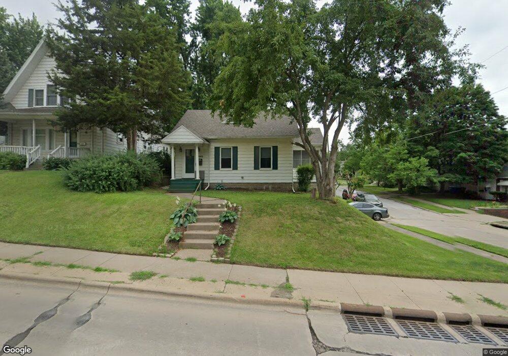
2501 E Locust St Davenport, IA 52803
East End NeighborhoodEstimated Value: $172,582 - $186,000
3
Beds
1
Bath
1,742
Sq Ft
$103/Sq Ft
Est. Value
About This Home
This home is located at 2501 E Locust St, Davenport, IA 52803 and is currently estimated at $179,396, approximately $102 per square foot. 2501 E Locust St is a home located in Scott County with nearby schools including McKinley Elementary School, Sudlow Intermediate School, and Central High School.
Ownership History
Date
Name
Owned For
Owner Type
Purchase Details
Closed on
Nov 6, 2020
Sold by
Lopshire Michelle and Diehn Michelle
Bought by
Hasselman Geri Louella and Hasselman Geri L
Current Estimated Value
Home Financials for this Owner
Home Financials are based on the most recent Mortgage that was taken out on this home.
Original Mortgage
$126,990
Outstanding Balance
$112,745
Interest Rate
2.8%
Mortgage Type
FHA
Estimated Equity
$66,651
Create a Home Valuation Report for This Property
The Home Valuation Report is an in-depth analysis detailing your home's value as well as a comparison with similar homes in the area
Home Values in the Area
Average Home Value in this Area
Purchase History
| Date | Buyer | Sale Price | Title Company |
|---|---|---|---|
| Hasselman Geri Louella | $129,500 | None Available |
Source: Public Records
Mortgage History
| Date | Status | Borrower | Loan Amount |
|---|---|---|---|
| Open | Hasselman Geri Louella | $126,990 |
Source: Public Records
Tax History Compared to Growth
Tax History
| Year | Tax Paid | Tax Assessment Tax Assessment Total Assessment is a certain percentage of the fair market value that is determined by local assessors to be the total taxable value of land and additions on the property. | Land | Improvement |
|---|---|---|---|---|
| 2025 | $2,406 | $167,320 | $22,050 | $145,270 |
| 2024 | $2,344 | $144,860 | $22,050 | $122,810 |
| 2023 | $2,644 | $144,860 | $22,050 | $122,810 |
| 2022 | $2,578 | $132,680 | $18,740 | $113,940 |
| 2021 | $2,578 | $129,070 | $18,740 | $110,330 |
| 2020 | $2,054 | $103,310 | $18,740 | $84,570 |
| 2019 | $1,992 | $97,320 | $18,740 | $78,580 |
| 2018 | $1,864 | $97,320 | $18,740 | $78,580 |
| 2017 | $521 | $93,580 | $18,740 | $74,840 |
| 2016 | $1,864 | $93,840 | $0 | $0 |
| 2015 | $1,864 | $104,080 | $0 | $0 |
| 2014 | $2,118 | $104,080 | $0 | $0 |
| 2013 | $2,078 | $0 | $0 | $0 |
| 2012 | -- | $94,570 | $18,840 | $75,730 |
Source: Public Records
Map
Nearby Homes
- 1734 Ridgewood Ave
- 1704 Jersey Ridge Rd
- 2704 E High St
- 1815 Belle Ave
- 1803 Belle Ave
- 49 Kenwood Ave
- 2131 Lorton Ave
- 1709 Christie St
- 1619 Christie St
- 2905 Middle Rd
- 1504 Christie St
- 46 Hillcrest Ave
- 2234 Fairhaven Rd
- 2950 E 18th St
- 123 Fernwood Ave
- 3009 E 18th St
- 2458 E Central Park Ave
- 3019 E 18th St
- 2103 E Lombard St
- 2122 E 12th St
- 2505 E Locust St
- 2511 E Locust St
- 2515 E Locust St
- 1824 Ridgewood Ave
- 1830 Ridgewood Ave
- 1816 Ridgewood Ave
- 2502 E 18th St
- 2506 E 18th St
- 2519 E Locust St
- 1810 Ridgewood Ave
- 2514 E 18th St
- 2523 E Locust St
- 1804 Ridgewood Ave
- 2518 E 18th St
- 2510 E Locust St
- 1823 Jersey Ridge Rd
- 2524 E 18th St
- 2514 E Locust St
- 2424 E Locust St
- 2525 E Locust St