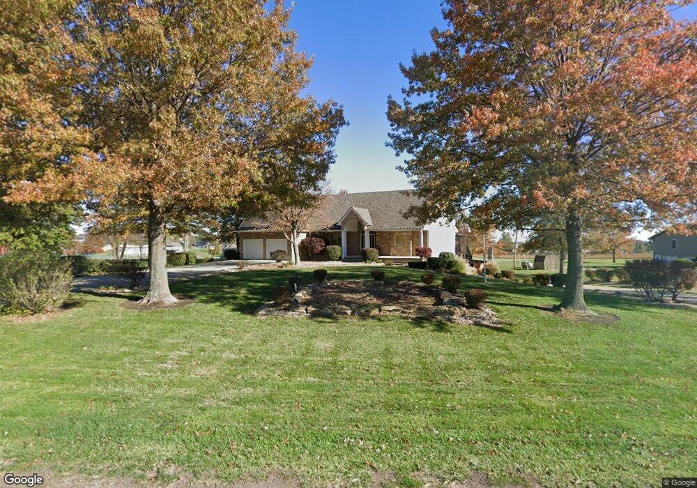
25012 164th St Leavenworth, KS 66048
Estimated Value: $528,000 - $685,000
5
Beds
4
Baths
3,136
Sq Ft
$189/Sq Ft
Est. Value
About This Home
This home is located at 25012 164th St, Leavenworth, KS 66048 and is currently estimated at $592,389, approximately $188 per square foot. 25012 164th St is a home located in Leavenworth County with nearby schools including Lansing Elementary School, Lansing Middle 6-8, and Lansing High 9-12.
Ownership History
Date
Name
Owned For
Owner Type
Purchase Details
Closed on
Dec 10, 2008
Sold by
Zupancic Living Trust
Bought by
Zupancic David P and Zupancic Sue A
Current Estimated Value
Home Financials for this Owner
Home Financials are based on the most recent Mortgage that was taken out on this home.
Original Mortgage
$193,500
Interest Rate
4.84%
Mortgage Type
New Conventional
Create a Home Valuation Report for This Property
The Home Valuation Report is an in-depth analysis detailing your home's value as well as a comparison with similar homes in the area
Home Values in the Area
Average Home Value in this Area
Purchase History
| Date | Buyer | Sale Price | Title Company |
|---|---|---|---|
| Zupancic David P | -- | Mccaffree-Short Title Co Inc |
Source: Public Records
Mortgage History
| Date | Status | Borrower | Loan Amount |
|---|---|---|---|
| Previous Owner | Zupancic David P | $193,500 |
Source: Public Records
Tax History Compared to Growth
Tax History
| Year | Tax Paid | Tax Assessment Tax Assessment Total Assessment is a certain percentage of the fair market value that is determined by local assessors to be the total taxable value of land and additions on the property. | Land | Improvement |
|---|---|---|---|---|
| 2025 | $8,394 | $69,681 | $6,768 | $62,913 |
| 2024 | $7,668 | $67,002 | $7,940 | $59,062 |
| 2023 | $7,668 | $63,745 | $7,940 | $55,805 |
| 2022 | $7,521 | $60,248 | $5,444 | $54,804 |
| 2021 | $7,153 | $56,419 | $4,557 | $51,862 |
| 2020 | $6,543 | $50,289 | $4,387 | $45,902 |
| 2019 | $6,318 | $48,265 | $4,042 | $44,223 |
| 2018 | $6,051 | $46,011 | $3,122 | $42,889 |
| 2017 | $5,857 | $44,204 | $2,920 | $41,284 |
| 2016 | $5,507 | $42,846 | $2,892 | $39,954 |
| 2015 | $5,388 | $42,846 | $2,892 | $39,954 |
| 2014 | $5,301 | $42,847 | $2,811 | $40,036 |
Source: Public Records
Map
Nearby Homes
- 16430 Dana Ln
- 00000 Gilman Rd
- Lot 6 163rd St
- 24450 171st St
- 25030 177th Terrace
- 25055 Woodridge Cir
- 17860 Clearview Dr
- 1221 S Desoto Rd
- 000 4-H Rd
- 833 Rock Creek Dr
- 15280 Roger Rd
- 875 Clearview Dr
- 811 4-H Rd
- 705 Rock Creek Dr
- 0000 Eisenhower Rd
- 16055 W Eisenhower Rd
- 922 Southfork St
- 15915 Eisenhower Rd
- 77 Continental Dr
- 115 W Gilman Rd