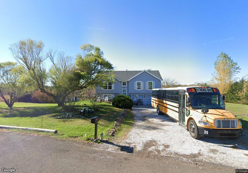
25015 165th St Leavenworth, KS 66048
Estimated Value: $330,649 - $447,000
4
Beds
3
Baths
1,094
Sq Ft
$340/Sq Ft
Est. Value
About This Home
This home is located at 25015 165th St, Leavenworth, KS 66048 and is currently estimated at $372,162, approximately $340 per square foot. 25015 165th St is a home located in Leavenworth County with nearby schools including Lansing Elementary School, Lansing Middle 6-8, and Lansing High 9-12.
Ownership History
Date
Name
Owned For
Owner Type
Purchase Details
Closed on
Jul 1, 2000
Bought by
Wakefield Delbert R and Wakefield Clytha J
Current Estimated Value
Home Financials for this Owner
Home Financials are based on the most recent Mortgage that was taken out on this home.
Original Mortgage
$173,350
Outstanding Balance
$106,751
Interest Rate
4%
Mortgage Type
New Conventional
Estimated Equity
$265,411
Create a Home Valuation Report for This Property
The Home Valuation Report is an in-depth analysis detailing your home's value as well as a comparison with similar homes in the area
Home Values in the Area
Average Home Value in this Area
Purchase History
| Date | Buyer | Sale Price | Title Company |
|---|---|---|---|
| Wakefield Delbert R | $121,500 | -- |
Source: Public Records
Mortgage History
| Date | Status | Borrower | Loan Amount |
|---|---|---|---|
| Open | Wakefield Delbert R | $173,350 | |
| Closed | Wakefield Delbert R | $8,868 |
Source: Public Records
Tax History Compared to Growth
Tax History
| Year | Tax Paid | Tax Assessment Tax Assessment Total Assessment is a certain percentage of the fair market value that is determined by local assessors to be the total taxable value of land and additions on the property. | Land | Improvement |
|---|---|---|---|---|
| 2025 | $4,312 | $33,485 | $7,041 | $26,444 |
| 2024 | $4,072 | $32,197 | $8,344 | $23,853 |
| 2023 | $4,072 | $31,260 | $8,344 | $22,916 |
| 2022 | $3,815 | $27,906 | $5,628 | $22,278 |
| 2021 | $3,451 | $24,238 | $4,747 | $19,491 |
| 2020 | $3,315 | $22,680 | $4,567 | $18,113 |
| 2019 | $3,208 | $21,724 | $4,222 | $17,502 |
| 2018 | $2,961 | $19,626 | $3,302 | $16,324 |
| 2017 | $2,839 | $18,515 | $3,104 | $15,411 |
| 2016 | $2,629 | $18,322 | $3,072 | $15,250 |
| 2015 | $2,433 | $17,567 | $3,072 | $14,495 |
| 2014 | $2,338 | $17,055 | $3,072 | $13,983 |
Source: Public Records
Map
Nearby Homes
- 16430 Dana Ln
- 00000 Gilman Rd
- Lot 6 163rd St
- 24450 171st St
- 25770 Tonganoxie Dr
- 25030 177th Terrace
- 17860 Clearview Dr
- 25055 Woodridge Cir
- 1221 S Desoto Rd
- 000 4-H Rd
- 15280 Roger Rd
- 833 Rock Creek Dr
- 875 Clearview Dr
- 811 4-H Rd
- 705 Rock Creek Dr
- 0000 Eisenhower Rd
- 16055 W Eisenhower Rd
- 15915 Eisenhower Rd
- 17096 Eisenhower Rd
- 17739 Eisenhower Rd