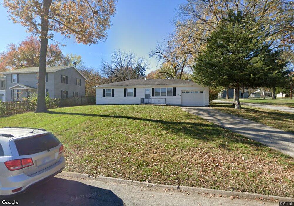
2502 4th Ave Leavenworth, KS 66048
Estimated Value: $213,000 - $255,000
3
Beds
1
Bath
1,148
Sq Ft
$201/Sq Ft
Est. Value
About This Home
This home is located at 2502 4th Ave, Leavenworth, KS 66048 and is currently estimated at $231,045, approximately $201 per square foot. 2502 4th Ave is a home located in Leavenworth County with nearby schools including Anthony Elementary School, Richard Warren Middle School, and Leavenworth Senior High School.
Ownership History
Date
Name
Owned For
Owner Type
Purchase Details
Closed on
Jan 30, 2024
Sold by
Sowle Cynthia
Bought by
Pugh Jimmy Gene
Current Estimated Value
Purchase Details
Closed on
Nov 1, 1999
Bought by
Henderson Rachel A
Home Financials for this Owner
Home Financials are based on the most recent Mortgage that was taken out on this home.
Original Mortgage
$68,000
Interest Rate
7.96%
Mortgage Type
New Conventional
Create a Home Valuation Report for This Property
The Home Valuation Report is an in-depth analysis detailing your home's value as well as a comparison with similar homes in the area
Home Values in the Area
Average Home Value in this Area
Purchase History
| Date | Buyer | Sale Price | Title Company |
|---|---|---|---|
| Pugh Jimmy Gene | -- | Lawyers Title | |
| Henderson Rachel A | $79,500 | -- |
Source: Public Records
Mortgage History
| Date | Status | Borrower | Loan Amount |
|---|---|---|---|
| Previous Owner | Henderson Rachel A | $68,000 | |
| Closed | Henderson Rachel A | $6,379 |
Source: Public Records
Tax History Compared to Growth
Tax History
| Year | Tax Paid | Tax Assessment Tax Assessment Total Assessment is a certain percentage of the fair market value that is determined by local assessors to be the total taxable value of land and additions on the property. | Land | Improvement |
|---|---|---|---|---|
| 2025 | $2,812 | $25,265 | $1,129 | $24,136 |
| 2024 | $2,189 | $24,084 | $1,129 | $22,955 |
| 2023 | $2,189 | $18,277 | $1,129 | $17,148 |
| 2022 | $1,917 | $15,893 | $1,191 | $14,702 |
| 2021 | $1,827 | $14,122 | $1,191 | $12,931 |
| 2020 | $1,680 | $12,868 | $1,191 | $11,677 |
| 2019 | $1,694 | $12,868 | $1,191 | $11,677 |
| 2018 | $1,608 | $12,102 | $1,191 | $10,911 |
| 2017 | $1,447 | $11,181 | $1,191 | $9,990 |
| 2016 | $1,450 | $11,181 | $1,191 | $9,990 |
| 2015 | $1,481 | $11,479 | $1,625 | $9,854 |
| 2014 | $1,474 | $11,479 | $1,625 | $9,854 |
Source: Public Records
Map
Nearby Homes
- 2307 Maple Ave
- 2825 Broadway Terrace
- 507 Santa fe St
- 708 Thornton St
- 1913 Cleveland Terrace
- 1932 S Broadway St
- 522 Buttinger Place
- 00000 Limit St
- 2104 Limit St
- 840 Limit St
- 901 Limit St
- 911 Limit St
- 3405 Iowa St
- 1708 S Broadway St
- 2017 Vilas St
- 1036 Vilas St
- 2021 Vilas St
- 1610 S Broadway St
- 3705 Shrine Park Rd
- 128 Logan St