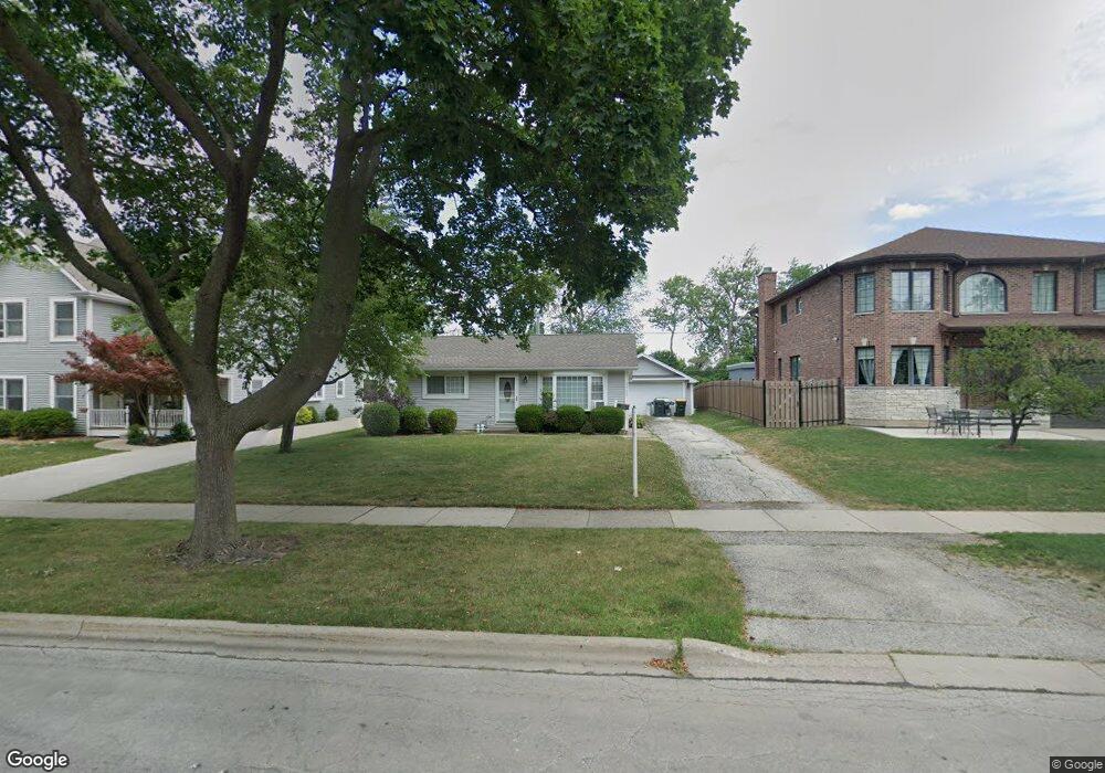
2502 Fremont St Rolling Meadows, IL 60008
Estimated Value: $284,000 - $377,000
4
Beds
2
Baths
1,437
Sq Ft
$243/Sq Ft
Est. Value
About This Home
This home is located at 2502 Fremont St, Rolling Meadows, IL 60008 and is currently estimated at $349,410, approximately $243 per square foot. 2502 Fremont St is a home located in Cook County with nearby schools including Kimball Hill Elementary School, King Elementary School, and Carl Sandburg Junior High School.
Ownership History
Date
Name
Owned For
Owner Type
Purchase Details
Closed on
Nov 23, 2018
Sold by
Bautista Ernesto
Bought by
Bautista Ernesto and Bautista Cornie
Current Estimated Value
Purchase Details
Closed on
Dec 18, 2008
Sold by
Devito John and Devito Ann Marie
Bought by
Bautista Ernesto
Home Financials for this Owner
Home Financials are based on the most recent Mortgage that was taken out on this home.
Original Mortgage
$157,916
Outstanding Balance
$105,206
Interest Rate
6.3%
Mortgage Type
FHA
Estimated Equity
$244,204
Purchase Details
Closed on
Jun 10, 2004
Sold by
Lasalle Bank Na
Bought by
Martin Alice
Create a Home Valuation Report for This Property
The Home Valuation Report is an in-depth analysis detailing your home's value as well as a comparison with similar homes in the area
Home Values in the Area
Average Home Value in this Area
Purchase History
| Date | Buyer | Sale Price | Title Company |
|---|---|---|---|
| Bautista Ernesto | -- | None Available | |
| Bautista Ernesto | $160,000 | Golden Title | |
| Martin Alice | -- | -- |
Source: Public Records
Mortgage History
| Date | Status | Borrower | Loan Amount |
|---|---|---|---|
| Open | Bautista Ernesto | $157,916 |
Source: Public Records
Tax History Compared to Growth
Tax History
| Year | Tax Paid | Tax Assessment Tax Assessment Total Assessment is a certain percentage of the fair market value that is determined by local assessors to be the total taxable value of land and additions on the property. | Land | Improvement |
|---|---|---|---|---|
| 2024 | $6,914 | $25,873 | $5,511 | $20,362 |
| 2023 | $6,590 | $25,873 | $5,511 | $20,362 |
| 2022 | $6,590 | $25,873 | $5,511 | $20,362 |
| 2021 | $5,144 | $18,862 | $3,256 | $15,606 |
| 2020 | $5,096 | $18,862 | $3,256 | $15,606 |
| 2019 | $5,134 | $21,075 | $3,256 | $17,819 |
| 2018 | $5,479 | $20,351 | $3,006 | $17,345 |
| 2017 | $5,386 | $20,351 | $3,006 | $17,345 |
| 2016 | $5,278 | $20,351 | $3,006 | $17,345 |
| 2015 | $4,281 | $16,220 | $2,755 | $13,465 |
| 2014 | $4,196 | $16,220 | $2,755 | $13,465 |
| 2013 | $4,671 | $18,203 | $2,755 | $15,448 |
Source: Public Records
Map
Nearby Homes
- 617 N Wilke Rd
- 1615 W Johanna Terrace
- 2611 South St
- 1506 W Northwest Hwy
- 12 S Princeton Ct
- 628 S Wilke Rd
- 2401 Rohlwing Rd
- 3316 Trillium Cir
- 3400 Wellington Ct Unit 306
- 3125 Town Square Dr Unit 408
- 543 S Warren Ave
- 3208 Wren Ln
- 3265 Kirchoff Rd Unit 223
- 2201 Kingfisher Ln
- 502 S Reuter Dr
- 3805 Fairfax Ave
- 1326 N Race Ave
- 3355 Kirchoff Rd Unit 6A
- 222 S Dwyer Ave
- 2100 Martin Ln
- 2504 Fremont St
- 2500 Fremont St
- 2412 Fremont St
- 2508 Fremont St
- 2410 Fremont St
- 2101 Bluebird Ln
- 2503 Fremont St
- 2408 Fremont St
- 2505 Fremont St
- 2510 Fremont St
- 2100 Bluebird Ln
- 2406 Fremont St
- 2103 Bluebird Ln
- 2100 Jay Ln
- 2405 Fremont St
- 2600 Fremont St
- 2102 Jay Ln
- 2404 Fremont St
- 2105 Bluebird Ln
- 2102 Bluebird Ln