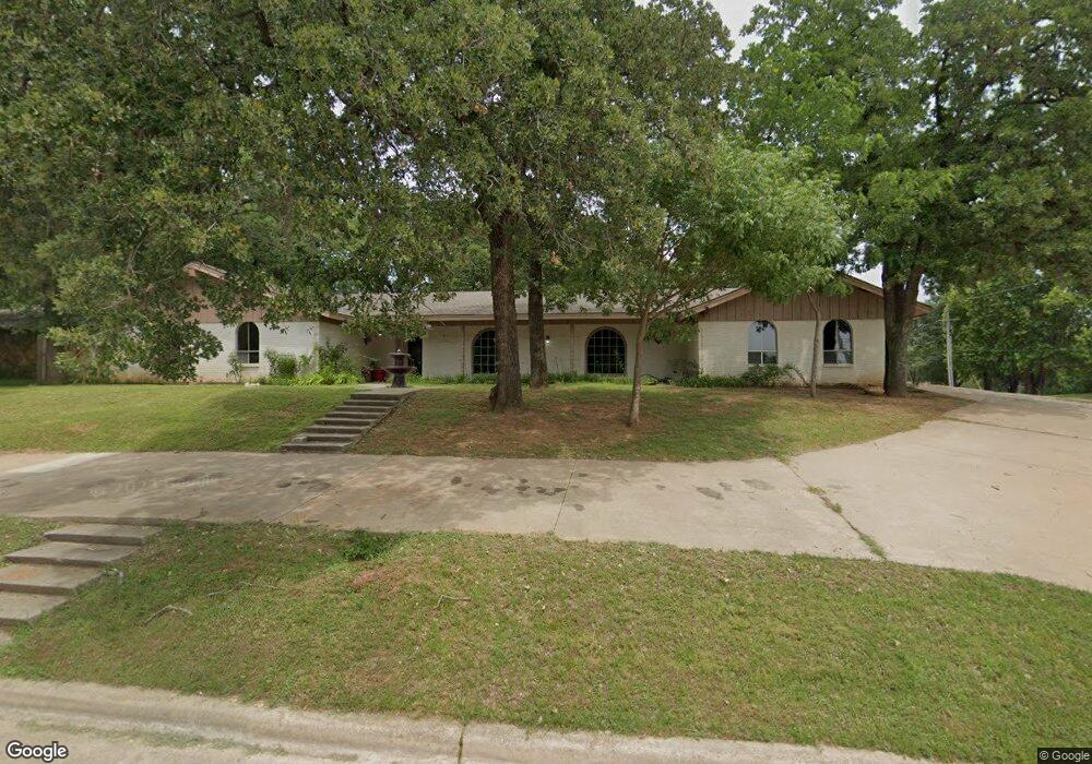
2502 Linwood Ln Duncan, OK 73533
Estimated Value: $345,000 - $395,000
4
Beds
3
Baths
3,858
Sq Ft
$96/Sq Ft
Est. Value
About This Home
This home is located at 2502 Linwood Ln, Duncan, OK 73533 and is currently estimated at $368,526, approximately $95 per square foot. 2502 Linwood Ln is a home with nearby schools including Plato Elementary School, Duncan Middle School, and Duncan High School.
Ownership History
Date
Name
Owned For
Owner Type
Purchase Details
Closed on
Sep 6, 2023
Sold by
Hall Jill
Bought by
Hall Jill and Patry Presley
Current Estimated Value
Purchase Details
Closed on
Aug 31, 2023
Sold by
Daube Ranch And Mineral Limited Partners and Sutton-Williams Lp
Bought by
Lowery Farms Llc
Purchase Details
Closed on
Aug 4, 2023
Sold by
Hawks Cynthia L
Bought by
Hawks Cynthia L and Kawks Cynthia Kate
Purchase Details
Closed on
Feb 12, 2001
Sold by
Thomas Michael D and Thomas Amela
Bought by
Stephenson Garry D and Stephenson Margaret
Purchase Details
Closed on
Oct 22, 1992
Sold by
Tregoning Marybelle
Create a Home Valuation Report for This Property
The Home Valuation Report is an in-depth analysis detailing your home's value as well as a comparison with similar homes in the area
Home Values in the Area
Average Home Value in this Area
Purchase History
| Date | Buyer | Sale Price | Title Company |
|---|---|---|---|
| Hall Jill | -- | None Listed On Document | |
| Hall Jill | -- | None Listed On Document | |
| Lowery Farms Llc | $20,000 | None Listed On Document | |
| Hawks Cynthia L | -- | None Listed On Document | |
| Hawks Cynthia L | -- | None Listed On Document | |
| Stephenson Garry D | $170,000 | -- | |
| -- | $114,000 | -- |
Source: Public Records
Tax History Compared to Growth
Tax History
| Year | Tax Paid | Tax Assessment Tax Assessment Total Assessment is a certain percentage of the fair market value that is determined by local assessors to be the total taxable value of land and additions on the property. | Land | Improvement |
|---|---|---|---|---|
| 2025 | $2,533 | $30,020 | $3,009 | $27,011 |
| 2024 | $2,512 | $29,486 | $3,009 | $26,477 |
| 2023 | $2,512 | $29,486 | $3,009 | $26,477 |
| 2022 | $2,274 | $28,082 | $3,009 | $25,073 |
| 2021 | $2,169 | $25,471 | $3,009 | $22,462 |
| 2020 | $2,212 | $25,618 | $3,009 | $22,609 |
| 2019 | $2,121 | $24,514 | $3,009 | $21,505 |
| 2018 | $2,246 | $25,222 | $3,009 | $22,213 |
| 2017 | $2,112 | $24,577 | $3,009 | $21,568 |
| 2016 | $2,209 | $25,990 | $3,009 | $22,981 |
| 2015 | $2,040 | $25,990 | $3,009 | $22,981 |
| 2014 | $2,040 | $25,026 | $3,009 | $22,017 |
Source: Public Records
Map
Nearby Homes
- 1108 1108 W Plato Unit 40
- 1108 1108 W Plato Unit 17
- 1108 W Plato Rd Unit 29
- 1108 W Plato Rd Unit 1
- 2518 Wildwood Place
- 1014 Oakview Dr
- 1004 Ranchwood Place
- 2702 2702 Wildwood Place
- 2106 Carolin Dr
- 1705 Foxboro Dr
- 2901 2901 Timber Ridge
- 2201 W Club Rd
- 1009 1009 Timbercreek Dr
- 0 Townsend St
- 1205 1205 Timbercreek Dr
- 2110 W Club Rd
- 3203 Williamsburg St
- 3202 Williamsburg St
- 1102 1102 Bent Tree
- 1209 Bent Tree St
- 2506 Linwood Ln
- 2505 Linwood Ln
- 2510 Linwood Ln
- 2509 Linwood Ln
- 2514 Linwood Ln
- 1108 W Plato Rd #41
- 1046 W Plato Rd
- 2513 Linwood Ln
- 2508 Wildwood Place
- 2510 Wildwood Place
- 2 N I St
- 2517 Linwood Ln
- 1108 1108 W Plato Apt Unit 12
- 1108 1108 W Plato Unit 1
- 2514 Wildwood Place
- 1108 W Plato Rd
- 1108 W Plato Rd Unit 55
- 1108 W Plato Rd Unit 54
- 1108 W Plato Rd Unit 53
- 1108 W Plato Rd Unit 52