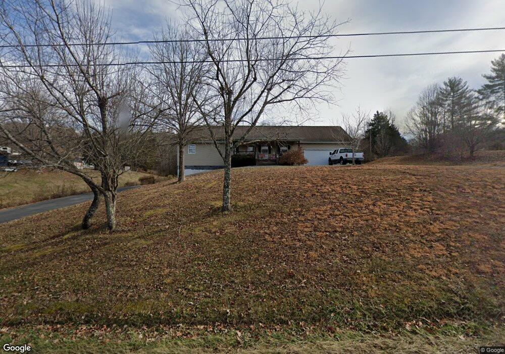
2502 Longbranch Rd Seymour, TN 37865
Estimated Value: $453,911 - $640,000
3
Beds
4
Baths
2,250
Sq Ft
$243/Sq Ft
Est. Value
About This Home
This home is located at 2502 Longbranch Rd, Seymour, TN 37865 and is currently estimated at $546,956, approximately $243 per square foot. 2502 Longbranch Rd is a home located in Sevier County with nearby schools including Northview Elementary School, Catons Chapel Elementary School, and Jones Cove Elementary School.
Ownership History
Date
Name
Owned For
Owner Type
Purchase Details
Closed on
Jun 6, 2011
Sold by
Rolen David M
Bought by
Bland Gary and Bland Melessa
Current Estimated Value
Home Financials for this Owner
Home Financials are based on the most recent Mortgage that was taken out on this home.
Original Mortgage
$247,409
Outstanding Balance
$171,198
Interest Rate
4.71%
Mortgage Type
Commercial
Estimated Equity
$375,758
Purchase Details
Closed on
Dec 30, 2002
Sold by
Householder Freida S
Bought by
Rolen David M
Create a Home Valuation Report for This Property
The Home Valuation Report is an in-depth analysis detailing your home's value as well as a comparison with similar homes in the area
Home Values in the Area
Average Home Value in this Area
Purchase History
| Date | Buyer | Sale Price | Title Company |
|---|---|---|---|
| Bland Gary | $235,000 | -- | |
| Rolen David M | $65,000 | -- | |
| Householder Freida S | -- | -- |
Source: Public Records
Mortgage History
| Date | Status | Borrower | Loan Amount |
|---|---|---|---|
| Open | Bland Gary | $247,409 |
Source: Public Records
Tax History Compared to Growth
Tax History
| Year | Tax Paid | Tax Assessment Tax Assessment Total Assessment is a certain percentage of the fair market value that is determined by local assessors to be the total taxable value of land and additions on the property. | Land | Improvement |
|---|---|---|---|---|
| 2025 | $1,015 | $68,575 | $18,450 | $50,125 |
| 2024 | $1,015 | $68,575 | $18,450 | $50,125 |
| 2023 | $1,015 | $68,575 | $0 | $0 |
| 2022 | $1,015 | $68,575 | $18,450 | $50,125 |
| 2021 | $1,015 | $68,575 | $18,450 | $50,125 |
| 2020 | $1,079 | $68,575 | $18,450 | $50,125 |
| 2019 | $1,079 | $58,025 | $18,825 | $39,200 |
| 2018 | $1,079 | $58,025 | $18,825 | $39,200 |
| 2017 | $1,079 | $58,025 | $18,825 | $39,200 |
| 2016 | $1,079 | $58,025 | $18,825 | $39,200 |
| 2015 | -- | $59,150 | $0 | $0 |
| 2014 | $964 | $59,145 | $0 | $0 |
Source: Public Records
Map
Nearby Homes
- 220 Cottontail Cove Ln
- 1710 Prey Ct
- 514 Indian Gap Rd
- 2072 Chapman Hwy
- 2064 Chapman Hwy
- 2101 Wingspan Dr
- 255 Villa Segrata North Ridge Rd
- 2105 Wingspan Dr
- 2034 Eagle Feather Dr
- 873 Indian Gap Rd
- 2028 Eagle Feather Dr
- 2033 Eagle Feather Dr
- 2345 Paradise Way
- Lot 1 Indian Gap Rd
- 880 Bethlehem Way
- 2043 Eagle Feather Dr
- 1863 Chapman Hwy
- 0 60 Acres Gist Creek Rd
- 2048 Eagle Feather Dr
- 0 Eagle Feather Dr
- 2464 Long Branch Rd
- 2520 Long Branch Rd
- 2506 Long Branch Rd
- 2452 Longbranch Rd
- 2452 Long Branch Rd
- 2460 Longbranch Rd
- 2451 Longbranch Rd
- 2460 Long Branch Rd
- 0 Zion Dr Unit 628384
- 0 Zion Dr Unit 628383
- 0 Zion Dr Unit 628380
- 442 Zion Hill Rd
- 438 Zion Hill Rd
- 0 Zion Hill Rd
- 2506 Longbranch Rd
- 2506 Long Branch Rd
- 440 Zion Hill Rd
- Lot 8 Kay Jay Way
- 2440 Longbranch Rd
- 2440 Long Branch Rd