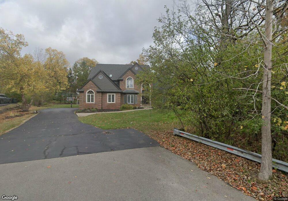
25022 Canterbury Rd Unit Bldg-Unit Franklin, MI 48025
Estimated Value: $1,188,003 - $1,674,000
6
Beds
6
Baths
4,763
Sq Ft
$306/Sq Ft
Est. Value
About This Home
This home is located at 25022 Canterbury Rd Unit Bldg-Unit, Franklin, MI 48025 and is currently estimated at $1,456,251, approximately $305 per square foot. 25022 Canterbury Rd Unit Bldg-Unit is a home located in Oakland County with nearby schools including Wylie E. Groves High School, West Maple Elementary School, and Berkshire Middle School.
Ownership History
Date
Name
Owned For
Owner Type
Purchase Details
Closed on
Aug 21, 2018
Sold by
Edelson Gary W and Bar Levay Leora P
Bought by
Hammoud Ihab O and Elberjawi Dina
Current Estimated Value
Home Financials for this Owner
Home Financials are based on the most recent Mortgage that was taken out on this home.
Original Mortgage
$676,000
Outstanding Balance
$580,474
Interest Rate
4%
Mortgage Type
Adjustable Rate Mortgage/ARM
Estimated Equity
$875,777
Create a Home Valuation Report for This Property
The Home Valuation Report is an in-depth analysis detailing your home's value as well as a comparison with similar homes in the area
Home Values in the Area
Average Home Value in this Area
Purchase History
| Date | Buyer | Sale Price | Title Company |
|---|---|---|---|
| Hammoud Ihab O | $845,000 | None Available |
Source: Public Records
Mortgage History
| Date | Status | Borrower | Loan Amount |
|---|---|---|---|
| Open | Hammoud Ihab O | $676,000 |
Source: Public Records
Tax History Compared to Growth
Tax History
| Year | Tax Paid | Tax Assessment Tax Assessment Total Assessment is a certain percentage of the fair market value that is determined by local assessors to be the total taxable value of land and additions on the property. | Land | Improvement |
|---|---|---|---|---|
| 2024 | $15,057 | $569,150 | $0 | $0 |
| 2023 | $14,277 | $487,610 | $0 | $0 |
| 2022 | $15,450 | $453,860 | $0 | $0 |
| 2021 | $15,785 | $450,780 | $0 | $0 |
| 2020 | $14,320 | $472,640 | $0 | $0 |
| 2019 | $13,512 | $480,370 | $0 | $0 |
| 2018 | $12,659 | $465,320 | $0 | $0 |
| 2017 | $12,843 | $465,320 | $0 | $0 |
| 2016 | $11,857 | $414,610 | $0 | $0 |
| 2015 | -- | $373,550 | $0 | $0 |
| 2014 | -- | $341,000 | $0 | $0 |
| 2011 | -- | $302,190 | $0 | $0 |
Source: Public Records
Map
Nearby Homes
- 25265 Canterbury Rd
- 24924 Riverwood Dr
- 25325 Devon Ln
- 25330 Devon Ln
- 31011 Pioneer Ave
- 30630 Helmandale Dr
- 31050 Briarcliff Rd
- 24066 Bingham Pointe Dr Unit 11
- 30526 Birchway Dr
- 30476 Birchway Dr
- 26075 Woodlore Rd
- 24459 Bloomington Ct
- 30915 Timberbrook Ln
- 25635 River Dr
- 30030 Wildbrook Dr Unit 102
- 0000 Woodlynne Dr
- 26377 Willowgreen Dr
- 25559 Farmbrook Rd
- 29413 Timberwood Ln
- 30486 S Greenbriar Rd
- 25022 Canterbury Rd
- 25066 Canterbury Rd
- 25015 Devon Ln
- 31225 Sunset Dr
- 31271 Sunset Dr
- 25045 Devon Ln
- 25055 Canterbury Rd
- 25020 W 13 Mile Rd
- 25080 Canterbury Rd
- 25020 W 13 Mile Rd
- 24510 W Thirteen Mile Rd N Unit Bldg-Unit
- 24510 W Thirteen Mile Rd N
- 25085 Canterbury Rd
- 31151 Sunset Dr
- 25075 Devon Ln
- 25020 Devon Ln
- 31331 Sunset Dr
- 25025 Canterbury Rd
- 31260 Sunset Dr
- 25100 Canterbury Rd