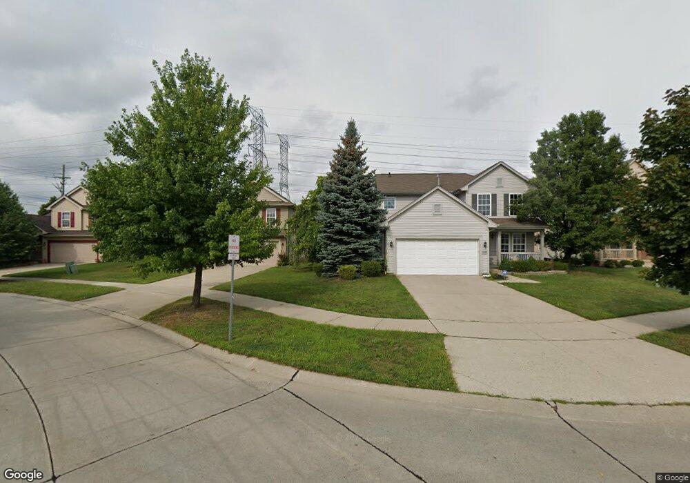
25033 Independence Trail Unit Bldg-Unit Warren, MI 48089
Southeast Warren NeighborhoodEstimated Value: $327,000 - $336,001
3
Beds
3
Baths
1,824
Sq Ft
$182/Sq Ft
Est. Value
About This Home
This home is located at 25033 Independence Trail Unit Bldg-Unit, Warren, MI 48089 and is currently estimated at $332,250, approximately $182 per square foot. 25033 Independence Trail Unit Bldg-Unit is a home located in Macomb County with nearby schools including Lincoln Middle School, Lincoln High School, and Macomb Montessori Academy.
Ownership History
Date
Name
Owned For
Owner Type
Purchase Details
Closed on
Jul 6, 2021
Sold by
Cocks Rory and Cocks Heather
Bought by
Masroor Safia and Khan Sajid
Current Estimated Value
Purchase Details
Closed on
May 30, 2018
Sold by
Bowie Rodney and Bowie Rodney
Bought by
Cocks Rory and Cocks Heather
Purchase Details
Closed on
Jul 25, 2012
Sold by
Eloms Joey L and Eloms Shara M
Bought by
Bowie Rodney
Purchase Details
Closed on
Dec 22, 2003
Sold by
Centex Homes
Bought by
Eloms Joey L
Create a Home Valuation Report for This Property
The Home Valuation Report is an in-depth analysis detailing your home's value as well as a comparison with similar homes in the area
Home Values in the Area
Average Home Value in this Area
Purchase History
| Date | Buyer | Sale Price | Title Company |
|---|---|---|---|
| Masroor Safia | $250,000 | First Premier Title | |
| Cocks Rory | $185,000 | None Available | |
| Bowie Rodney | $97,000 | Progressive Title | |
| Eloms Joey L | -- | -- | |
| Centex Homes | -- | -- |
Source: Public Records
Tax History Compared to Growth
Tax History
| Year | Tax Paid | Tax Assessment Tax Assessment Total Assessment is a certain percentage of the fair market value that is determined by local assessors to be the total taxable value of land and additions on the property. | Land | Improvement |
|---|---|---|---|---|
| 2025 | $8,697 | $137,240 | $0 | $0 |
| 2024 | $8,513 | $126,310 | $0 | $0 |
| 2023 | $8,178 | $119,190 | $0 | $0 |
| 2022 | $8,014 | $109,940 | $0 | $0 |
| 2021 | $4,778 | $98,870 | $0 | $0 |
| 2020 | $4,656 | $95,930 | $0 | $0 |
| 2019 | $4,543 | $83,560 | $0 | $0 |
| 2018 | $86 | $68,370 | $0 | $0 |
| 2017 | $2,983 | $67,570 | $10,500 | $57,070 |
| 2016 | $2,959 | $67,570 | $0 | $0 |
| 2015 | -- | $64,170 | $0 | $0 |
| 2013 | $2,593 | $51,730 | $0 | $0 |
Source: Public Records
Map
Nearby Homes
- 25050 Constitution Ave
- 25137 Palomino Ave
- 13062 E 10 Mile Rd
- 12922 Heritage S Unit 54
- 25227 Marilyn Ave
- 24820 Wagner Ave
- 25653 Palomino Ave
- 25031 Wagner Ave
- 25317 Wagner Ave
- 24821 Wagner Ave
- 13429 Zagaiski Ave
- 13203 Frazho Rd
- 13653 Brainbridge Ave
- 11657 Engleman Rd
- 11647 Hovey St
- 11920 Carney St
- 13171 Burgundy Ave
- 26515 Newport Ave
- 24450 Groesbeck Hwy
- 0000 Frazho Rd
- 25033 Independence Trail
- 25033 Independence Tr
- 25001 Constitution Ave
- 25065 Independence Trail Unit 5
- 25035 Constitution Ave
- 25081 Independence Trail Unit 6
- 25002 Constitution Ave
- 25051 Constitution Ave
- 25014 Constitution Ave
- 25084 Independence Trail
- 0 E 10 Mile Rd Unit 4899016
- 0 E 10 Mile Rd Unit 4898564
- 0 E 10 Mile Rd Unit 4635784
- 0 E 10 Mile Rd Unit 4897762
- 0 E 10 Mile Rd Unit 4670751
- 0 E 10 Mile Rd Unit 213029977
- 0 E 10 Mile Rd Unit 213119263
- 0 E 10 Mile Rd Unit G31190698
- 0 E 10 Mile Rd Unit G31217583
- 0 E 10 Mile Rd Unit R214110270