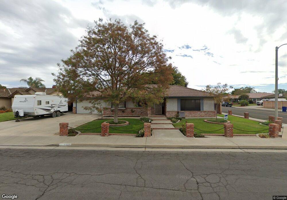
2505 Michael Way Hanford, CA 93230
Estimated Value: $386,927 - $415,000
3
Beds
2
Baths
1,828
Sq Ft
$221/Sq Ft
Est. Value
About This Home
This home is located at 2505 Michael Way, Hanford, CA 93230 and is currently estimated at $404,482, approximately $221 per square foot. 2505 Michael Way is a home located in Kings County with nearby schools including Hanford West High School, Pioneer Elementary School, and Pioneer Middle School.
Ownership History
Date
Name
Owned For
Owner Type
Purchase Details
Closed on
Jun 13, 2001
Sold by
Yeafoli Domenic J and The Domenic J & Barbara E Yeaf
Bought by
Ike Richard A and Ike Kelly A
Current Estimated Value
Home Financials for this Owner
Home Financials are based on the most recent Mortgage that was taken out on this home.
Original Mortgage
$103,000
Outstanding Balance
$39,235
Interest Rate
7.14%
Estimated Equity
$365,247
Create a Home Valuation Report for This Property
The Home Valuation Report is an in-depth analysis detailing your home's value as well as a comparison with similar homes in the area
Home Values in the Area
Average Home Value in this Area
Purchase History
| Date | Buyer | Sale Price | Title Company |
|---|---|---|---|
| Ike Richard A | $148,000 | Chicago Title Co |
Source: Public Records
Mortgage History
| Date | Status | Borrower | Loan Amount |
|---|---|---|---|
| Open | Ike Richard A | $103,000 |
Source: Public Records
Tax History Compared to Growth
Tax History
| Year | Tax Paid | Tax Assessment Tax Assessment Total Assessment is a certain percentage of the fair market value that is determined by local assessors to be the total taxable value of land and additions on the property. | Land | Improvement |
|---|---|---|---|---|
| 2025 | $2,322 | $223,011 | $54,243 | $168,768 |
| 2023 | $2,322 | $214,353 | $52,138 | $162,215 |
| 2022 | $2,247 | $210,151 | $51,116 | $159,035 |
| 2021 | $2,205 | $206,031 | $50,114 | $155,917 |
| 2020 | $2,210 | $203,918 | $49,600 | $154,318 |
| 2019 | $2,174 | $199,919 | $48,627 | $151,292 |
| 2018 | $2,160 | $195,999 | $47,674 | $148,325 |
| 2017 | $2,120 | $192,156 | $46,739 | $145,417 |
| 2016 | $2,005 | $188,389 | $45,823 | $142,566 |
| 2015 | $1,942 | $185,560 | $45,135 | $140,425 |
| 2014 | $1,955 | $181,925 | $44,251 | $137,674 |
Source: Public Records
Map
Nearby Homes
- 314 W Birch Ave
- 2352 Cabrillo Way
- 2612 Aspen St
- 165 W Magnolia Ave
- 2234 Carter Way
- 496 W Earl Way
- 2475 Santa Lucia Ct
- 2210 N Douty St
- 332 E Ash Ave
- 710 Northstar Dr
- 216 Palm Ct
- 325 E Amber Way
- 850 Northstar Dr
- 405 E Magnolia Ave
- 450 E Birch Ave
- 2851 Julia Cir
- 2127 N 11th Ave
- 2020 Short Dr
- 259 E Sherwood Dr
- 136 W Colonial Dr
- 2521 Michael Way
- 284 W Fargo Ave
- 2489 Michael Way
- 266 W Fargo Ave
- 2537 Michael Way
- 265 W Redwood St
- 2506 Michael Way
- 283 W Fargo Ave
- 265 W Fargo Ave
- 253 W Redwood St
- 2485 Michael Way
- 248 W Fargo Ave
- 2538 Michael Way
- 304 W Fargo Ave
- 247 W Fargo Ave
- 241 W Redwood St
- 274 W Ash Ave
- 2484 Michael Way
- 288 W Ash Ave Unit 2
- 232 W Fargo Ave