Estimated Value: $292,356 - $341,000
3
Beds
2
Baths
1,808
Sq Ft
$181/Sq Ft
Est. Value
About This Home
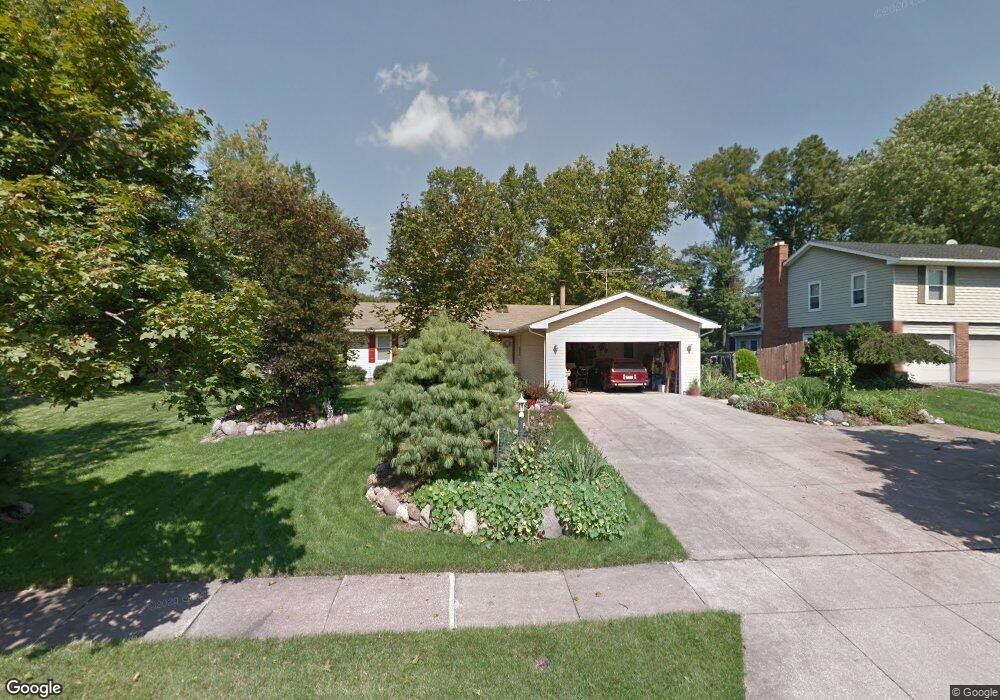
This home is located at 2505 Valleydale Rd, Stow, OH 44224 and is currently estimated at $326,589, approximately $180 per square foot. 2505 Valleydale Rd is a home located in Summit County with nearby schools including Stow-Munroe Falls High School, Primrose School of Hudson, and Holy Family Elementary School.
Ownership History
Date
Name
Owned For
Owner Type
Purchase Details
Closed on
Jul 9, 2019
Sold by
Sengel Taylor Lenette and The Lenette Senhel Taylor Trus
Bought by
Taylor Larry E and Taylor Lenette S
Current Estimated Value
Purchase Details
Closed on
Nov 6, 2008
Sold by
Taylor Lenette Sengel and Taylor Larry Edward
Bought by
Taylor Larry Edward and The Larry Edward Taylor Trust
Create a Home Valuation Report for This Property
The Home Valuation Report is an in-depth analysis detailing your home's value as well as a comparison with similar homes in the area
Home Values in the Area
Average Home Value in this Area
Purchase History
| Date | Buyer | Sale Price | Title Company |
|---|---|---|---|
| Taylor Larry E | -- | None Available | |
| Taylor Larry Edward | -- | Attorney | |
| Taylor Lenette Sengel | -- | Attorney |
Source: Public Records
Tax History Compared to Growth
Tax History
| Year | Tax Paid | Tax Assessment Tax Assessment Total Assessment is a certain percentage of the fair market value that is determined by local assessors to be the total taxable value of land and additions on the property. | Land | Improvement |
|---|---|---|---|---|
| 2025 | $4,192 | $83,356 | $14,518 | $68,838 |
| 2024 | $4,192 | $83,356 | $14,518 | $68,838 |
| 2023 | $4,192 | $83,356 | $14,518 | $68,838 |
| 2022 | $3,435 | $62,300 | $11,900 | $50,400 |
| 2021 | $3,077 | $62,300 | $11,900 | $50,400 |
| 2020 | $3,358 | $68,320 | $11,900 | $56,420 |
| 2019 | $2,971 | $57,910 | $11,660 | $46,250 |
| 2018 | $2,923 | $57,910 | $11,660 | $46,250 |
| 2017 | $2,677 | $57,910 | $11,660 | $46,250 |
| 2016 | $2,755 | $52,450 | $11,660 | $40,790 |
| 2015 | $2,677 | $52,450 | $11,660 | $40,790 |
| 2014 | $2,680 | $52,450 | $11,660 | $40,790 |
| 2013 | $2,663 | $52,450 | $11,660 | $40,790 |
Source: Public Records
Map
Nearby Homes
- 4901 Independence Cir Unit B
- 2444 Port Charles Dr
- 4903 Fishcreek Rd Unit 11B
- 2380 Port Williams Dr Unit 2380
- 4944 Friar Rd Unit D
- 0 Stow Rd Unit 5102979
- 2327 Crockett Cir
- 4322 Lorwood Dr
- 4901 Pebblehurst Dr
- 2140 Woodlawn Cir Unit 2144
- 2714 Wexford Blvd
- 4604 Muirwood Place
- 4227 Baird Rd
- 4131 Burton Dr
- 4233 Smokerise Dr
- 4227 Maribend Dr
- 4120 Klein Ave
- 2908 Wexford Blvd
- 4630 Red Willow Rd
- 1938 Higby Dr
- 2513 Valleydale Rd
- 2495 Valleydale Rd
- 2508 Mallory Ln
- 2521 Valleydale Rd
- 2516 Mallory Ln
- 2500 Mallory Ln
- 2504 Valleydale Rd
- 2494 Valleydale Rd
- 2483 Valleydale Rd
- 2524 Mallory Ln
- 2529 Valleydale Rd
- 2584 Celia Dr
- 2492 Mallory Ln
- 2482 Valleydale Rd
- 2532 Mallory Ln
- 2571 Celia Dr
- 2576 Celia Dr
- 2537 Valleydale Rd
- 2510 Sherwood Dr
- 2563 Celia Dr