Estimated Value: $378,603 - $403,000
4
Beds
3
Baths
1,727
Sq Ft
$228/Sq Ft
Est. Value
About This Home
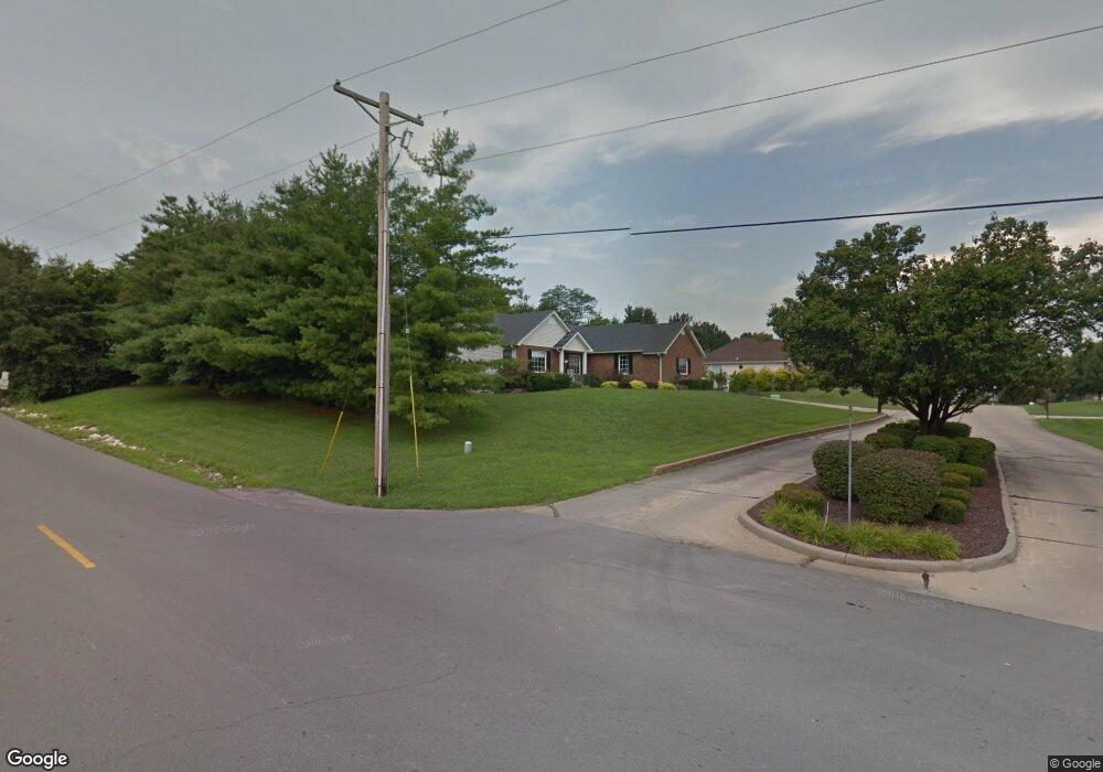
This home is located at 251 Eastbrook Dr, Troy, MO 63379 and is currently estimated at $394,151, approximately $228 per square foot. 251 Eastbrook Dr is a home located in Lincoln County with nearby schools including Main Street Elementary School, Troy Middle School, and Troy Buchanan High School.
Ownership History
Date
Name
Owned For
Owner Type
Purchase Details
Closed on
Dec 5, 2016
Sold by
Colson Norma J
Bought by
Colson Norma J and Dunnermann Judith K
Current Estimated Value
Purchase Details
Closed on
Apr 12, 2012
Sold by
Browett William and Browett Jan
Bought by
Miller Larry L and Colson Norma J
Home Financials for this Owner
Home Financials are based on the most recent Mortgage that was taken out on this home.
Original Mortgage
$163,163
Outstanding Balance
$113,756
Interest Rate
4.11%
Mortgage Type
New Conventional
Estimated Equity
$280,395
Create a Home Valuation Report for This Property
The Home Valuation Report is an in-depth analysis detailing your home's value as well as a comparison with similar homes in the area
Home Values in the Area
Average Home Value in this Area
Purchase History
| Date | Buyer | Sale Price | Title Company |
|---|---|---|---|
| Colson Norma J | -- | None Available | |
| Miller Larry L | -- | Meyer Title Company |
Source: Public Records
Mortgage History
| Date | Status | Borrower | Loan Amount |
|---|---|---|---|
| Open | Miller Larry L | $163,163 |
Source: Public Records
Tax History Compared to Growth
Tax History
| Year | Tax Paid | Tax Assessment Tax Assessment Total Assessment is a certain percentage of the fair market value that is determined by local assessors to be the total taxable value of land and additions on the property. | Land | Improvement |
|---|---|---|---|---|
| 2025 | $2,987 | $51,053 | $7,053 | $44,000 |
| 2024 | $2,987 | $46,656 | $5,373 | $41,283 |
| 2023 | $2,965 | $46,603 | $5,320 | $41,283 |
| 2022 | $2,792 | $43,672 | $4,750 | $38,922 |
| 2021 | $2,806 | $229,850 | $0 | $0 |
| 2020 | $2,444 | $199,760 | $0 | $0 |
| 2019 | $2,447 | $199,760 | $0 | $0 |
| 2018 | $2,523 | $38,669 | $0 | $0 |
| 2017 | $2,530 | $38,669 | $0 | $0 |
| 2016 | $2,022 | $30,083 | $0 | $0 |
| 2015 | $2,026 | $30,083 | $0 | $0 |
| 2014 | $2,031 | $30,083 | $0 | $0 |
| 2013 | -- | $30,083 | $0 | $0 |
Source: Public Records
Map
Nearby Homes
- 1030 Meadowbrook Dr
- 107 Carrington Blvd
- 210 River Bluff Ct
- 701 Cap Au Gris St
- 429 Bluff Dr
- 513 Oakbluff Ct
- 151 Colonial Ln
- 571 S Lincoln Dr
- 0 S 3rd St Unit MAR23052580
- 161 Bluffview Dr
- 51 Schulze Dr
- 620 E College St
- 430 Cap Au Gris St
- 0 Turnbull Trail (1-3+ - Acres)
- 1 Lincoln Center
- 0 Turnbull Trail (4-7+ - Acres)
- 731 Old Moscow Mills Rd
- 890 Main St
- 0 E Outer Road Hwy 61 (Multiple Industrial Lots) Unit MIS25071736
- 0 E Outer Road Hwy 61 (Multiple Industrial Lots) Unit MIS25071768
- 257 Eastbrook Dr
- 250 Eastbrook Dr
- 256 Eastbrook Dr
- 263 Eastbrook Dr
- 508 Bridgeway Dr
- 514 Bridgeway Dr
- 503 Bridgeway Dr
- 269 Eastbrook Dr
- 509 Bridgeway Dr
- 515 Bridgeway Dr
- 520 Bridgeway Dr
- 526 Bridgeway Dr
- 275 Eastbrook Dr
- 521 Bridgeway Dr
- 506 Pebble Ct
- 527 Bridgeway Dr
- 532 Bridgeway Dr
- 279 Eastbrook Dr
- 7 Pebble Place Ct
- 19 Pebble Place Ct