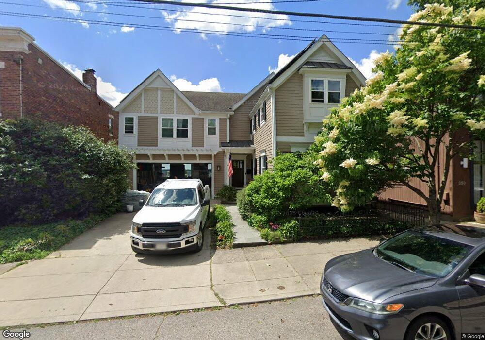
251 Klotter Ave Cincinnati, OH 45219
Clifton NeighborhoodEstimated Value: $535,000 - $741,000
3
Beds
4
Baths
2,186
Sq Ft
$278/Sq Ft
Est. Value
About This Home
This home is located at 251 Klotter Ave, Cincinnati, OH 45219 and is currently estimated at $607,570, approximately $277 per square foot. 251 Klotter Ave is a home located in Hamilton County with nearby schools including Clifton Area Neighborhood School, Robert A. Taft Information Technology High School, and Gilbert A. Dater High School.
Ownership History
Date
Name
Owned For
Owner Type
Purchase Details
Closed on
Jul 22, 2004
Sold by
Goering Ruth F
Bought by
Caywood Jeffrey E and Neel Robert W
Current Estimated Value
Home Financials for this Owner
Home Financials are based on the most recent Mortgage that was taken out on this home.
Original Mortgage
$200,000
Outstanding Balance
$95,174
Interest Rate
5.5%
Mortgage Type
Fannie Mae Freddie Mac
Estimated Equity
$512,396
Purchase Details
Closed on
Jul 30, 2003
Sold by
Endres Joan M
Bought by
Mayoue Mark P
Create a Home Valuation Report for This Property
The Home Valuation Report is an in-depth analysis detailing your home's value as well as a comparison with similar homes in the area
Home Values in the Area
Average Home Value in this Area
Purchase History
| Date | Buyer | Sale Price | Title Company |
|---|---|---|---|
| Caywood Jeffrey E | $250,000 | -- | |
| Mayoue Mark P | $255,000 | -- |
Source: Public Records
Mortgage History
| Date | Status | Borrower | Loan Amount |
|---|---|---|---|
| Open | Caywood Jeffrey E | $200,000 |
Source: Public Records
Tax History Compared to Growth
Tax History
| Year | Tax Paid | Tax Assessment Tax Assessment Total Assessment is a certain percentage of the fair market value that is determined by local assessors to be the total taxable value of land and additions on the property. | Land | Improvement |
|---|---|---|---|---|
| 2024 | $8,992 | $176,740 | $62,055 | $114,685 |
| 2023 | $9,195 | $176,740 | $62,055 | $114,685 |
| 2022 | $7,521 | $134,078 | $30,359 | $103,719 |
| 2021 | $7,239 | $134,078 | $30,359 | $103,719 |
| 2020 | $7,452 | $134,078 | $30,359 | $103,719 |
| 2019 | $8,111 | $109,900 | $24,885 | $85,015 |
| 2018 | $8,123 | $109,141 | $24,885 | $84,256 |
| 2017 | $7,668 | $109,141 | $24,885 | $84,256 |
| 2016 | $7,304 | $102,470 | $23,422 | $79,048 |
| 2015 | $6,582 | $102,470 | $23,422 | $79,048 |
| 2014 | $5,471 | $84,511 | $23,422 | $61,089 |
| 2013 | $5,352 | $81,264 | $22,523 | $58,741 |
Source: Public Records
Map
Nearby Homes
- 305 Klotter Ave
- 276 Emming St
- 261 Renner St
- 316 Klotter Ave
- 251 Renner St
- 2143 W Clifton Ave
- 237 Renner St
- 2175 Sohn St
- 227 Renner St
- 221 Renner St
- 306 W McMicken Ave
- 269 W McMicken Ave
- 265 W McMicken Ave
- 2114 Ravine St
- 255 Warner St
- 280 Stark St
- 2150 Ravine St
- 305 Warner St
- 411 W McMicken Ave
- 421 W McMicken Ave
- 253 Klotter Ave
- 247 Klotter Ave
- 255 Klotter Ave
- 245 Klotter Ave
- 259 Klotter Ave
- 243 Klotter Ave
- 252 Klotter Ave
- 261 Klotter Ave
- 250 Klotter Ave
- 246 Klotter Ave
- 239 Klotter Ave
- 254 Klotter Ave
- 244 Klotter Ave
- 256 Klotter Ave
- 242 Klotter Ave
- 258 Klotter Ave
- 263 Klotter Ave
- 237 Klotter Ave
- 260 Klotter Ave
- 238 Klotter Ave