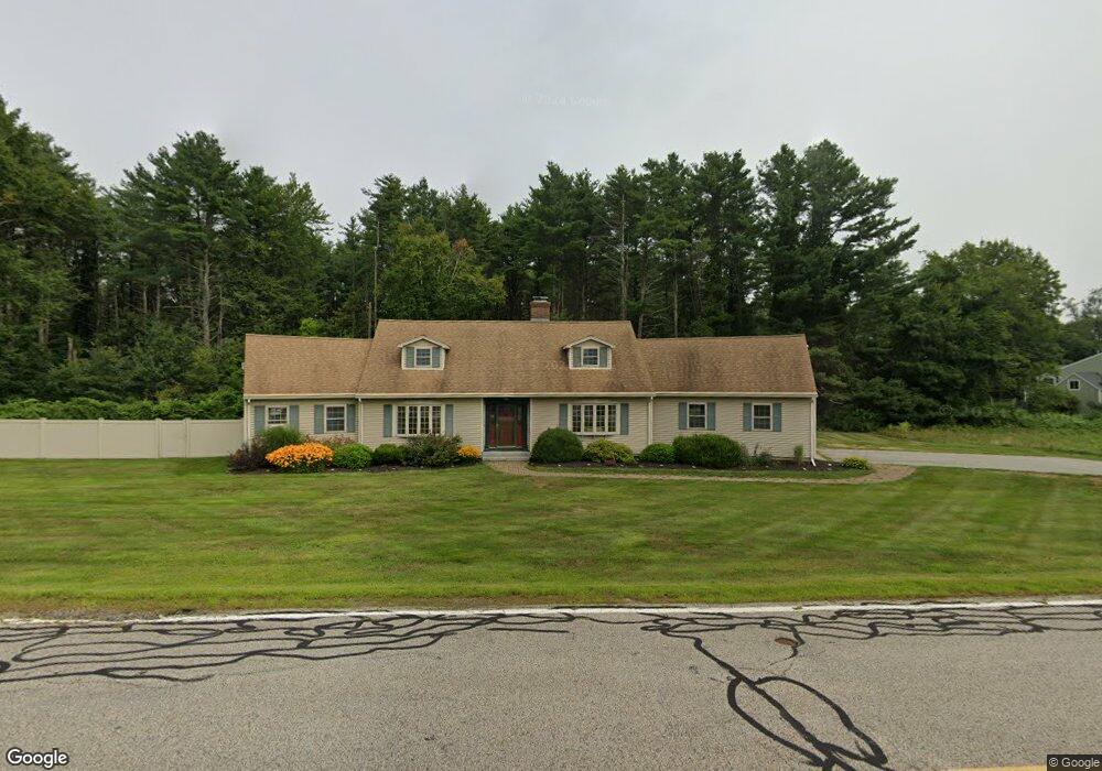
251 Little Bay Rd Newington, NH 03801
Estimated Value: $1,008,920 - $1,209,000
3
Beds
2
Baths
2,815
Sq Ft
$402/Sq Ft
Est. Value
About This Home
This home is located at 251 Little Bay Rd, Newington, NH 03801 and is currently estimated at $1,130,230, approximately $401 per square foot. 251 Little Bay Rd is a home located in Rockingham County with nearby schools including Newington Public School.
Ownership History
Date
Name
Owned For
Owner Type
Purchase Details
Closed on
Apr 10, 2017
Sold by
Dumont Kimberly A and Dumont Brian
Bought by
Kimberly Ann Dumont Re
Current Estimated Value
Purchase Details
Closed on
Sep 24, 2002
Sold by
Frink Marlon S
Bought by
Dumont Kimberly A and Dumont Brian
Home Financials for this Owner
Home Financials are based on the most recent Mortgage that was taken out on this home.
Original Mortgage
$225,000
Interest Rate
6.36%
Create a Home Valuation Report for This Property
The Home Valuation Report is an in-depth analysis detailing your home's value as well as a comparison with similar homes in the area
Home Values in the Area
Average Home Value in this Area
Purchase History
| Date | Buyer | Sale Price | Title Company |
|---|---|---|---|
| Kimberly Ann Dumont Re | -- | -- | |
| Dumont Kimberly A | $225,000 | -- |
Source: Public Records
Mortgage History
| Date | Status | Borrower | Loan Amount |
|---|---|---|---|
| Previous Owner | Dumont Kimberly A | $290,000 | |
| Previous Owner | Dumont Kimberly A | $40,000 | |
| Previous Owner | Dumont Kimberly A | $300,000 | |
| Previous Owner | Dumont Kimberly A | $225,000 |
Source: Public Records
Tax History Compared to Growth
Tax History
| Year | Tax Paid | Tax Assessment Tax Assessment Total Assessment is a certain percentage of the fair market value that is determined by local assessors to be the total taxable value of land and additions on the property. | Land | Improvement |
|---|---|---|---|---|
| 2024 | $6,458 | $819,600 | $457,200 | $362,400 |
| 2023 | $9,624 | $571,500 | $305,700 | $265,800 |
| 2022 | $5,646 | $571,500 | $305,700 | $265,800 |
| 2021 | $5,704 | $571,500 | $305,700 | $265,800 |
| 2020 | $4,150 | $571,500 | $305,700 | $265,800 |
| 2018 | $4,649 | $501,500 | $246,000 | $255,500 |
| 2017 | $4,564 | $501,500 | $246,000 | $255,500 |
| 2016 | $4,589 | $501,500 | $246,000 | $255,500 |
| 2015 | $4,229 | $445,200 | $196,800 | $248,400 |
| 2014 | $4,327 | $445,200 | $271,320 | $173,880 |
| 2011 | $3,584 | $400,400 | $156,300 | $244,100 |
Source: Public Records
Map
Nearby Homes
- 36 Shipwright Way
- 10 Shipwright Way
- 71 Shipwright Way
- 263 Durham Point Rd
- SLIP 15 Little Bay Marina
- 367 Durham Point Rd
- 18 Little Bay Dr
- 28 Little Bay Dr
- 33 Little Bay Dr
- 27 Wentworth Terrace
- 354 Dover Point Rd
- 348 Dover Point Rd
- 0 Cote Dr
- 37 Cedar Point Rd
- 245 Piscataqua Rd
- 59 Clearwater Dr
- 0 Franks Fort Island Unit 1631886
- 5 Blue Heron Dr
- Slip B18 Little Bay
- 88 Durham Point Rd
- 251 Little Bay Rd
- 264 Little Bay Rd
- 271 Little Bay Rd
- 2 Little Bay Road Extension
- 244 Little Bay Rd
- 283 Little Bay Rd
- 26 Welsh Cove Dr
- 15 Welsh Cove Dr
- 5 Little Bay Road Extension
- 23 Welsh Cove Dr
- 9 Little Bay Road Extension
- 6 Little Bay Road Extension
- 224 Little Bay Rd
- 293 Little Bay Rd
- 34 Welsh Cove Dr
- 275 Little Bay Rd
- 236 Little Bay Rd
- 5 Gundalow Landing
- 40 Captains Landing
- 888 Mcintyre Rd