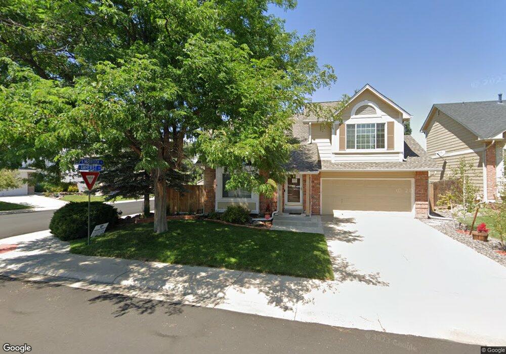
251 S Amherst St Castle Rock, CO 80104
Founders Village NeighborhoodEstimated Value: $525,000 - $537,000
4
Beds
4
Baths
2,128
Sq Ft
$249/Sq Ft
Est. Value
About This Home
This home is located at 251 S Amherst St, Castle Rock, CO 80104 and is currently estimated at $530,919, approximately $249 per square foot. 251 S Amherst St is a home located in Douglas County with nearby schools including Rock Ridge Elementary School, Mesa Middle School, and Douglas County High School.
Ownership History
Date
Name
Owned For
Owner Type
Purchase Details
Closed on
Nov 16, 2015
Sold by
Matott Justin R and Matott Kelli
Bought by
Zappanti Brian
Current Estimated Value
Home Financials for this Owner
Home Financials are based on the most recent Mortgage that was taken out on this home.
Original Mortgage
$217,500
Outstanding Balance
$171,422
Interest Rate
3.85%
Mortgage Type
New Conventional
Estimated Equity
$359,497
Purchase Details
Closed on
Feb 21, 2014
Sold by
Matott Justin R
Bought by
Matott Justin R and Matott Kelli
Home Financials for this Owner
Home Financials are based on the most recent Mortgage that was taken out on this home.
Original Mortgage
$181,600
Interest Rate
4.47%
Mortgage Type
New Conventional
Purchase Details
Closed on
Jan 7, 2008
Sold by
Dahl J Kerstan J and Dahl Jeanette Dawn
Bought by
Matott Justin R
Home Financials for this Owner
Home Financials are based on the most recent Mortgage that was taken out on this home.
Original Mortgage
$217,000
Interest Rate
6.07%
Mortgage Type
Purchase Money Mortgage
Purchase Details
Closed on
Nov 15, 1996
Sold by
Blessner Paul L and Adams Candace Adams
Bought by
Dahl J Kerstan J and Dahl Jeanette Dawn
Home Financials for this Owner
Home Financials are based on the most recent Mortgage that was taken out on this home.
Original Mortgage
$132,350
Interest Rate
8.05%
Mortgage Type
VA
Purchase Details
Closed on
Nov 4, 1996
Sold by
Blessner Paul L Et Al Ring Candace Adam
Bought by
Fritts Lesli
Home Financials for this Owner
Home Financials are based on the most recent Mortgage that was taken out on this home.
Original Mortgage
$132,350
Interest Rate
8.05%
Mortgage Type
VA
Purchase Details
Closed on
Feb 25, 1994
Sold by
Parlett Philip M
Bought by
Ring Candace Adams and Blessner Paul L
Purchase Details
Closed on
Mar 30, 1990
Sold by
Hardin James T and Hardin Sharman L
Bought by
Parlett Philip M
Purchase Details
Closed on
Jun 30, 1986
Sold by
Richmond Belmont Ltd
Bought by
Hardin James T and Hardin Sharmon L
Create a Home Valuation Report for This Property
The Home Valuation Report is an in-depth analysis detailing your home's value as well as a comparison with similar homes in the area
Home Values in the Area
Average Home Value in this Area
Purchase History
| Date | Buyer | Sale Price | Title Company |
|---|---|---|---|
| Zappanti Brian | $297,500 | Chicago Title | |
| Matott Justin R | -- | Assured Title | |
| Matott Justin R | $217,000 | None Available | |
| Dahl J Kerstan J | $128,500 | -- | |
| Fritts Lesli | -- | -- | |
| Ring Candace Adams | $114,000 | -- | |
| Parlett Philip M | $96,500 | -- | |
| Hardin James T | $94,200 | -- |
Source: Public Records
Mortgage History
| Date | Status | Borrower | Loan Amount |
|---|---|---|---|
| Open | Zappanti Brian | $217,500 | |
| Previous Owner | Matott Justin R | $181,600 | |
| Previous Owner | Matott Justin R | $217,000 | |
| Previous Owner | Dahl J Kerstan J | $132,350 |
Source: Public Records
Tax History Compared to Growth
Tax History
| Year | Tax Paid | Tax Assessment Tax Assessment Total Assessment is a certain percentage of the fair market value that is determined by local assessors to be the total taxable value of land and additions on the property. | Land | Improvement |
|---|---|---|---|---|
| 2024 | $5,316 | $36,050 | $8,350 | $27,700 |
| 2023 | $5,347 | $36,050 | $8,350 | $27,700 |
| 2022 | $3,996 | $25,240 | $6,160 | $19,080 |
| 2021 | $4,071 | $25,240 | $6,160 | $19,080 |
| 2020 | $3,897 | $24,870 | $5,250 | $19,620 |
| 2019 | $3,898 | $24,870 | $5,250 | $19,620 |
| 2018 | $3,333 | $21,100 | $4,060 | $17,040 |
| 2017 | $3,208 | $21,100 | $4,060 | $17,040 |
| 2016 | $2,621 | $18,000 | $3,930 | $14,070 |
| 2015 | $2,655 | $18,000 | $3,930 | $14,070 |
| 2014 | $2,238 | $14,570 | $3,420 | $11,150 |
Source: Public Records
Map
Nearby Homes
- 176 S Pembrook St
- 5181 Devon Ave
- 5282 Devon Ave
- 510 Fairhaven St
- 5133 E Essex Ave
- 5323 E Sandpiper Ave
- 321 Lockwood St
- 576 S Lindsey St
- 596 S Lindsey St
- 378 Benton St
- 5326 E Howe St
- 630 Fairhaven St
- 364 N Willow St
- 4590 Wakefield Ave
- 535 Howe St
- 157 S Quicksilver Ave
- 109 N Quicksilver Ave
- 4372 E Andover Ave
- 98 N Quicksilver Ave
- 5521 Spruce Ave
- 221 S Amherst St
- 232 S Pembrook St
- 191 S Amherst St
- 171 S Amherst St
- 212 S Pembrook St
- 272 S Pembrook St
- 241 S Pembrook St
- 251 S Pembrook St
- 229 S Pembrook St
- 263 S Pembrook St
- 151 S Amherst St
- 219 S Pembrook St
- 256 S Amherst St
- 282 S Pembrook St
- 200 S Pembrook St
- 275 S Pembrook St Unit ST3
- 133 S Amherst St
- 326 S Lindsey St
- 306 S Lindsey St
- 240 S Amherst St