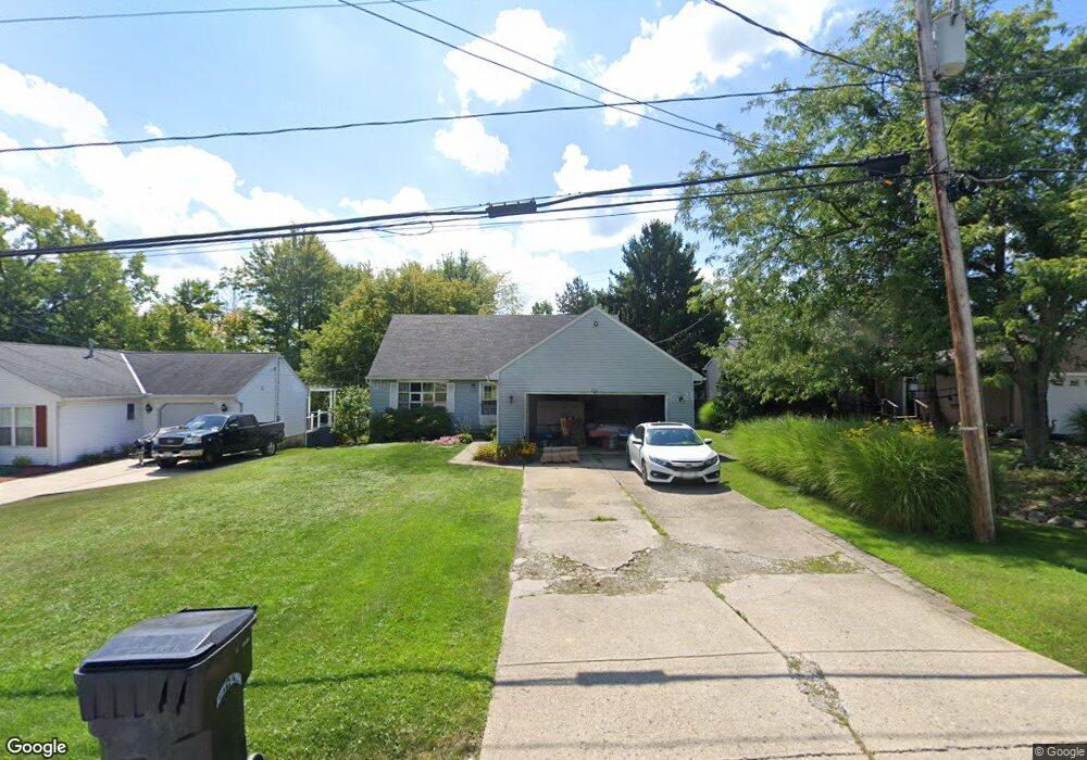
251 Schadden Rd Elyria, OH 44035
Estimated Value: $169,274 - $230,000
2
Beds
1
Bath
1,658
Sq Ft
$119/Sq Ft
Est. Value
About This Home
This home is located at 251 Schadden Rd, Elyria, OH 44035 and is currently estimated at $197,319, approximately $119 per square foot. 251 Schadden Rd is a home located in Lorain County with nearby schools including Crestwood Elementary School, Westwood Middle School, and Elyria High School.
Ownership History
Date
Name
Owned For
Owner Type
Purchase Details
Closed on
Sep 15, 2021
Sold by
Lowery Eugene R and Lowery Mary V
Bought by
Mcdermott Liam
Current Estimated Value
Home Financials for this Owner
Home Financials are based on the most recent Mortgage that was taken out on this home.
Original Mortgage
$78,449
Interest Rate
3.11%
Mortgage Type
FHA
Purchase Details
Closed on
Aug 11, 2006
Sold by
Lowery Eugene R and Lowery Mary V
Bought by
Lowery Eugene R and Lowery Mary
Purchase Details
Closed on
Jun 7, 2002
Sold by
Lowery Eugene R and Lowery Mary V
Bought by
Lowery Eugene R and Lowery Mary
Purchase Details
Closed on
Apr 16, 2002
Sold by
Cropp James A
Bought by
Lowery Eugene R and Lowery Mary
Purchase Details
Closed on
Mar 16, 2000
Sold by
Estate Of Marilyn Cropp
Bought by
Cropp James A
Home Financials for this Owner
Home Financials are based on the most recent Mortgage that was taken out on this home.
Original Mortgage
$52,200
Interest Rate
9.75%
Mortgage Type
Purchase Money Mortgage
Create a Home Valuation Report for This Property
The Home Valuation Report is an in-depth analysis detailing your home's value as well as a comparison with similar homes in the area
Home Values in the Area
Average Home Value in this Area
Purchase History
| Date | Buyer | Sale Price | Title Company |
|---|---|---|---|
| Mcdermott Liam | $120,000 | Amrock Llc | |
| Lowery Eugene R | -- | None Available | |
| Lowery Eugene R | -- | Lorain County Title Co Inc | |
| Lowery Eugene R | $79,700 | -- | |
| Cropp James A | -- | Trident Title Agency |
Source: Public Records
Mortgage History
| Date | Status | Borrower | Loan Amount |
|---|---|---|---|
| Previous Owner | Mcdermott Liam | $78,449 | |
| Previous Owner | Cropp James A | $52,200 |
Source: Public Records
Tax History
| Year | Tax Paid | Tax Assessment Tax Assessment Total Assessment is a certain percentage of the fair market value that is determined by local assessors to be the total taxable value of land and additions on the property. | Land | Improvement |
|---|---|---|---|---|
| 2024 | $2,419 | $50,425 | $7,980 | $42,445 |
| 2023 | $2,225 | $40,541 | $8,775 | $31,766 |
| 2022 | $2,256 | $40,541 | $8,775 | $31,766 |
| 2021 | $2,261 | $40,541 | $8,775 | $31,766 |
| 2020 | $2,173 | $34,650 | $7,500 | $27,150 |
| 2019 | $2,159 | $34,650 | $7,500 | $27,150 |
| 2018 | $2,312 | $36,730 | $7,500 | $29,230 |
| 2017 | $2,331 | $35,790 | $7,980 | $27,810 |
| 2016 | $2,302 | $35,790 | $7,980 | $27,810 |
| 2015 | $2,159 | $35,790 | $7,980 | $27,810 |
| 2014 | $2,134 | $35,790 | $7,980 | $27,810 |
| 2013 | $2,116 | $35,790 | $7,980 | $27,810 |
Source: Public Records
Map
Nearby Homes
- 416 Deer Crossing
- V/L Rear Land Unit 1
- V/L Rear Land Unit 2
- 41629 Northwood St
- 5193 Liberty Ave
- VL Ridgewood St
- 5196 Farr Ave
- 42953 N Ridge Rd
- 348 Robin Dr
- 6445 Lake Ave
- 4721 Andover Ave
- 42190 Helen St
- 132 Warden Ave
- 114 Timberlane Dr
- 127 Parmely Ave
- 367 Crestview Dr
- V/L Grove Ave
- 4510 Riverside Dr
- 1693 Elfleda St
- 4434 Riverside Dr
- 247 Schadden Rd
- 255 Schadden Rd
- 243 Schadden Rd
- 231 Schadden Rd
- 240 Schadden Rd
- 41186 St Rt 57 Bee Dr
- 221 Schadden Rd
- 125 Creekfield Ct
- 232 Schadden Rd
- 250 Schadden Rd
- 121 Creekfield Ct
- 103 Meadowfield Ct
- 220 Schadden Rd
- 113 Creekfield Ct
- 118 Creekfield Ct
- 115 Meadowfield Ct
- 105 Creekfield Ct
- 114 Creekfield Ct
- 129 Schadden Rd
- 108 Creekfield Ct
Your Personal Tour Guide
Ask me questions while you tour the home.