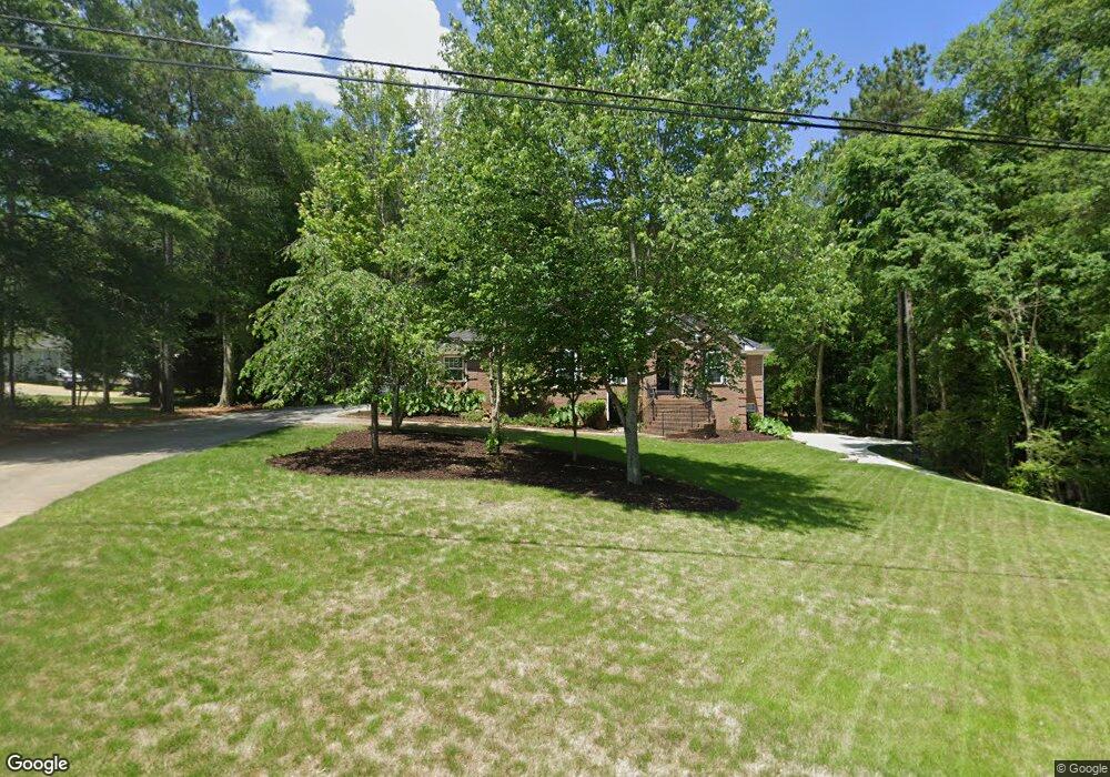
251 St Andrews Dr Jackson, GA 30233
Estimated Value: $481,000 - $530,000
4
Beds
5
Baths
2,660
Sq Ft
$188/Sq Ft
Est. Value
About This Home
This home is located at 251 St Andrews Dr, Jackson, GA 30233 and is currently estimated at $501,177, approximately $188 per square foot. 251 St Andrews Dr is a home located in Butts County with nearby schools including Jackson High School.
Ownership History
Date
Name
Owned For
Owner Type
Purchase Details
Closed on
Oct 14, 2011
Sold by
Mcintosh State Bank
Bought by
Bond Vincent Loyd
Current Estimated Value
Purchase Details
Closed on
Jan 4, 2011
Sold by
Canavan Steven
Bought by
Mcintosh State Bank
Purchase Details
Closed on
Oct 21, 2005
Sold by
Canavan Steve
Bought by
Canavan Steven J and Canavan Katherine T
Purchase Details
Closed on
Sep 23, 2005
Sold by
Garland Fam Properties
Bought by
Canavan Steve
Create a Home Valuation Report for This Property
The Home Valuation Report is an in-depth analysis detailing your home's value as well as a comparison with similar homes in the area
Home Values in the Area
Average Home Value in this Area
Purchase History
| Date | Buyer | Sale Price | Title Company |
|---|---|---|---|
| Bond Vincent Loyd | $187,000 | -- | |
| Mcintosh State Bank | $250,000 | -- | |
| Canavan Steven J | -- | -- | |
| Canavan Steve | $33,668 | -- |
Source: Public Records
Tax History Compared to Growth
Tax History
| Year | Tax Paid | Tax Assessment Tax Assessment Total Assessment is a certain percentage of the fair market value that is determined by local assessors to be the total taxable value of land and additions on the property. | Land | Improvement |
|---|---|---|---|---|
| 2024 | $5,016 | $222,744 | $15,960 | $206,784 |
| 2023 | $5,140 | $217,278 | $15,960 | $201,318 |
| 2022 | $4,828 | $179,936 | $12,000 | $167,936 |
| 2021 | $4,749 | $165,497 | $12,000 | $153,497 |
| 2020 | $4,762 | $159,854 | $12,000 | $147,854 |
| 2019 | $3,712 | $129,245 | $12,000 | $117,245 |
| 2018 | $3,570 | $119,309 | $12,000 | $107,309 |
| 2017 | $3,191 | $105,024 | $12,000 | $93,024 |
| 2016 | $3,223 | $103,424 | $10,400 | $93,024 |
| 2015 | $2,887 | $103,424 | $10,400 | $93,024 |
| 2014 | $2,464 | $88,892 | $10,400 | $78,492 |
Source: Public Records
Map
Nearby Homes
- 375 Saint Andrews Dr
- 0 Morningside Ct Unit 10557547
- 330 James Moore Cir
- 1375 Highway 42 S
- 0 Macon Ave Unit 179549
- 0 Macon Ave Unit 10514173
- 908 Nelson St
- 14 Weaver St
- 323 Maddox Cir
- 1065 Nelson St
- 965 Nelson St
- 591 Freeman St
- 119 Taylor Rd
- 347 Ww Carr Ave
- 544 Franklin St
- 1263 Highway 16 E
- 143 Valley Hills Rd
- 131 Taylor Rd
- 742 Joy St
- 144 Blake Ave
- 251 Saint Andrews Dr
- 215 Saint Andrews Dr
- 0 Thornbury Ct Unit 8169235
- 0 Thornbury Ct Unit 8044872
- 0 Thornbury Ct Unit 8118196
- 0 Thornbury Ct Unit 8007681
- 0 Thornbury Ct Unit 7552973
- 0 Thornbury Ct Unit 7401367
- 0 Thornbury Ct Unit 7311335
- 0 Thornbury Ct Unit 7157282
- 0 Thornbury Ct Unit 3149864
- 111 Thornbury Ct
- 295 St Andrews Dr
- 295 Saint Andrews Dr
- 336 Briarcliff Rd
- 292 Briarcliff Rd
- 298 Saint Andrews Dr
- 108 Thornbury Ct
- 173 Saint Andrews Dr
- 135 Thornbury Ct