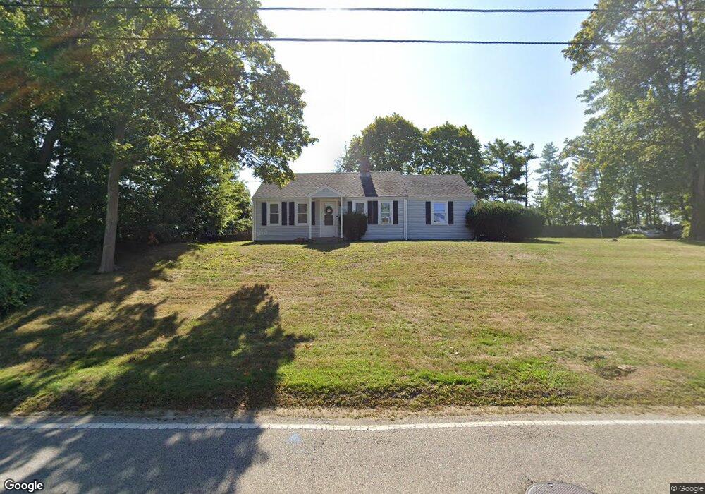
251 Stockbridge Rd Scituate, MA 02066
Estimated Value: $610,000 - $792,000
3
Beds
1
Bath
1,064
Sq Ft
$629/Sq Ft
Est. Value
About This Home
This home is located at 251 Stockbridge Rd, Scituate, MA 02066 and is currently estimated at $669,772, approximately $629 per square foot. 251 Stockbridge Rd is a home located in Plymouth County with nearby schools including Jenkins Elementary School, Lester J. Gates Middle School, and Scituate High School.
Ownership History
Date
Name
Owned For
Owner Type
Purchase Details
Closed on
Aug 10, 2010
Sold by
Stockbridge T
Bought by
Hoffman Richard W and Hoffman William E
Current Estimated Value
Home Financials for this Owner
Home Financials are based on the most recent Mortgage that was taken out on this home.
Original Mortgage
$187,500
Outstanding Balance
$125,141
Interest Rate
4.73%
Mortgage Type
Purchase Money Mortgage
Estimated Equity
$544,631
Create a Home Valuation Report for This Property
The Home Valuation Report is an in-depth analysis detailing your home's value as well as a comparison with similar homes in the area
Home Values in the Area
Average Home Value in this Area
Purchase History
| Date | Buyer | Sale Price | Title Company |
|---|---|---|---|
| Hoffman Richard W | $250,000 | -- | |
| Stockbridge T | -- | -- |
Source: Public Records
Mortgage History
| Date | Status | Borrower | Loan Amount |
|---|---|---|---|
| Open | Hoffman Richard W | $187,500 |
Source: Public Records
Tax History Compared to Growth
Tax History
| Year | Tax Paid | Tax Assessment Tax Assessment Total Assessment is a certain percentage of the fair market value that is determined by local assessors to be the total taxable value of land and additions on the property. | Land | Improvement |
|---|---|---|---|---|
| 2025 | $5,242 | $524,700 | $339,700 | $185,000 |
| 2024 | $5,106 | $492,900 | $308,800 | $184,100 |
| 2023 | $4,729 | $430,300 | $264,200 | $166,100 |
| 2022 | $4,729 | $374,700 | $222,300 | $152,400 |
| 2021 | $4,548 | $341,200 | $211,700 | $129,500 |
| 2020 | $4,342 | $321,600 | $203,500 | $118,100 |
| 2019 | $4,294 | $312,500 | $199,500 | $113,000 |
| 2018 | $3,931 | $281,800 | $189,200 | $92,600 |
| 2017 | $3,673 | $260,700 | $168,100 | $92,600 |
| 2016 | $3,389 | $239,700 | $147,100 | $92,600 |
| 2015 | $3,106 | $237,100 | $144,500 | $92,600 |
Source: Public Records
Map
Nearby Homes
- 19 Ford Place Unit 3
- 19 Ford Place Unit 1
- 19 Ford Place Unit 4
- 29 Ladds Way Unit 29
- 12 Sassamon Rd
- 17 Old Oaken Bucket Rd
- 49 Cornet Stetson Rd
- 146 Chief Justice Cushing Hwy
- 67 Greenfield Ln
- 59 Greenfield Ln
- 9 Cushing Park Rd
- 48 Neal Gate St
- 115 Elm St
- 111 Elm St
- 16 Salt Meadow Ln
- 12 Meeting House Ln Unit 308
- 50 First Parish Rd
- 76 A Brook St
- 76 A Brook St Unit 1
- 74 Tilden Rd
- 253 Stockbridge Rd
- 254 Stockbridge Rd
- 244 Stockbridge Rd
- 259 Stockbridge Rd Unit 3 & 4
- 259 Stockbridge Rd Unit 2 & 3
- 259 Stockbridge Rd Unit 2, 3, 4
- 259 Stockbridge Rd Unit B
- 259 Stockbridge Rd
- 261 Stockbridge Rd Unit 4
- 261 Stockbridge Rd Unit 3
- 261 Stockbridge Rd Unit 1
- 261 Stockbridge Rd Unit 2
- 261 Stockbridge Rd
- 237 Stockbridge Rd
- 240 Stockbridge Rd
- 236 Stockbridge Rd
- 8 Union St
- 232 Stockbridge Rd
- 7 Union St
- 4 Union St Unit 1