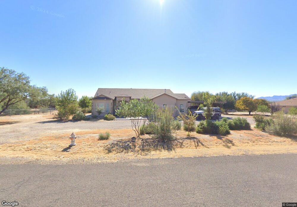
251 W Corral Dr Saint David, AZ 85630
Estimated Value: $388,784 - $445,000
--
Bed
--
Bath
2,559
Sq Ft
$164/Sq Ft
Est. Value
About This Home
This home is located at 251 W Corral Dr, Saint David, AZ 85630 and is currently estimated at $420,946, approximately $164 per square foot. 251 W Corral Dr is a home located in Cochise County with nearby schools including St. David Elementary School and St. David High School.
Ownership History
Date
Name
Owned For
Owner Type
Purchase Details
Closed on
Aug 1, 2018
Sold by
Despain Dustin Waters
Bought by
Despain Dustin Waters and Despain Laurie Ann
Current Estimated Value
Home Financials for this Owner
Home Financials are based on the most recent Mortgage that was taken out on this home.
Original Mortgage
$216,218
Outstanding Balance
$161,394
Interest Rate
4.87%
Mortgage Type
FHA
Estimated Equity
$259,552
Purchase Details
Closed on
Jun 10, 2010
Sold by
Despain Darcy Lynn
Bought by
Despain Dustin Waters
Purchase Details
Closed on
Jul 29, 2005
Sold by
Robinson Melvin R and Robinsons Building & Developme
Bought by
Despain Dustin and Despain Darcy
Purchase Details
Closed on
Jul 27, 2005
Sold by
St David Countryside Estates Lp
Bought by
Despain Dustin and Despain Darcy
Create a Home Valuation Report for This Property
The Home Valuation Report is an in-depth analysis detailing your home's value as well as a comparison with similar homes in the area
Home Values in the Area
Average Home Value in this Area
Purchase History
| Date | Buyer | Sale Price | Title Company |
|---|---|---|---|
| Despain Dustin Waters | -- | Advantage Title Llc | |
| Despain Dustin Waters | -- | None Available | |
| Despain Dustin | -- | Pioneer Title Agency | |
| Despain Dustin | $25,967 | Pioneer Title Agency |
Source: Public Records
Mortgage History
| Date | Status | Borrower | Loan Amount |
|---|---|---|---|
| Open | Despain Dustin Waters | $216,218 |
Source: Public Records
Tax History Compared to Growth
Tax History
| Year | Tax Paid | Tax Assessment Tax Assessment Total Assessment is a certain percentage of the fair market value that is determined by local assessors to be the total taxable value of land and additions on the property. | Land | Improvement |
|---|---|---|---|---|
| 2025 | $3,037 | $37,211 | $3,200 | $34,011 |
| 2024 | $3,037 | $37,021 | $3,200 | $33,821 |
| 2023 | $3,061 | $31,530 | $3,200 | $28,330 |
| 2022 | $2,518 | $25,357 | $3,200 | $22,157 |
| 2021 | $2,538 | $23,264 | $3,200 | $20,064 |
| 2020 | $2,602 | $0 | $0 | $0 |
| 2019 | $2,524 | $0 | $0 | $0 |
| 2018 | $2,456 | $0 | $0 | $0 |
| 2017 | $2,381 | $0 | $0 | $0 |
| 2016 | $2,539 | $0 | $0 | $0 |
| 2015 | $2,464 | $0 | $0 | $0 |
Source: Public Records
Map
Nearby Homes
- 305 W Branding Iron Dr
- 515 N Higgie Ln
- TBD N Sibyl Rd
- Tbd North Sibyl Rd
- 419 N Miller Ln
- 9.93 ac E Taylor Pass
- 000 E Taylor Pass
- 24 W Patton St
- 9.93 ac S Lonesome Rd
- 5ac S Ewing St
- 000 S Ewing St
- TBD N Jacobs Rd
- TBD 011 N Jacobs Rd Unit 12009011
- TBD 010 N Jacobs Rd Unit 12009010
- 0 Arizona 80 Unit 20014801
- 471 E Medicare St
- 730 N River Rd
- 53 S Miller Ln
- 0 Tbd 130 Unit 130 22314630
- 0 S Lonesome Rd Unit n/a 22504296
- 277 W Corral Ct
- 717 N Saddlehorn Dr
- 227 W Corral Dr
- 250 W Corral Ct
- 276 W Corral Ct
- 276 W Corral Dr
- 700 N Saddlehorn Dr
- 224 W Corral Dr
- 301 W Corral Dr
- 695 N Saddlehorn Dr
- 280 W Branding Iron Dr
- 301 W Corral Ct
- 300 W Corral Ct
- 684 N Saddlehorn Dr
- 304 W Branding Iron Dr
- 327 W Corral Dr
- 685 N Saddlehorn Dr
- 716 N Mesquite Dr
- 326 W Corral Ct
- 658 N Mesquite Dr