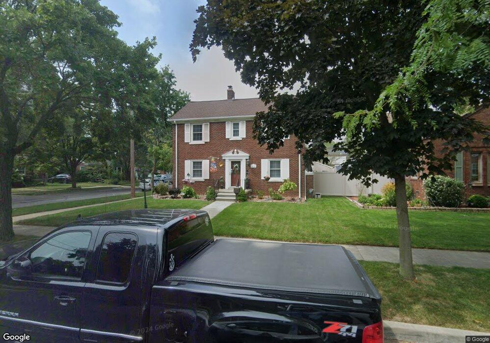
2510 22nd St Wyandotte, MI 48192
Estimated Value: $243,000 - $278,000
--
Bed
1
Bath
1,430
Sq Ft
$182/Sq Ft
Est. Value
About This Home
This home is located at 2510 22nd St, Wyandotte, MI 48192 and is currently estimated at $260,965, approximately $182 per square foot. 2510 22nd St is a home located in Wayne County with nearby schools including Washington Elementary School, Woodrow Wilson School, and Roosevelt High School.
Ownership History
Date
Name
Owned For
Owner Type
Purchase Details
Closed on
Dec 29, 2005
Sold by
Stone Kimberly A
Bought by
Stone Edward
Current Estimated Value
Purchase Details
Closed on
Aug 5, 2004
Sold by
Lennox Richard Theodore and Lennox Laura C
Bought by
Stone Kimberly A
Purchase Details
Closed on
Dec 20, 2002
Sold by
Metrusias Gus and Metrusias John
Bought by
Johnson Brian
Home Financials for this Owner
Home Financials are based on the most recent Mortgage that was taken out on this home.
Original Mortgage
$75,000
Interest Rate
8.5%
Mortgage Type
Seller Take Back
Create a Home Valuation Report for This Property
The Home Valuation Report is an in-depth analysis detailing your home's value as well as a comparison with similar homes in the area
Home Values in the Area
Average Home Value in this Area
Purchase History
| Date | Buyer | Sale Price | Title Company |
|---|---|---|---|
| Stone Edward | -- | None Available | |
| Stone Kimberly A | $165,000 | Downriver Title Agency | |
| Johnson Brian | $115,000 | Best Title Company |
Source: Public Records
Mortgage History
| Date | Status | Borrower | Loan Amount |
|---|---|---|---|
| Previous Owner | Johnson Brian | $75,000 |
Source: Public Records
Tax History Compared to Growth
Tax History
| Year | Tax Paid | Tax Assessment Tax Assessment Total Assessment is a certain percentage of the fair market value that is determined by local assessors to be the total taxable value of land and additions on the property. | Land | Improvement |
|---|---|---|---|---|
| 2025 | $2,140 | $126,900 | $0 | $0 |
| 2024 | $2,140 | $120,100 | $0 | $0 |
| 2023 | $2,041 | $108,300 | $0 | $0 |
| 2022 | $2,364 | $98,800 | $0 | $0 |
| 2021 | $2,317 | $92,900 | $0 | $0 |
| 2020 | $2,285 | $82,200 | $0 | $0 |
| 2019 | $2,253 | $75,600 | $0 | $0 |
| 2018 | $1,798 | $48,700 | $0 | $0 |
| 2017 | $788 | $48,700 | $0 | $0 |
| 2016 | $2,175 | $44,300 | $0 | $0 |
| 2015 | $3,881 | $41,100 | $0 | $0 |
| 2013 | $3,760 | $37,600 | $0 | $0 |
| 2012 | $1,733 | $38,800 | $9,400 | $29,400 |
Source: Public Records
Map
Nearby Homes
- 12753 Backus St
- 12773 Walnut St
- 1568 Chestnut St
- 12937 Walnut St
- 12757 Cunningham St
- 12745 Phelps St
- 2419 15th St
- 12770 Veronica St
- 1316 Vinewood St
- 12937 Pullman St
- 13311 Castle St
- 1817 Sycamore St
- 13371 Walnut St
- 1235 Chestnut St
- 13200 Mercier St
- 13272 Venness St
- 1864 18th St
- 13459 Jobin St
- 13480 Argyle St
- 13460 Chestnut St