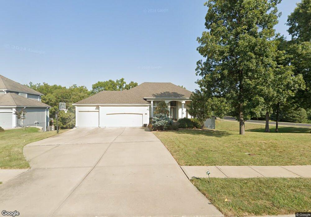
2510 NW Riven Point Cir Lees Summit, MO 64081
Estimated Value: $643,000 - $789,000
4
Beds
4
Baths
2,712
Sq Ft
$270/Sq Ft
Est. Value
About This Home
This home is located at 2510 NW Riven Point Cir, Lees Summit, MO 64081 and is currently estimated at $731,159, approximately $269 per square foot. 2510 NW Riven Point Cir is a home located in Jackson County with nearby schools including Cedar Creek Elementary School, Pleasant Lea Middle School, and Lee's Summit Senior High School.
Ownership History
Date
Name
Owned For
Owner Type
Purchase Details
Closed on
Dec 11, 2013
Sold by
Bondon Ralph J and Bondon Andrea J
Bought by
Bondon Ralph Joseph and Bondon Andrea Jean
Current Estimated Value
Purchase Details
Closed on
Jan 20, 2006
Sold by
Cerra & Sons Construction Inc
Bought by
Bondon Ralph J and Bondon Andrea J
Home Financials for this Owner
Home Financials are based on the most recent Mortgage that was taken out on this home.
Original Mortgage
$325,000
Outstanding Balance
$182,134
Interest Rate
6.22%
Mortgage Type
Fannie Mae Freddie Mac
Estimated Equity
$549,025
Purchase Details
Closed on
Jun 28, 2002
Sold by
Winterset Woods Llc
Bought by
Cerra & Sons Construction Inc
Home Financials for this Owner
Home Financials are based on the most recent Mortgage that was taken out on this home.
Original Mortgage
$496,000
Interest Rate
6.78%
Mortgage Type
Construction
Create a Home Valuation Report for This Property
The Home Valuation Report is an in-depth analysis detailing your home's value as well as a comparison with similar homes in the area
Home Values in the Area
Average Home Value in this Area
Purchase History
We collect this data history from publicly available records. To have your information removed, we recommend requesting removal directly through your county’s website.
| Date | Buyer | Sale Price | Title Company |
|---|---|---|---|
| Bondon Ralph Joseph | -- | None Available | |
| Bondon Ralph J | -- | First American Title Ins Co | |
| Cerra & Sons Construction Inc | -- | Security Land Title Company |
Source: Public Records
Mortgage History
We collect this data history from publicly available records. To have your information removed, we recommend requesting removal directly through your county’s website.
| Date | Status | Borrower | Loan Amount |
|---|---|---|---|
| Open | Bondon Ralph J | $325,000 | |
| Previous Owner | Cerra & Sons Construction Inc | $496,000 |
Source: Public Records
Tax History
| Year | Tax Paid | Tax Assessment Tax Assessment Total Assessment is a certain percentage of the fair market value that is determined by local assessors to be the total taxable value of land and additions on the property. | Land | Improvement |
|---|---|---|---|---|
| 2025 | $8,454 | $124,402 | $21,084 | $103,318 |
| 2024 | $8,392 | $117,078 | $15,808 | $101,270 |
| 2023 | $8,392 | $117,078 | $17,659 | $99,419 |
| 2022 | $9,356 | $115,900 | $17,556 | $98,344 |
| 2021 | $9,550 | $115,900 | $17,556 | $98,344 |
| 2020 | $9,180 | $110,328 | $17,556 | $92,772 |
| 2019 | $8,929 | $110,328 | $17,556 | $92,772 |
| 2018 | $1,519,476 | $105,003 | $14,332 | $90,671 |
| 2017 | $9,020 | $105,003 | $14,332 | $90,671 |
| 2016 | $9,020 | $102,372 | $22,325 | $80,047 |
| 2014 | $9,393 | $104,501 | $19,086 | $85,415 |
Source: Public Records
Map
Nearby Homes
- 2635 NW Ashurst Ln
- 2648 NW Ashurst Ln
- 319 NW Rockwood Ct
- 341 NW Thoreau Cir
- 336 NW Thoreau Cir
- 3121 SW Merriam Dr
- 129 NW Morton Dr
- 202 NW Ambersham Dr
- 2508 NW Bent Tree Cir
- 920 NW High Point Dr
- 2702 NW Cedar Brook
- 100 SW Gray Cir
- 416 NW Highcliffe Dr
- 2448 NW Valley View Dr
- 317 NW Lovins
- 316 NW Lovins
- 320 NW Lovins
- 321 NW Lovins
- 125 SW Gray Cir
- 980 NW High Point Dr
- 2514 NW Riven Point Cir
- 489 NW Riven Rock Trail
- 2515 NW Riven Point Cir
- 2511 NW Riven Point Cir
- 2518 NW Riven Point Cir
- 2599 NW Ashurst Dr
- 2519 NW Riven Point Cir
- 485 NW Riven Rock Trail
- 2522 NW Riven Point Cir
- 2513 NW Ashurst Dr
- 2605 NW Ashurst Ln
- 2509 NW Ashurst Dr
- 481 NW Riven Rock Trail
- 2609 NW Ashurst Ln
- 2507 NW Ashurst Dr
- 468 NW Riven Rock Cir
- 2629 NW Ashurst Ln
- 472 NW Riven Rock Cir
- 2505 NW Ashurst Dr
- 593 NW Riven Rock Trail
Your Personal Tour Guide
Ask me questions while you tour the home.