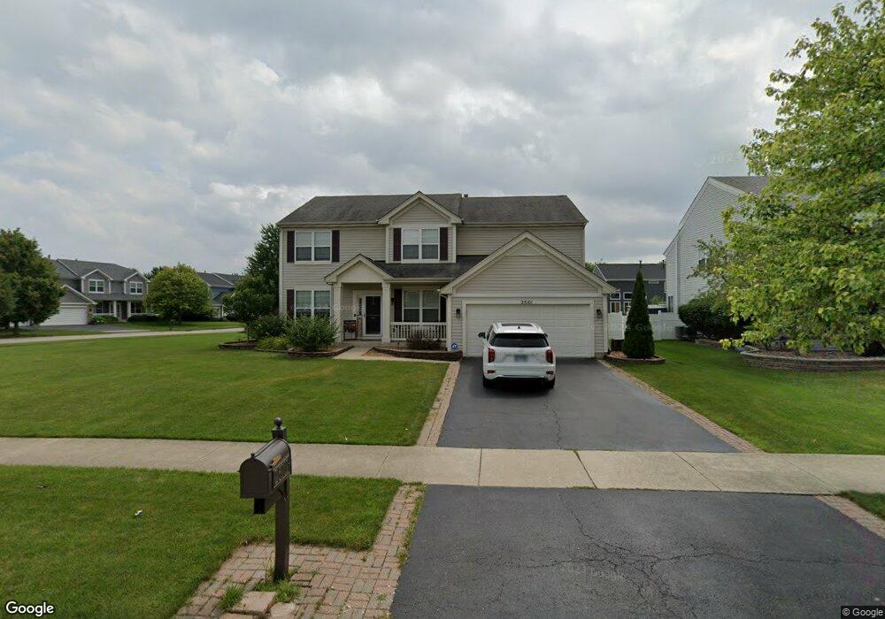
25101 Liberty Grove Blvd Plainfield, IL 60544
West Plainfield NeighborhoodEstimated Value: $477,830 - $502,000
3
Beds
3
Baths
2,430
Sq Ft
$201/Sq Ft
Est. Value
About This Home
This home is located at 25101 Liberty Grove Blvd, Plainfield, IL 60544 and is currently estimated at $487,958, approximately $200 per square foot. 25101 Liberty Grove Blvd is a home located in Will County with nearby schools including Lincoln Elementary School, Richard Ira Jones Middle School, and Plainfield North High School.
Ownership History
Date
Name
Owned For
Owner Type
Purchase Details
Closed on
Jun 20, 2017
Sold by
Berkes Robert L and Berkes Patricia A
Bought by
Luksa Daniel and Bonarek Renee
Current Estimated Value
Home Financials for this Owner
Home Financials are based on the most recent Mortgage that was taken out on this home.
Original Mortgage
$257,550
Outstanding Balance
$214,228
Interest Rate
4.02%
Mortgage Type
New Conventional
Estimated Equity
$273,730
Create a Home Valuation Report for This Property
The Home Valuation Report is an in-depth analysis detailing your home's value as well as a comparison with similar homes in the area
Home Values in the Area
Average Home Value in this Area
Purchase History
| Date | Buyer | Sale Price | Title Company |
|---|---|---|---|
| Luksa Daniel | $303,000 | Fidelity Title |
Source: Public Records
Mortgage History
| Date | Status | Borrower | Loan Amount |
|---|---|---|---|
| Open | Luksa Daniel | $257,550 |
Source: Public Records
Tax History Compared to Growth
Tax History
| Year | Tax Paid | Tax Assessment Tax Assessment Total Assessment is a certain percentage of the fair market value that is determined by local assessors to be the total taxable value of land and additions on the property. | Land | Improvement |
|---|---|---|---|---|
| 2024 | $9,609 | $138,334 | $30,220 | $108,114 |
| 2023 | $9,609 | $124,940 | $27,294 | $97,646 |
| 2022 | $8,622 | $112,213 | $24,514 | $87,699 |
| 2021 | $8,140 | $104,872 | $22,910 | $81,962 |
| 2020 | $8,023 | $101,897 | $22,260 | $79,637 |
| 2019 | $7,737 | $97,091 | $21,210 | $75,881 |
| 2018 | $7,177 | $88,789 | $19,730 | $69,059 |
| 2017 | $6,950 | $84,376 | $18,749 | $65,627 |
| 2016 | $6,774 | $80,473 | $17,882 | $62,591 |
| 2015 | $6,319 | $75,384 | $16,751 | $58,633 |
| 2014 | $6,319 | $72,723 | $16,160 | $56,563 |
| 2013 | $6,319 | $72,723 | $16,160 | $56,563 |
Source: Public Records
Map
Nearby Homes
- Siena Plan at Keller Farm - Andare Series
- Sonoma Plan at Keller Farm - Andare Series
- Napa Plan at Keller Farm - Andare Series
- Rutherford Plan at Keller Farm - Andare Series
- 14901 S Mccarthy Cir
- 14958 S Dyer Ln
- 14934 S Dyer Ln
- 14940 S Dyer Ln
- 14938 S Dyer Ln
- 14824 S Henebry Ln
- 14844 S Henebry Ln
- 14951 S Dyer Ln
- 14949 S Dyer Ln
- 14933 S Dyer Ln
- Chelsea Plan at Keller Farm - Townhome Series
- Amherst Plan at Keller Farm - Townhome Series
- Chatham Plan at Keller Farm - Townhome Series
- 25309 Federal Cir
- 510 E Plainfield West Rd
- Santa Rosa Plan at Keller Farm - Medallion Series
- 25111 Liberty Grove Blvd
- 25102 Patriot Ct
- 25112 Patriot Ct Unit 2
- 25123 Liberty Grove Blvd
- 24932 Liberty Grove Blvd
- 24924 Liberty Grove Blvd
- 25100 Liberty Grove Blvd
- 14825 Colonial Pkwy Unit 2
- 14811 Colonial Pkwy
- 25110 Liberty Grove Blvd
- 14837 Colonial Pkwy
- 25124 Patriot Ct Unit 2
- 25122 Liberty Grove Blvd
- 25129 Liberty Grove Blvd
- 14763 Colonial Pkwy
- 25136 Patriot Ct Unit 2
- 14754 Colonial Pkwy
- 14849 Colonial Pkwy Unit 2
- 14753 Cavalry Ct
- 25135 Liberty Grove Blvd Unit 2